Area Overview for BS24 6TL
Photos of BS24 6TL
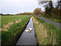
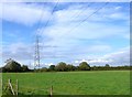
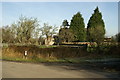
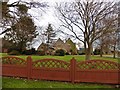
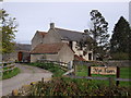
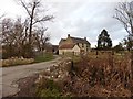
6 photos from this area
Area Information
Key information about the BS24 6TL including its size, population, and administrative classification.
- Area Type
- Postcode
- Area Size
- 2.2 km²
- Population
- 1726
- Population Density
- 279 people/km²
House Prices in BS24 6TL
8
Properties
£811,667
Average Sold Price
£85,000
Lowest Price
£1,700,000
Highest Price
Showing 8 properties
| Address | Type | Beds | Baths | Last Sale Price | Last Sale Date | |
|---|---|---|---|---|---|---|
| Rookery Farm West, Puxton Lane, Hewish, BS24 6TL | house | - | - | £650,000 | Oct 2023 | |
| Nut Tree Farm, Puxton Lane, Hewish, BS24 6TL | Detached | 6 | 3 | £1,700,000 | Nov 2021 | |
| Shangri-la Cottage, Puxton Lane, Hewish, BS24 6TL | Land | - | - | £85,000 | Aug 2002 | |
| Proposed New Dweling At Shangri-la Cottage, Puxton Lane, Hewish, BS24 6TL | Unknown | - | - | - | - | |
| Farm House, Nye Farm, Puxton Lane, Hewish, BS24 6TL | Detached | - | - | - | - | |
| Nye Farm, Puxton Lane, Hewish, BS24 6TL | Farm | - | - | - | - | |
| Rookery Farm Cottage, Rookery Farm, Puxton Lane, Hewish, BS24 6TL | house | - | - | - | - | |
| Rookery Farm East, Puxton Lane, Hewish, BS24 6TL | house | - | - | - | - |
Energy Efficiency in BS24 6TL
Amenities
Schools
| Rank | School | Type | Entry gender | Ages |
|---|
Explore more schools in this area
Go to Schools tabDemographics
Household Size
Two person
most common
Accommodation Type
Houses
most common
Tenure
83
majority
Ethnic Group
White
most common
Religion
N/A
most common
Household Composition
N/A
most common
Age
47
median
Adults (30-64 years)
most common
Household Deprivation
N/A
with no deprivation
NS-SEC
41
in Lower managerial occupations
Explore more demographic insights in this area
Go to Demographics tabPlanning
Planning Constraints
- Flood RiskPremium
- Ramsar Wetland SitesPremium
- Area of Outstanding Natural BeautyPremium
- Protected Nature ReservePremium
- Protected WoodlandPremium