Area Overview for BS24 0HY
Photos of BS24 0HY
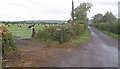
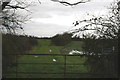
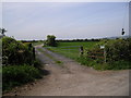
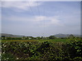
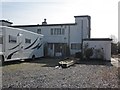
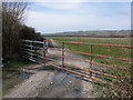
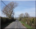
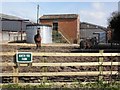
8 photos from this area
Area Information
Key information about the BS24 0HY including its size, population, and administrative classification.
- Area Type
- Postcode
- Area Size
- 48.9 hectares
- Population
- 2328
- Population Density
- 96 people/km²
House Prices in BS24 0HY
15
Properties
£415,667
Average Sold Price
£167,000
Lowest Price
£750,000
Highest Price
Showing 15 properties
| Address | Type | Beds | Baths | Last Sale Price | Last Sale Date | |
|---|---|---|---|---|---|---|
| Poplar Cottage, Eastertown, Lympsham, Weston Super Mare, BS24 0HY | Detached | 6 | 5 | £750,000 | Nov 2022 | |
| Hawthorns, Eastertown, Lympsham, Weston Super Mare, BS24 0HY | Detached | 6 | 5 | £330,000 | Jul 2014 | |
| Eastfield Cottage, Eastertown, Lympsham, Weston Super Mare, BS24 0HY | Cottage | 2 | - | £167,000 | Jun 1998 | |
| Cornerstones, Eastertown, Lympsham, Weston Super Mare, BS24 0HY | Detached | 6 | 5 | - | - | |
| Pine Cottage, Poplar Farm, Eastertown, Lympsham, Weston Super Mare, BS24 0HY | Cottage | 2 | 2 | - | - | |
| Willow Cottage, Poplar Farm, Eastertown, Lympsham, Weston Super Mare, BS24 0HY | Bungalow | - | - | - | - | |
| Cedar House, Poplar Farm, Eastertown, Lympsham, Weston Super Mare, BS24 0HY | Semi-detached | - | - | - | - | |
| Apple Tree Cottage, Poplar Farm, Eastertown, Lympsham, Weston Super Mare, BS24 0HY | Bungalow | - | - | - | - | |
| Rowan Cottage, Poplar Farm, Eastertown, Lympsham, Weston Super Mare, BS24 0HY | Terraced | 3 | - | - | - | |
| Maple Cottage, Poplar Farm, Eastertown, Lympsham, Weston Super Mare, BS24 0HY | house | - | - | - | - |
Page 1 of 2
Energy Efficiency in BS24 0HY
Amenities
Schools
| Rank | School | Type | Entry gender | Ages |
|---|
Explore more schools in this area
Go to Schools tabDemographics
Household Size
Two person
most common
Accommodation Type
Houses
most common
Tenure
81
majority
Ethnic Group
White
most common
Religion
N/A
most common
Household Composition
N/A
most common
Age
47
median
Adults (30-64 years)
most common
Household Deprivation
N/A
with no deprivation
NS-SEC
37
in Lower managerial occupations
Explore more demographic insights in this area
Go to Demographics tabPlanning
Planning Constraints
- Flood RiskPremium
- Ramsar Wetland SitesPremium
- Area of Outstanding Natural BeautyPremium
- Protected Nature ReservePremium
- Protected WoodlandPremium