Area Overview for BS23 4SG
Photos of BS23 4SG
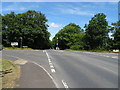
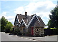
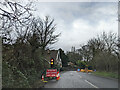
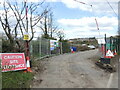
61 photos from this area
Area Information
Key information about the BS23 4SG including its size, population, and administrative classification.
- Area Type
- Postcode
- Area Size
- 1.3 hectares
- Population
- 1464
- Population Density
- 912 people/km²
House Prices in BS23 4SG
24
Properties
£348,613
Average Sold Price
£66,500
Lowest Price
£710,000
Highest Price
Showing 24 properties
| Address | Type | Beds | Baths | Last Sale Price | Last Sale Date | |
|---|---|---|---|---|---|---|
| 19 Uphill Road South, Uphill, BS23 4SG | Detached | 4 | 2 | £635,000 | Dec 2024 | |
| 14 Uphill Road South, Uphill, BS23 4SG | Detached | 4 | - | £499,999 | Mar 2022 | |
| 23 Uphill Road South, Uphill, BS23 4SG | house | - | - | £710,000 | Jan 2022 | |
| 12 Uphill Road South, Uphill, BS23 4SG | house | - | - | £450,750 | Dec 2021 | |
| 22A Uphill Road South, Uphill, BS23 4SG | Flat | 2 | 1 | £194,000 | Aug 2021 | |
| 10 Uphill Road South, Uphill, BS23 4SG | Semi-detached | 4 | 1 | £437,500 | Feb 2019 | |
| 17 Uphill Road South, Uphill, BS23 4SG | Detached | 4 | 1 | £499,950 | Jun 2018 | |
| 15 Uphill Road South, Uphill, BS23 4SG | house | - | - | £438,000 | Sep 2017 | |
| 13 Uphill Road South, Uphill, BS23 4SG | Detached | 3 | - | £312,000 | Oct 2015 | |
| 31 Uphill Road South, Uphill, BS23 4SG | Cottage | 2 | - | £262,500 | Jan 2008 |
Page 1 of 3
Energy Efficiency in BS23 4SG
Amenities
Schools
| Rank | School | Type | Entry gender | Ages |
|---|
Explore more schools in this area
Go to Schools tabDemographics
Household Size
Two person
most common
Accommodation Type
Houses
most common
Tenure
81
majority
Ethnic Group
White
most common
Religion
N/A
most common
Household Composition
N/A
most common
Age
47
median
Adults (30-64 years)
most common
Household Deprivation
N/A
with no deprivation
NS-SEC
37
in Lower managerial occupations
Explore more demographic insights in this area
Go to Demographics tabPlanning
Planning Constraints
- Flood RiskPremium
- Ramsar Wetland SitesPremium
- Area of Outstanding Natural BeautyPremium
- Protected Nature ReservePremium
- Protected WoodlandPremium