Area Overview for BS23 4NP
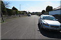
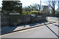
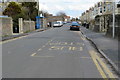
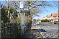
Photos of BS23 4NP

Area Information
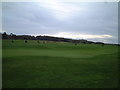
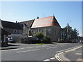
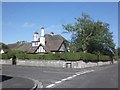
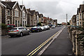
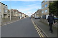
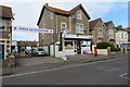
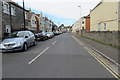
Living in BS23 4NP means being part of a compact, residential cluster in North Somerset, nestled within the historic seaside town of Weston-super-Mare. This postcode covers 12.7 hectares, housing 1,447 people at a density of 1,273 per square kilometre. The area reflects the town’s Victorian heritage, with its sandy beaches, tidal landscapes, and 19th-century development. Residents benefit from proximity to Weston’s cultural and recreational offerings, from the Grand Pier to the Old Thatched Cottage Restaurant. The community is defined by a median age of 47, with a majority of adults aged 30–64. Home ownership is high at 67%, suggesting a stable, long-term presence. Daily life here balances coastal charm with practical amenities, including nearby rail links, retail hubs, and a mix of schools. While the area is small, its connectivity to Weston’s broader infrastructure ensures convenience without sacrificing the quiet, residential character of a smaller postcode.
- Area Type
- Postcode
- Area Size
- 12.7 hectares
- Population
- 1447
- Population Density
- 1273 people/km²
The property market in BS23 4NP is characterised by a high rate of home ownership (67%) and a predominance of houses. This indicates a market skewed towards owner-occupied properties rather than rental units, which may reflect the area’s appeal to families seeking stability. The small size of the postcode—just 12.7 hectares—suggests limited housing stock, likely concentrated in semi-detached or detached homes. Buyers should consider the proximity to Weston-super-Mare’s broader infrastructure, as the immediate area may not offer extensive property variety. The presence of houses, rather than flats or apartments, aligns with the demographic of older, established residents. However, the compact nature of the postcode means that property availability could be constrained, particularly for those seeking larger or newer homes. Prospective buyers should also note the area’s proximity to protected natural sites, which may influence planning restrictions or development potential.
House Prices in BS23 4NP
No properties found in this postcode.
Energy Efficiency in BS23 4NP
Life in BS23 4NP is shaped by its proximity to Weston-super-Mare’s amenities, which include a mix of retail, transport, and leisure options. Within practical reach are five retail outlets, including Morrisons, Spar, and Tesco, ensuring everyday shopping needs are met. Three rail stations provide access to regional travel, while a ferry service in Weston offers additional mobility. The area’s compact size means that residents can easily access the coastal character of Weston, with its promenades, historic buildings, and Victorian architecture. The presence of schools, parks, and specialist services like the Inclusion Support Service adds to the area’s appeal for families. While the postcode itself is small, its integration with Weston’s broader infrastructure ensures a balance between residential tranquillity and urban convenience. The character of the area is defined by its historical roots and practical amenities, offering a lifestyle that blends coastal charm with modern necessities.
Amenities
Schools
Residents of BS23 4NP have access to a range of educational institutions, including Uphill Primary School and Broadoak Mathematics and Computing College, both primary schools. For independent education, Wyncroft School offers a private option, while Westhaven School caters to students with special educational needs. The Inclusion Support Service provides additional resources for those requiring tailored support. This mix of state, independent, and specialist schools offers families flexibility, whether they prioritise mainstream education, specialist provision, or private schooling. The presence of a special school highlights the area’s commitment to inclusive education, ensuring that children with diverse needs are well served. Families seeking a broad choice of schooling will find the proximity to multiple institutions advantageous, though the small postcode size may mean that some schools are located slightly further afield within Weston-super-Mare.
| Rank | School | Type | Entry gender | Ages |
|---|
Explore more schools in this area
Go to Schools tabDemographics
BS23 4NP’s population of 1,447 is predominantly composed of adults aged 30–64, with a median age of 47. This suggests a mature, established community, likely with strong family ties and long-term residency. Home ownership rates are high at 67%, indicating a stable housing market where most residents live in their own homes. The area’s accommodation is largely composed of houses, reflecting a preference for private, standalone properties. The predominant ethnic group is White, though no specific diversity statistics are provided. The population density of 1,273 people per square kilometre implies a tightly knit community, where social interactions are likely frequent. This demographic profile suggests a focus on quality of life, with residents prioritising stability, space, and proximity to local amenities. The absence of detailed deprivation data means the area’s socioeconomic challenges are not quantified here, but the high home ownership and age profile suggest a relatively affluent, settled population.
Household Size
Accommodation Type
Tenure
Ethnic Group
Religion
Household Composition
Age
Household Deprivation
NS-SEC
Explore more demographic insights in this area
Go to Demographics tabPlanning
Planning Constraints
- Flood RiskPremium
- Ramsar Wetland SitesPremium
- Area of Outstanding Natural BeautyPremium
- Protected Nature ReservePremium
- Protected WoodlandPremium