Area Overview for BS23 4NH
Photos of BS23 4NH
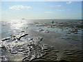
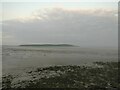
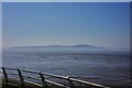
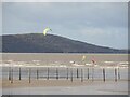


6 photos from this area
Area Information
Key information about the BS23 4NH including its size, population, and administrative classification.
- Area Type
- Postcode
- Area Size
- 1.4 km²
- Population
- 1447
- Population Density
- 1273 people/km²
House Prices in BS23 4NH
68
Properties
£270,339
Average Sold Price
£112,000
Lowest Price
£477,500
Highest Price
Showing 68 properties
| Address | Type | Beds | Baths | Last Sale Price | Last Sale Date | |
|---|---|---|---|---|---|---|
| 30 Royal Sands, Weston Super Mare, BS23 4NH | Flat | 3 | 2 | £340,000 | Sep 2025 | |
| 56 Royal Sands, Weston Super Mare, BS23 4NH | Terraced | 3 | 2 | £360,000 | Sep 2025 | |
| 22 Royal Sands, Weston Super Mare, BS23 4NH | Terraced | 4 | 3 | £477,500 | Sep 2025 | |
| 44 Royal Sands, Weston Super Mare, BS23 4NH | Flat | - | - | £330,000 | Sep 2024 | |
| 1 Royal Sands, Weston Super Mare, BS23 4NH | Terraced | 3 | 2 | £435,000 | Sep 2023 | |
| 54 Royal Sands, Weston Super Mare, BS23 4NH | house | 3 | 2 | £420,000 | May 2023 | |
| 53 Royal Sands, Weston Super Mare, BS23 4NH | Semi-detached | 3 | 2 | £385,000 | Apr 2023 | |
| 16 Royal Sands, Weston Super Mare, BS23 4NH | Flat | - | - | £315,000 | Mar 2023 | |
| 32 Royal Sands, Weston Super Mare, BS23 4NH | Flat | 1 | 1 | £217,500 | Jan 2023 | |
| 21 Royal Sands, Weston Super Mare, BS23 4NH | Flat | 2 | - | £350,000 | Nov 2022 |
Page 1 of 7
Energy Efficiency in BS23 4NH
Amenities
Schools
| Rank | School | Type | Entry gender | Ages |
|---|
Explore more schools in this area
Go to Schools tabDemographics
Household Size
Two person
most common
Accommodation Type
Houses
most common
Tenure
67
majority
Ethnic Group
White
most common
Religion
N/A
most common
Household Composition
N/A
most common
Age
47
median
Adults (30-64 years)
most common
Household Deprivation
N/A
with no deprivation
NS-SEC
38
in Lower managerial occupations
Explore more demographic insights in this area
Go to Demographics tabPlanning
Planning Constraints
- Flood RiskPremium
- Ramsar Wetland SitesPremium
- Area of Outstanding Natural BeautyPremium
- Protected Nature ReservePremium
- Protected WoodlandPremium