Area Overview for BS23 4HQ
Photos of BS23 4HQ
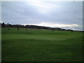
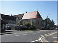
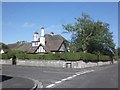
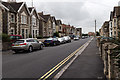
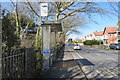
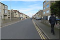
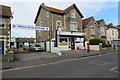
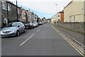
85 photos from this area
Area Information
Key information about the BS23 4HQ including its size, population, and administrative classification.
- Area Type
- Postcode
- Area Size
- 1.2 hectares
- Population
- 1447
- Population Density
- 1273 people/km²
House Prices in BS23 4HQ
21
Properties
£349,204
Average Sold Price
£85,000
Lowest Price
£549,950
Highest Price
Showing 21 properties
| Address | Type | Beds | Baths | Last Sale Price | Last Sale Date | |
|---|---|---|---|---|---|---|
| 8 Charlton Road, Weston Super Mare, BS23 4HQ | house | - | - | £400,000 | Jun 2023 | |
| 14 Charlton Road, Weston Super Mare, BS23 4HQ | Detached | 5 | 2 | £549,950 | May 2021 | |
| 12 Charlton Road, Weston Super Mare, BS23 4HQ | Detached | 4 | 1 | £392,500 | Aug 2020 | |
| 18 Charlton Road, Weston Super Mare, BS23 4HQ | house | - | - | £490,000 | Apr 2019 | |
| 30 Charlton Road, Weston Super Mare, BS23 4HQ | Detached | 4 | - | £409,750 | Jun 2016 | |
| 6 Charlton Road, Weston Super Mare, BS23 4HQ | Detached | 4 | 2 | £320,000 | Feb 2016 | |
| 20 Charlton Road, Weston Super Mare, BS23 4HQ | Detached | 4 | - | £370,000 | Jul 2015 | |
| 28 Charlton Road, Weston Super Mare, BS23 4HQ | house | 4 | - | £330,000 | Jun 2012 | |
| 36 Charlton Road, Weston Super Mare, BS23 4HQ | house | 4 | - | £332,500 | Jan 2012 | |
| 26 Charlton Road, Weston Super Mare, BS23 4HQ | house | - | - | £300,000 | Feb 2010 |
Page 1 of 3
Energy Efficiency in BS23 4HQ
Amenities
Schools
| Rank | School | Type | Entry gender | Ages |
|---|
Explore more schools in this area
Go to Schools tabDemographics
Household Size
Two person
most common
Accommodation Type
Houses
most common
Tenure
67
majority
Ethnic Group
White
most common
Religion
N/A
most common
Household Composition
N/A
most common
Age
47
median
Adults (30-64 years)
most common
Household Deprivation
N/A
with no deprivation
NS-SEC
38
in Lower managerial occupations
Explore more demographic insights in this area
Go to Demographics tabPlanning
Planning Constraints
- Flood RiskPremium
- Ramsar Wetland SitesPremium
- Area of Outstanding Natural BeautyPremium
- Protected Nature ReservePremium
- Protected WoodlandPremium