Area Overview for BS23 3UQ
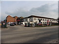
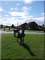
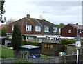
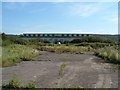
Photos of BS23 3UQ


Area Information
BS23 3UQ is a small residential postcode nestled within the historic town of Weston-super-Mare, a Victorian seaside resort in North Somerset. With a population of 1,543, this area reflects the character of a coastal community that has evolved from a 19th-century fishing village into a bustling holiday destination. The town’s sandy beaches, high tidal range, and iconic Grand Pier—rebuilt after fires in 1930 and 2008—anchor its identity. Residents here benefit from proximity to a mix of retail, transport, and leisure options, including three railway stations and a ferry service. The area’s compact size means daily life is walkable, with easy access to local amenities and the seafront. While the population is small, the community is defined by its Victorian heritage, with listed buildings and conservation areas preserving the town’s architectural legacy. For buyers, this postcode offers a blend of coastal charm and practical connectivity, though the limited size of the area means housing stock is concentrated and distinct from larger urban centres.
- Area Type
- Postcode
- Area Size
- Not available
- Population
- Not available
- Population Density
- Not available
The property market in BS23 3UQ is characterised by a 32% home ownership rate, with houses being the predominant accommodation type. This suggests that the area is not heavily reliant on rental properties, though the relatively low ownership rate indicates that a significant proportion of homes are likely rented. Given the postcode’s small size and the presence of houses rather than apartments or flats, the housing stock is likely limited in volume and diversity. Buyers should consider that the area’s compact nature means property options are concentrated, and the surrounding immediate vicinity may offer more choices. The mix of houses may appeal to families or individuals seeking traditional, spacious living, but the limited scale of the area could mean competition for available properties. For those prioritising proximity to the coast and established infrastructure, this postcode may present a niche opportunity, though its small size means buyers must weigh the trade-off between location and property availability.
House Prices in BS23 3UQ
No properties found in this postcode.
Energy Efficiency in BS23 3UQ
Residents of BS23 3UQ enjoy a range of amenities within practical reach, including retail options such as Lidl Bourneville Weston-Super, Iceland Weston, and Asda Weston. These stores provide everyday shopping convenience, while the three railway stations—Weston, Weston Milton, and Worle—offer access to regional travel. A ferry service to Weston adds to the area’s connectivity, particularly for those reliant on maritime transport. The presence of multiple retail outlets and transport hubs suggests a community-oriented lifestyle, with easy access to both local services and broader networks. While the area lacks large-scale leisure facilities, its proximity to the seafront and Victorian architecture means outdoor activities and historical exploration are readily available. The combination of retail, transport, and coastal access creates a practical yet characterful environment, ideal for those seeking a balance between convenience and a small-town atmosphere.
Amenities
Schools
Residents of BS23 3UQ have access to several schools, including Bournville Community Infant School and Bournville Primary School, both of which are primary institutions. The area also includes Rathbone Key Stage 4, an independent school catering to older students. While the presence of two primary schools provides options for younger families, the lack of secondary schools within the postcode means students may need to travel to nearby areas. The inclusion of an independent school suggests a range of educational choices, though it is not clear if these institutions are Ofsted-rated or what their performance metrics are. For families prioritising local schooling, the availability of primary education is a strength, but the absence of comprehensive secondary options could be a limitation. Parents should consider the broader educational landscape beyond the immediate postcode when planning for their children’s schooling.
| Rank | School | Type | Entry gender | Ages |
|---|
Explore more schools in this area
Go to Schools tabDemographics
The population of BS23 3UQ is 1,543, with a median age of 47 and the majority of residents aged between 30 and 64. This suggests a community skewed toward middle-aged adults, likely including professionals, retirees, and families. Home ownership stands at 32%, indicating that a significant portion of the housing stock is rented, which may reflect the area’s smaller size and limited property diversity. The predominant accommodation type is houses, which is unusual for a seaside town but aligns with the area’s historical development as a resort with detached residences. The predominant ethnic group is White, with no data provided on other demographics. The age profile and ownership rates suggest a stable, long-term resident base rather than a transient population. However, the lower home ownership rate may impact the local rental market, potentially affecting affordability for new buyers.
Household Size
Accommodation Type
Tenure
Ethnic Group
Religion
Household Composition
Age
Household Deprivation
NS-SEC
Explore more demographic insights in this area
Go to Demographics tabPlanning
Planning Constraints
- Flood RiskPremium
- Ramsar Wetland SitesPremium
- Area of Outstanding Natural BeautyPremium
- Protected Nature ReservePremium
- Protected WoodlandPremium