Area Overview for BS23 3UB
Photos of BS23 3UB
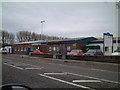

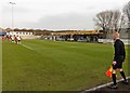
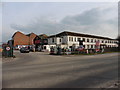
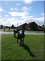
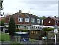
14 photos from this area
Area Information
Key information about the BS23 3UB including its size, population, and administrative classification.
- Area Type
- Postcode
- Area Size
- 6027 m²
- Population
- Not available
- Population Density
- Not available
House Prices in BS23 3UB
17
Properties
£131,383
Average Sold Price
£39,950
Lowest Price
£240,000
Highest Price
Showing 17 properties
| Address | Type | Beds | Baths | Last Sale Price | Last Sale Date | |
|---|---|---|---|---|---|---|
| 15 Wordsworth Road, Weston Super Mare, BS23 3UB | Semi-detached | 3 | 2 | £240,000 | Mar 2023 | |
| 2 Wordsworth Road, Weston Super Mare, BS23 3UB | house | - | - | £201,000 | Aug 2022 | |
| 9 Wordsworth Road, Weston Super Mare, BS23 3UB | Semi-detached | 2 | 1 | £146,000 | Jan 2018 | |
| 7 Wordsworth Road, Weston Super Mare, BS23 3UB | house | 3 | 1 | £148,500 | Mar 2017 | |
| 5 Wordsworth Road, Weston Super Mare, BS23 3UB | house | 2 | 1 | £135,000 | Nov 2015 | |
| 13 Wordsworth Road, Weston Super Mare, BS23 3UB | house | - | - | £95,000 | Aug 2015 | |
| 11 Wordsworth Road, Weston Super Mare, BS23 3UB | Terraced | - | - | £107,000 | Oct 2007 | |
| 10 Wordsworth Road, Weston Super Mare, BS23 3UB | Terraced | - | - | £70,000 | Feb 2006 | |
| 8 Wordsworth Road, Weston Super Mare, BS23 3UB | house | - | - | £39,950 | Jan 1997 | |
| 15A Wordsworth Road, Weston Super Mare, BS23 3UB | Unknown | - | - | - | - |
Page 1 of 2
Energy Efficiency in BS23 3UB
Amenities
Schools
| Rank | School | Type | Entry gender | Ages |
|---|
Explore more schools in this area
Go to Schools tabDemographics
Household Size
One person
most common
Accommodation Type
Houses
most common
Tenure
32
majority
Ethnic Group
White
most common
Religion
N/A
most common
Household Composition
N/A
most common
Age
47
median
Adults (30-64 years)
most common
Household Deprivation
N/A
with no deprivation
NS-SEC
13
in Lower managerial occupations
Explore more demographic insights in this area
Go to Demographics tabPlanning
Planning Constraints
- Flood RiskPremium
- Ramsar Wetland SitesPremium
- Area of Outstanding Natural BeautyPremium
- Protected Nature ReservePremium
- Protected WoodlandPremium