Area Overview for BS23 2LP
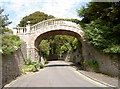
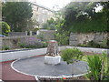
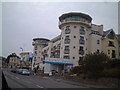
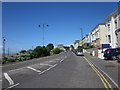
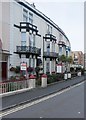
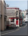
Photos of BS23 2LP


Area Information
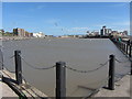
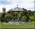
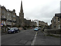
Living in BS23 2LP means being part of a tightly knit residential cluster in North Somerset, nestled within the historic seaside town of Weston-super-Mare. The area covers just 1.3 hectares, housing 1,594 people in a densely populated space with 119,538 people per square kilometre. This postcode lies at the heart of a town that evolved from a 19th-century fishing village into a bustling coastal resort. Daily life here is shaped by proximity to the Bristol Channel, with the town’s Victorian heritage evident in its seafront promenades, grand piers, and historic architecture. Residents benefit from easy access to local amenities, including shops, transport links, and the nearby ferry services. The community is predominantly composed of adults aged 30–64, with a median age of 47, reflecting a mature, stable demographic. While the area is compact, it offers a blend of convenience and historical charm, ideal for those seeking a balance between coastal living and urban accessibility.
- Area Type
- Postcode
- Area Size
- 1.3 hectares
- Population
- Not available
- Population Density
- Not available
The property market in BS23 2LP is characterised by a mix of owner-occupied and rental properties, with 49% of homes owned by residents. Given the area’s small size and high population density, the housing stock is limited, with flats being the predominant accommodation type. This suggests a focus on compact, efficient living spaces, often suited to individuals or small families. The concentration of flats may indicate a higher proportion of rental properties, though the exact split between owner-occupied and rented units is not specified. For buyers, the area’s proximity to amenities and transport links could be appealing, but the limited land area means competition for available properties. Those considering purchase should factor in the potential for a more transient rental market, alongside the need to balance space constraints with the benefits of coastal living.
House Prices in BS23 2LP
Showing 14 properties
| Address | Type | Beds | Baths | Last Sale Price | Last Sale Date | |
|---|---|---|---|---|---|---|
| 10 St Johns Close, Weston Super Mare, BS23 2LP | house | - | - | £523,000 | Jan 2023 | |
| 14 St Johns Close, Weston Super Mare, BS23 2LP | Detached | 4 | 2 | £500,000 | Jan 2023 | |
| 11 St Johns Close, Weston Super Mare, BS23 2LP | house | - | - | £565,000 | Jul 2022 | |
| 13 St Johns Close, Weston Super Mare, BS23 2LP | Detached | 4 | 2 | £462,000 | Sep 2021 | |
| 5 St Johns Close, Weston Super Mare, BS23 2LP | Bungalow | 2 | 2 | £390,000 | Feb 2021 | |
| 6 St Johns Close, Weston Super Mare, BS23 2LP | house | - | - | £480,000 | Aug 2019 | |
| 7 St Johns Close, Weston Super Mare, BS23 2LP | Detached | 4 | 2 | £485,000 | Feb 2017 | |
| 2 St Johns Close, Weston Super Mare, BS23 2LP | Bungalow | 3 | - | £325,000 | Jun 2012 | |
| 8 St Johns Close, Weston Super Mare, BS23 2LP | house | - | - | £332,500 | Aug 2010 | |
| 3 St Johns Close, Weston Super Mare, BS23 2LP | Detached | - | - | £310,000 | Feb 2008 |
Energy Efficiency in BS23 2LP
Residents of BS23 2LP have access to a range of local amenities within easy reach. Retail options include Spar, Tesco Weston, and Morrisons Daily Weston Super, offering everyday essentials and convenience. The nearby ferry service to Weston provides additional transport flexibility, while three railway stations—Weston, Weston Milton, and Worle—connect the area to broader networks. Though the postcode itself is small, its proximity to Weston-super-Mare’s historic seafront, Victorian architecture, and cultural landmarks enriches daily life. The availability of shops, transport, and coastal access fosters a practical, community-oriented lifestyle. While the area’s compact size means limited green spaces, the surrounding town offers parks and leisure facilities. This balance of convenience and historical context makes BS23 2LP appealing to those seeking accessible living without sacrificing the charm of a coastal town.
Amenities
Schools
| Rank | School | Type | Entry gender | Ages |
|---|
Explore more schools in this area
Go to Schools tabDemographics
BS23 2LP has a median age of 47, with the majority of residents falling within the 30–64 age range. This suggests a community of established professionals and families, rather than a transient population. Home ownership rates stand at 49%, indicating that nearly half of properties are owner-occupied, while the other 51% are likely rented. The accommodation type is predominantly flats, reflecting a housing stock suited to smaller households or those prioritising convenience over larger living spaces. The predominant ethnic group is White, though specific data on diversity is not provided. The high population density of 119,538 people per square kilometre underscores the area’s compact nature, which may influence the pace of life and availability of communal spaces. For residents, this density means a tightly connected community but also potential challenges in finding private outdoor space.
Household Size
Accommodation Type
Tenure
Ethnic Group
Religion
Household Composition
Age
Household Deprivation
NS-SEC
Explore more demographic insights in this area
Go to Demographics tabPlanning
Planning Constraints
- Flood RiskPremium
- Ramsar Wetland SitesPremium
- Area of Outstanding Natural BeautyPremium
- Protected Nature ReservePremium
- Protected WoodlandPremium