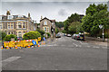
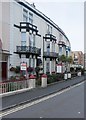
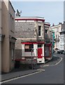
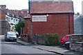
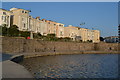
Area Overview for BS23 2HP
Photos of BS23 2HP


Area Information
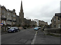
BS23 2HP is a small, densely populated postcode area in England, covering just 1.6 hectares and home to 1,758 residents. Its compact size means it is a tightly knit residential cluster, with a population density of 1,564 people per square kilometre. Nestled within the historic seaside town of Weston-super-Mare, this area benefits from its proximity to the town’s Victorian architecture, coastal promenades, and long-standing role as a holiday destination. The median age of 47 suggests a mature community, with a significant proportion of residents aged 30–64. Daily life here is shaped by the surrounding town’s amenities, including nearby rail stations, retail outlets, and the West Somerset Railway’s ferry service. While the area lacks large-scale infrastructure, its small footprint ensures a sense of intimacy and accessibility. For buyers, this postcode offers a snapshot of a coastal town’s charm, with a focus on practical living rather than sprawling development. Its location within Weston-super-Mare also provides easy access to the broader town’s cultural and recreational offerings.
- Area Type
- Postcode
- Area Size
- 1.6 hectares
- Population
- 1758
- Population Density
- 1564 people/km²
The property market in BS23 2HP is characterised by a high proportion of rental properties, with only 48% of homes owned by their occupants. This suggests that the area functions more as a rental market than a primary owner-occupied community. The accommodation type is predominantly flats, which aligns with the compact nature of the postcode and its limited land area of 1.6 hectares. Given the small size of the area, the housing stock is likely to be concentrated in a few residential blocks or developments, offering limited scope for expansion. For buyers, this means the available properties are likely to be flats in established buildings, with a focus on practical living spaces rather than large homes. The immediate surroundings of BS23 2HP, being part of Weston-super-Mare, may offer more varied options, but the postcode itself is unlikely to have significant new construction. Buyers should consider the area’s small footprint and the predominance of rental properties when evaluating its long-term value.
House Prices in BS23 2HP
Showing 15 properties
| Address | Type | Beds | Baths | Last Sale Price | Last Sale Date | |
|---|---|---|---|---|---|---|
| 11 Trinity Road, Weston Super Mare, BS23 2HP | Terraced | 5 | 2 | £520,000 | Sep 2025 | |
| 9 Trinity Road, Weston Super Mare, BS23 2HP | Terraced | 5 | 2 | £377,500 | Feb 2021 | |
| The Cottage, Trinity Road, Weston Super Mare, BS23 2HP | Detached | 4 | 2 | £442,000 | Jun 2020 | |
| 3 Trinity Road, Weston Super Mare, BS23 2HP | Terraced | 4 | 2 | - | - | |
| Windsong, Trinity Road, Weston Super Mare, BS23 2HP | Detached | 5 | 2 | - | - | |
| 7 Trinity Road, Weston Super Mare, BS23 2HP | Semi-detached | 3 | 3 | - | - | |
| Flat 4, Pembroke House, Trinity Road, Weston Super Mare, BS23 2HP | Detached | 3 | 2 | - | - | |
| Flat 1, Pembroke House, Trinity Road, Weston Super Mare, BS23 2HP | Detached | 4 | - | - | - | |
| Flat 6, Pembroke House, Trinity Road, Weston Super Mare, BS23 2HP | Flat | - | - | - | - | |
| Flat 7, Pembroke House, Trinity Road, Weston Super Mare, BS23 2HP | Flat | - | - | - | - |
Energy Efficiency in BS23 2HP
Living in BS23 2HP offers access to a range of local amenities within practical reach. The area is served by five retail outlets, including Spar, Tesco Weston, and Morrisons Daily Weston Super, providing essential shopping and dining options. Three rail stations—Weston, Weston Milton, and Worle—offer regular services to nearby towns and the broader region. The nearby ferry service at Weston adds a unique dimension to transport and leisure, with connections to the surrounding waterways. While the area itself is small, its integration into Weston-super-Mare means residents can access the town’s historic sites, including the Grand Pier and Victorian architecture, as well as its coastal promenades. The convenience of nearby shops and transport hubs supports a lifestyle that balances practicality with the charm of a seaside town. However, the absence of detailed information on parks or recreational spaces means the area’s green spaces remain unexplored in this context.
Amenities
Schools
| Rank | School | Type | Entry gender | Ages |
|---|
Explore more schools in this area
Go to Schools tabDemographics
The population of BS23 2HP is predominantly adults aged 30–64, with a median age of 47. This suggests a community of established residents, many of whom may be in their prime working years or nearing retirement. Home ownership in the area is relatively low, with only 48% of properties owned by their occupants, indicating that the majority of residents are renters. The accommodation type is primarily flats, reflecting a housing stock suited to smaller households or those seeking manageable living spaces. The predominant ethnic group is White, though the data does not provide further breakdowns of diversity. The high population density—1,564 people per square kilometre—means the area is compact and likely to have a strong sense of local identity. However, the lack of specific data on deprivation or income levels means the area’s socioeconomic challenges remain unquantified. For prospective buyers, this demographic profile suggests a stable, mature community with a focus on rental affordability over long-term property investment.
Household Size
Accommodation Type
Tenure
Ethnic Group
Religion
Household Composition
Age
Household Deprivation
NS-SEC
Explore more demographic insights in this area
Go to Demographics tabPlanning
Planning Constraints
- Flood RiskPremium
- Ramsar Wetland SitesPremium
- Area of Outstanding Natural BeautyPremium
- Protected Nature ReservePremium
- Protected WoodlandPremium