Area Overview for BS23 2EL
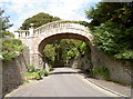
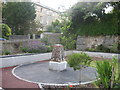
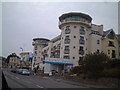
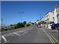
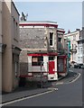
Photos of BS23 2EL


Area Information
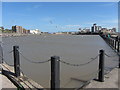
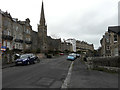
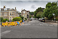
Living in BS23 2EL means being part of a tightly knit residential cluster in the heart of Weston-super-Mare, a historic seaside town in North Somerset. The area covers just 1,578 square metres, housing 1,758 residents in a densely populated setting. With a median age of 47, the community is predominantly composed of adults aged 30–64, reflecting a mature demographic. Daily life here is shaped by proximity to the coast, with the town’s Victorian heritage and modern amenities blending seamlessly. Residents benefit from easy access to local shops, rail networks, and the nearby ferry service to Weston, which connects to the broader region. While the area is small, its strategic location near Weston-super-Mare’s core ensures a balance between quiet residential living and the vibrancy of a coastal town. The high population density means a compact, walkable environment, though the limited space also underscores the need for efficient land use. For those seeking a mix of seaside charm and practical living, BS23 2EL offers a distinct blend of historical character and modern convenience.
- Area Type
- Postcode
- Area Size
- 1578 m²
- Population
- 1758
- Population Density
- 1564 people/km²
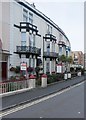
The property market in BS23 2EL is characterised by a high proportion of flats, with 48% of residents owning their homes. This suggests a housing stock that prioritises multi-unit dwellings over detached or semi-detached properties, typical of urban or densely populated areas. The relatively low home ownership rate implies that a significant portion of the housing is rented, possibly accommodating younger professionals or families seeking affordability. Given the area’s small size, the property market is likely constrained by limited availability, making it a niche market for buyers seeking specific types of housing. The focus on flats may also reflect the area’s proximity to transport links, such as rail stations and the ferry, which are critical for commuters. For buyers, this means a limited selection of properties, but the compact nature of the area ensures proximity to essential services and amenities.
House Prices in BS23 2EL
Showing 19 properties
| Address | Type | Beds | Baths | Last Sale Price | Last Sale Date | |
|---|---|---|---|---|---|---|
| 18A Madeira Road, Weston Super Mare, BS23 2EL | Flat | - | - | £165,000 | Apr 2017 | |
| APARTMENT 17, 18 MADEIRA ROAD, Weston-super-Mare, BS23 2EL | Flat | - | - | - | - | |
| Apartment 14, 18 Madeira Road, Weston Super Mare, BS23 2EL | Flat | - | - | - | - | |
| Apartment 12, 18 Madeira Road, Weston Super Mare, BS23 2EL | Flat | - | - | - | - | |
| Apartment 5, 18 Madeira Road, Weston Super Mare, BS23 2EL | Flat | - | - | - | - | |
| Apartment 10, 18 Madeira Road, Weston Super Mare, BS23 2EL | Flat | 2 | 1 | - | - | |
| Apartment 18, 18 Madeira Road, Weston Super Mare, BS23 2EL | Flat | - | - | - | - | |
| Apartment 1, 18 Madeira Road, Weston Super Mare, BS23 2EL | Flat | - | - | - | - | |
| Apartment 7, 18 Madeira Road, Weston Super Mare, BS23 2EL | Flat | - | - | - | - | |
| Apartment 8, 18 Madeira Road, Weston Super Mare, BS23 2EL | Flat | - | - | - | - |
Energy Efficiency in BS23 2EL
The lifestyle in BS23 2EL is shaped by its proximity to Weston-super-Mare’s amenities, including five retail outlets such as Spar, Tesco Weston, and Morrisons Daily Weston Super, ensuring everyday shopping needs are met. The nearby ferry service to Weston adds to the area’s convenience, offering alternative transport options. Rail stations like Weston Milton and Worle provide easy access to broader networks, supporting both daily commutes and weekend excursions. While the data does not mention parks or leisure facilities directly, the area’s integration into Weston-super-Mare’s coastal town identity suggests access to the Grand Pier, promenades, and historic sites. The compact nature of the area means residents can navigate daily life with minimal travel, though the limited space may restrict larger recreational spaces. The blend of retail, transport, and coastal proximity creates a lifestyle that balances practicality with the charm of a seaside town.
Amenities
Schools
| Rank | School | Type | Entry gender | Ages |
|---|
Explore more schools in this area
Go to Schools tabDemographics
BS23 2EL’s population of 1,758 is concentrated in a small area, resulting in a high density of 1,564 people per square kilometre. The median age of 47 indicates a community skewed toward middle-aged adults, with the 30–64 age group forming the majority. Home ownership stands at 48%, suggesting a mix of owner-occupied and rental properties, though the accommodation type is predominantly flats. This reflects a residential profile where multi-unit housing is the norm, likely catering to families or individuals seeking manageable living spaces. The predominant ethnic group is White, though specific data on diversity is not provided. The absence of detailed demographic breakdowns means the area’s social composition remains largely unexplored in the data. However, the age profile and housing stock suggest a stable, established community with a focus on practical living over luxury.
Household Size
Accommodation Type
Tenure
Ethnic Group
Religion
Household Composition
Age
Household Deprivation
NS-SEC
Explore more demographic insights in this area
Go to Demographics tabPlanning
Planning Constraints
- Flood RiskPremium
- Ramsar Wetland SitesPremium
- Area of Outstanding Natural BeautyPremium
- Protected Nature ReservePremium
- Protected WoodlandPremium