Area Overview for BS23 2DR
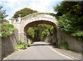
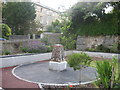
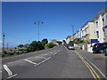
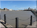
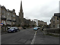
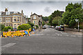
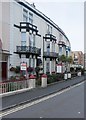
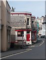
Photos of BS23 2DR


Area Information
BS23 2DR is a compact residential postcode nestled within the historic town of Weston-super-Mare, a Victorian seaside resort in North Somerset. With a population of 1,758 spread across 5,202 square metres, this area reflects the town’s legacy as a bustling coastal destination. The high population density of 1,564 people per square kilometre suggests a tightly knit community, though the area’s small size means it is best suited for those seeking a quiet, established residential environment rather than sprawling suburbs. Weston-super-Mare itself evolved from a 19th-century fishing village into a major tourist hub, defined by its sandy beaches, Victorian architecture, and the iconic Grand Pier. Residents of BS23 2DR benefit from proximity to the town’s cultural and recreational assets, including its seafront promenades and historic landmarks. The area’s compact nature ensures that amenities like shops, transport links, and leisure facilities are within easy reach, though its limited size means it is more of a satellite cluster than a standalone district. This postcode is ideal for those prioritising convenience, heritage, and coastal living over expansive space.
- Area Type
- Postcode
- Area Size
- 5202 m²
- Population
- 1758
- Population Density
- 1564 people/km²
The property market in BS23 2DR is characterised by a high concentration of flats, with 48% of homes owned by residents and the remainder likely rented. This suggests a mixed market where owner-occupation coexists with rental demand, though the area’s small size means housing stock is limited. The prevalence of flats may reflect the town’s historical development as a resort, where space constraints led to denser housing solutions. For buyers, this means competition for available properties, particularly in a postcode with such a high population density. The compact nature of BS23 2DR also means that proximity to amenities like the seafront, rail stations, and retail hubs is a key selling point. However, the lack of larger properties or detached homes may deter those seeking more space. Potential buyers should consider the area’s limited size and the dominance of flats when evaluating long-term suitability, as the market is unlikely to expand significantly.
House Prices in BS23 2DR
Showing 25 properties
| Address | Type | Beds | Baths | Last Sale Price | Last Sale Date | |
|---|---|---|---|---|---|---|
| 6A Highbury Road, Weston Super Mare, BS23 2DR | Flat | 3 | 1 | £177,500 | Aug 2022 | |
| 6 Highbury Road, Weston Super Mare, BS23 2DR | Flat | 2 | 1 | £177,500 | Aug 2022 | |
| Little Orchard, 9 Highbury Road, Weston Super Mare, BS23 2DR | Bungalow | - | - | £238,500 | Jan 2021 | |
| Glentworth Cottage, Highbury Road, Weston Super Mare, BS23 2DR | Semi-detached | 2 | 2 | £110,000 | Nov 2020 | |
| Bundorin Lea, Highbury Road, Weston Super Mare, BS23 2DR | house | - | - | £390,000 | Feb 2020 | |
| Southleigh, 11 Highbury Road, Weston Super Mare, BS23 2DR | Detached | - | - | £225,000 | Dec 2008 | |
| 5A Highbury Road, Weston Super Mare, BS23 2DR | Flat | - | - | £26,000 | Mar 1995 | |
| Flat 3, Highbury Court, Highbury Road, Weston Super Mare, BS23 2DR | Flat | 2 | 1 | - | - | |
| Flat 4, Highbury Mansions, 4 Highbury Road, Weston Super Mare, BS23 2DR | Flat | 2 | 1 | - | - | |
| Flat 2, Highbury Court, Highbury Road, Weston Super Mare, BS23 2DR | Flat | 2 | 1 | - | - |
Energy Efficiency in BS23 2DR
Living in BS23 2DR offers access to a mix of practical amenities and coastal charm. The nearby retail options—Spar, Tesco Weston, and Morrisons Daily Weston Super—ensure that groceries, household goods, and daily necessities are within walking or short driving distance. The area’s proximity to Weston-super-Mare’s seafront means residents can enjoy the town’s historic promenades, Victorian architecture, and the Grand Pier, a key leisure attraction. The ferry to Weston and three rail stations provide easy access to broader regional networks, supporting both local and longer-distance travel. While the area itself is small, its integration with the larger town’s infrastructure means that cultural, recreational, and commercial opportunities are readily available. The compact nature of BS23 2DR fosters a convenient lifestyle, where the balance between residential tranquillity and coastal accessibility is maintained.
Amenities
Schools
| Rank | School | Type | Entry gender | Ages |
|---|
Explore more schools in this area
Go to Schools tabDemographics
The population of BS23 2DR skews towards mature adults, with a median age of 47 and the majority of residents aged between 30 and 64. This suggests a community with established careers and family structures, though the 48% home ownership rate indicates that nearly half of residents rent their homes. The accommodation type is predominantly flats, reflecting the area’s compact layout and likely development history. The predominant ethnic group is White, with no specific data provided on other demographics. The high population density of 1,564 people per square kilometre underscores the area’s intensity, which may influence the pace of life and availability of housing. While the data does not quantify deprivation levels, the mix of renters and homeowners, combined with the mature age profile, implies a stable but potentially less dynamic community. This is a place where long-term residents may outnumber newcomers, offering a sense of continuity but also limited turnover in the housing market.
Household Size
Accommodation Type
Tenure
Ethnic Group
Religion
Household Composition
Age
Household Deprivation
NS-SEC
Explore more demographic insights in this area
Go to Demographics tabPlanning
Planning Constraints
- Flood RiskPremium
- Ramsar Wetland SitesPremium
- Area of Outstanding Natural BeautyPremium
- Protected Nature ReservePremium
- Protected WoodlandPremium