Area Overview for BS23 2BH
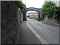
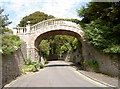
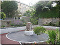
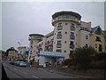
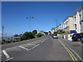
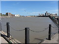
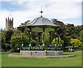
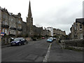
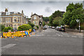
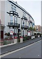
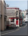
Photos of BS23 2BH

Area Information
Living in BS23 2BH means being part of a small, densely populated residential cluster in North Somerset, nestled within the historic seaside town of Weston-super-Mare. This area, covering just 2,163 square metres, is home to 1,594 people, making it one of the most densely populated postcode areas in England. Its proximity to the Bristol Channel and the town’s Victorian heritage shape daily life, with a mix of coastal charm and modern convenience. Residents benefit from nearby transport links, including three rail stations and a ferry service to Weston, while the area’s compact size ensures amenities are within easy reach. The community here reflects the broader demographics of Weston-super-Mare, with a median age of 47 and a focus on adult households. While the area lacks natural reserves or protected landscapes, its location near the town’s historic seafront and Victorian architecture offers a blend of residential comfort and historical interest. For buyers, BS23 2BH represents a chance to live in a well-connected, tightly knit community with a strong sense of local identity, though its small size means housing options are limited to primarily flats.
- Area Type
- Postcode
- Area Size
- 2163 m²
- Population
- Not available
- Population Density
- Not available
The property market in BS23 2BH is defined by its high density and limited housing stock. With 49% of residents owning their homes, the area is not dominated by owner-occupation, suggesting a significant portion of the housing stock is rented out. The accommodation type is overwhelmingly flats, which aligns with the needs of smaller households or those prioritising space efficiency in a compact postcode. This makes BS23 2BH a rental-focused area, where buyers may find fewer opportunities for larger properties or family homes. The small size of the postcode means the housing market is tightly concentrated, with limited scope for expansion or development. For buyers, this presents a challenge: the area’s appeal lies in its proximity to amenities and transport, but the scarcity of available properties—particularly flats—could drive competition. Those considering purchase should also factor in the area’s flood risk and the potential need for flood defences, which may affect property value and insurance costs.
House Prices in BS23 2BH
Showing 67 properties
Energy Efficiency in BS23 2BH
Life in BS23 2BH is shaped by its proximity to Weston-super-Mare’s amenities, which are within practical reach. The area is served by five retail outlets, including Spar, Tesco Weston, and Morrisons Daily Weston Super, providing everyday shopping needs. These stores cater to a range of preferences, from convenience purchases to larger grocery needs. The three rail stations—Weston, Weston Milton, and Worle—offer easy access to the town centre, where the historic Grand Pier, Victorian architecture, and seafront promenades add to the area’s character. While BS23 2BH itself is a small postcode, its residents can enjoy the broader offerings of Weston-super-Mare, including cultural landmarks and coastal activities. The compact nature of the area means amenities are close, reducing the need for long commutes. However, the lack of green spaces or natural reserves within the postcode means outdoor recreation is more reliant on nearby parks or the town’s coastal walkways.
Amenities
Schools
| Rank | School | Type | Entry gender | Ages |
|---|
Explore more schools in this area
Go to Schools tabDemographics
The community in BS23 2BH is predominantly composed of adults aged 30–64, with a median age of 47. This suggests a mature, established population, likely with long-term ties to the area. Home ownership rates stand at 49%, meaning just under half of residents own their properties, while the remaining 51% are likely renters. The accommodation type is almost exclusively flats, reflecting a housing stock tailored to smaller households or those prioritising convenience over larger properties. The predominant ethnic group is White, indicating a relatively homogenous demographic profile. With a population density of 736,919 people per square kilometre, the area is exceptionally crowded, which may influence the character of daily life, with a focus on shared spaces and community interaction. While specific deprivation data is not provided, the high population density and reliance on rental housing could suggest varying levels of economic diversity. Residents here are likely to be middle-aged professionals, retirees, or those seeking affordable housing in a coastal town with historical significance.
Household Size
Accommodation Type
Tenure
Ethnic Group
Religion
Household Composition
Age
Household Deprivation
NS-SEC
Explore more demographic insights in this area
Go to Demographics tabPlanning
Planning Constraints
- Flood RiskPremium
- Ramsar Wetland SitesPremium
- Area of Outstanding Natural BeautyPremium
- Protected Nature ReservePremium
- Protected WoodlandPremium