Area Overview for BS22 9TG
Photos of BS22 9TG


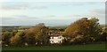


42 photos from this area
Area Information
Key information about the BS22 9TG including its size, population, and administrative classification.
- Area Type
- Postcode
- Area Size
- 12.5 hectares
- Population
- Not available
- Population Density
- Not available
House Prices in BS22 9TG
22
Properties
£292,431
Average Sold Price
£99,950
Lowest Price
£720,000
Highest Price
Showing 22 properties
| Address | Type | Beds | Baths | Last Sale Price | Last Sale Date | |
|---|---|---|---|---|---|---|
| 114 Worlebury Hill Road, Weston Super Mare, BS22 9TG | Bungalow | - | - | £720,000 | Nov 2021 | |
| 82 Worlebury Hill Road, Weston Super Mare, BS22 9TG | house | - | - | £367,000 | Oct 2018 | |
| 102 Worlebury Hill Road, Weston Super Mare, BS22 9TG | Detached | - | - | £435,000 | Aug 2007 | |
| 78 Worlebury Hill Road, Weston Super Mare, BS22 9TG | Flat | - | - | £173,000 | Oct 2000 | |
| 84 Worlebury Hill Road, Weston Super Mare, BS22 9TG | Detached | - | - | £280,000 | Jan 2000 | |
| 94 Worlebury Hill Road, Weston Super Mare, BS22 9TG | Cottage | 3 | 1 | £105,500 | Feb 1998 | |
| 106 Worlebury Hill Road, Weston Super Mare, BS22 9TG | Detached | - | - | £99,950 | Jul 1997 | |
| 108 Worlebury Hill Road, Weston Super Mare, BS22 9TG | Detached | 5 | 2 | £159,000 | Oct 1995 | |
| 104 Worlebury Hill Road, Weston Super Mare, BS22 9TG | Detached | 4 | 1 | - | - | |
| 78C Worlebury Hill Road, Weston Super Mare, BS22 9TG | Flat | 2 | 1 | - | - |
Page 1 of 3
Energy Efficiency in BS22 9TG
Amenities
Schools
| Rank | School | Type | Entry gender | Ages |
|---|
Explore more schools in this area
Go to Schools tabDemographics
Household Size
Two person
most common
Accommodation Type
Houses
most common
Tenure
91
majority
Ethnic Group
White
most common
Religion
N/A
most common
Household Composition
N/A
most common
Age
47
median
Adults (30-64 years)
most common
Household Deprivation
N/A
with no deprivation
NS-SEC
42
in Lower managerial occupations
Explore more demographic insights in this area
Go to Demographics tabPlanning
Planning Constraints
- Flood RiskPremium
- Ramsar Wetland SitesPremium
- Area of Outstanding Natural BeautyPremium
- Protected Nature ReservePremium
- Protected WoodlandPremium