Area Overview for BS22 7SG
Photos of BS22 7SG


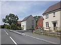
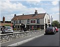
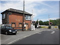
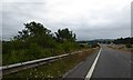


100 photos from this area
Area Information
Key information about the BS22 7SG including its size, population, and administrative classification.
- Area Type
- Postcode
- Area Size
- 6219 m²
- Population
- 1300
- Population Density
- 128 people/km²
House Prices in BS22 7SG
14
Properties
£237,577
Average Sold Price
£149,000
Lowest Price
£302,000
Highest Price
Showing 14 properties
| Address | Type | Beds | Baths | Last Sale Price | Last Sale Date | |
|---|---|---|---|---|---|---|
| 12 The Fields, St Georges, Weston Super Mare, BS22 7SG | Detached | 3 | 2 | £288,000 | Jun 2025 | |
| 5 The Fields, St Georges, Weston Super Mare, BS22 7SG | Semi-detached | 3 | 2 | £302,000 | Aug 2023 | |
| 11 The Fields, St Georges, Weston Super Mare, BS22 7SG | Semi-detached | - | - | £280,000 | Jul 2022 | |
| 8 The Fields, St Georges, Weston Super Mare, BS22 7SG | Detached | 3 | 2 | £290,000 | Dec 2021 | |
| 7 The Fields, St Georges, Weston Super Mare, BS22 7SG | Semi-detached | 3 | 2 | £230,000 | Oct 2019 | |
| 15 The Fields, St Georges, Weston Super Mare, BS22 7SG | house | 4 | 1 | £287,000 | Sep 2018 | |
| 14 The Fields, St Georges, Weston Super Mare, BS22 7SG | Semi-detached | 3 | 2 | £215,000 | May 2017 | |
| 9 The Fields, St Georges, Weston Super Mare, BS22 7SG | house | - | - | £190,000 | Sep 2014 | |
| 3 The Fields, St Georges, Weston Super Mare, BS22 7SG | Detached | 4 | - | £247,500 | Dec 2012 | |
| 10 The Fields, St Georges, Weston Super Mare, BS22 7SG | Detached | - | - | £280,000 | Dec 2007 |
Page 1 of 2
Energy Efficiency in BS22 7SG
Amenities
Schools
| Rank | School | Type | Entry gender | Ages |
|---|
Explore more schools in this area
Go to Schools tabDemographics
Household Size
Family (3-5 people)
most common
Accommodation Type
Houses
most common
Tenure
77
majority
Ethnic Group
White
most common
Religion
N/A
most common
Household Composition
N/A
most common
Age
47
median
Adults (30-64 years)
most common
Household Deprivation
N/A
with no deprivation
NS-SEC
37
in Lower managerial occupations
Explore more demographic insights in this area
Go to Demographics tabPlanning
Planning Constraints
- Flood RiskPremium
- Ramsar Wetland SitesPremium
- Area of Outstanding Natural BeautyPremium
- Protected Nature ReservePremium
- Protected WoodlandPremium