Area Overview for BS22 6DP
Photos of BS22 6DP

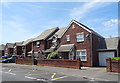
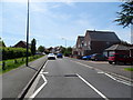
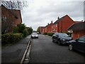
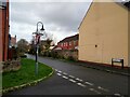
58 photos from this area
Area Information
Key information about the BS22 6DP including its size, population, and administrative classification.
- Area Type
- Postcode
- Area Size
- 5.2 hectares
- Population
- 1581
- Population Density
- 3048 people/km²
House Prices in BS22 6DP
10
Properties
£161,723
Average Sold Price
£95,000
Lowest Price
£245,000
Highest Price
Showing 10 properties
| Address | Type | Beds | Baths | Last Sale Price | Last Sale Date | |
|---|---|---|---|---|---|---|
| 4 Morgan Close, Weston Super Mare, BS22 6DP | Flat | 1 | 1 | £158,500 | Jan 2025 | |
| 3 Morgan Close, Weston Super Mare, BS22 6DP | Terraced | 2 | 1 | £239,000 | Jul 2023 | |
| 7 Morgan Close, Weston Super Mare, BS22 6DP | Flat | - | - | £155,000 | Jan 2022 | |
| 8 Morgan Close, Weston Super Mare, BS22 6DP | Terraced | 3 | 2 | £245,000 | Aug 2019 | |
| 2 Morgan Close, Weston Super Mare, BS22 6DP | Terraced | 2 | 1 | £190,000 | Aug 2019 | |
| 9 Morgan Close, Weston Super Mare, BS22 6DP | house | - | - | £95,000 | Dec 2008 | |
| 10 Morgan Close, Weston Super Mare, BS22 6DP | Terraced | - | - | £118,500 | Oct 2006 | |
| 5 Morgan Close, Weston Super Mare, BS22 6DP | Terraced | - | - | £179,275 | Feb 2006 | |
| 1 Morgan Close, Weston Super Mare, BS22 6DP | Detached | 2 | 1 | £112,000 | Nov 2003 | |
| 6 Morgan Close, Weston Super Mare, BS22 6DP | Semi-detached | 3 | 2 | £124,950 | Apr 2002 |
Energy Efficiency in BS22 6DP
Amenities
Schools
| Rank | School | Type | Entry gender | Ages |
|---|
Explore more schools in this area
Go to Schools tabDemographics
Household Size
Family (3-5 people)
most common
Accommodation Type
Houses
most common
Tenure
70
majority
Ethnic Group
White
most common
Religion
N/A
most common
Household Composition
N/A
most common
Age
47
median
Adults (30-64 years)
most common
Household Deprivation
N/A
with no deprivation
NS-SEC
29
in Lower managerial occupations
Explore more demographic insights in this area
Go to Demographics tabPlanning
Planning Constraints
- Flood RiskPremium
- Ramsar Wetland SitesPremium
- Area of Outstanding Natural BeautyPremium
- Protected Nature ReservePremium
- Protected WoodlandPremium