Area Overview for BS21 6UU
Photos of BS21 6UU
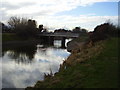
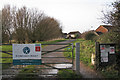

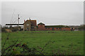
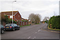
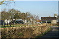

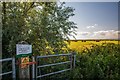
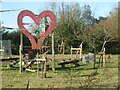
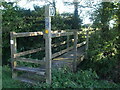

49 photos from this area
Area Information
Key information about the BS21 6UU including its size, population, and administrative classification.
- Area Type
- Postcode
- Area Size
- 1.2 km²
- Population
- 1474
- Population Density
- 927 people/km²
House Prices in BS21 6UU
25
Properties
£424,786
Average Sold Price
£83,500
Lowest Price
£780,000
Highest Price
Showing 25 properties
| Address | Type | Beds | Baths | Last Sale Price | Last Sale Date | |
|---|---|---|---|---|---|---|
| Clanna, Lower Strode Road, Clevedon, BS21 6UU | Semi-detached | 3 | 1 | £585,000 | Nov 2024 | |
| Moor Cottage, Lower Strode Road, Clevedon, BS21 6UU | Detached | - | - | £230,000 | Dec 2021 | |
| Dowlais Cottage Farm, Lower Strode Road, Clevedon, BS21 6UU | Detached | 5 | 4 | £780,000 | Mar 2020 | |
| Courtlands, Lower Strode Road, Clevedon, BS21 6UU | house | - | - | £120,000 | Jul 2018 | |
| Dorsal Farm, Lower Strode Road, Clevedon, BS21 6UU | Detached | - | - | £725,000 | Nov 2007 | |
| Leabrook Lodge, Lower Strode Road, Clevedon, BS21 6UU | Detached | - | - | £450,000 | Jan 2004 | |
| Hayes Cottage, Lower Strode Road, Clevedon, BS21 6UU | Semi-detached | - | - | £83,500 | Jan 1995 | |
| The Willows, Lower Strode Road, Clevedon, BS21 6UU | Bungalow | 5 | 4 | - | - | |
| Flat, Stileway House, Lower Strode Road, Clevedon, BS21 6UU | Flat | - | - | - | - | |
| Stileway Farm, Lower Strode Road, Clevedon, BS21 6UU | Farm | - | - | - | - |
Page 1 of 3
Energy Efficiency in BS21 6UU
Amenities
Schools
| Rank | School | Type | Entry gender | Ages |
|---|
Explore more schools in this area
Go to Schools tabDemographics
Household Size
Two person
most common
Accommodation Type
Houses
most common
Tenure
87
majority
Ethnic Group
White
most common
Religion
N/A
most common
Household Composition
N/A
most common
Age
47
median
Adults (30-64 years)
most common
Household Deprivation
N/A
with no deprivation
NS-SEC
37
in Lower managerial occupations
Explore more demographic insights in this area
Go to Demographics tabPlanning
Planning Constraints
- Flood RiskPremium
- Ramsar Wetland SitesPremium
- Area of Outstanding Natural BeautyPremium
- Protected Nature ReservePremium
- Protected WoodlandPremium