Area Overview for BS21 5DH
Photos of BS21 5DH
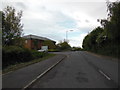
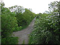
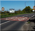
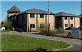
35 photos from this area
Area Information
Key information about the BS21 5DH including its size, population, and administrative classification.
- Area Type
- Postcode
- Area Size
- 6044 m²
- Population
- Not available
- Population Density
- Not available
House Prices in BS21 5DH
25
Properties
£105,879
Average Sold Price
£37,000
Lowest Price
£262,500
Highest Price
Showing 25 properties
| Address | Type | Beds | Baths | Last Sale Price | Last Sale Date | |
|---|---|---|---|---|---|---|
| 47 Carice Gardens, Clevedon, BS21 5DH | Terraced | 2 | 1 | £262,500 | Jun 2025 | |
| 24 Carice Gardens, Clevedon, BS21 5DH | Flat | - | - | £100,000 | Jun 2025 | |
| 33 Carice Gardens, Clevedon, BS21 5DH | Flat | - | 1 | £99,950 | Sep 2023 | |
| 45 Carice Gardens, Clevedon, BS21 5DH | house | - | - | £150,000 | Aug 2017 | |
| 29 Carice Gardens, Clevedon, BS21 5DH | Flat | - | - | £92,500 | Jun 2017 | |
| 48 Carice Gardens, Clevedon, BS21 5DH | house | 2 | - | £202,000 | Jun 2017 | |
| 37 Carice Gardens, Clevedon, BS21 5DH | Terraced | 2 | 1 | £195,000 | Mar 2017 | |
| 34 Carice Gardens, Clevedon, BS21 5DH | Flat | - | - | £76,995 | Jun 2016 | |
| 26 Carice Gardens, Clevedon, BS21 5DH | Flat | 1 | 1 | £80,000 | May 2016 | |
| 35 Carice Gardens, Clevedon, BS21 5DH | Flat | - | - | £65,000 | May 2013 |
Page 1 of 3
Energy Efficiency in BS21 5DH
Amenities
Schools
| Rank | School | Type | Entry gender | Ages |
|---|
Explore more schools in this area
Go to Schools tabDemographics
Household Size
One person
most common
Accommodation Type
Houses
most common
Tenure
69
majority
Ethnic Group
White
most common
Religion
N/A
most common
Household Composition
N/A
most common
Age
47
median
Adults (30-64 years)
most common
Household Deprivation
N/A
with no deprivation
NS-SEC
32
in Lower managerial occupations
Explore more demographic insights in this area
Go to Demographics tabPlanning
Planning Constraints
- Flood RiskPremium
- Ramsar Wetland SitesPremium
- Area of Outstanding Natural BeautyPremium
- Protected Nature ReservePremium
- Protected WoodlandPremium