Area Overview for BS20 9XP
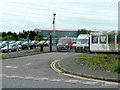
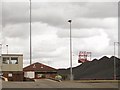
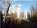
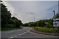
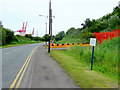
Photos of BS20 9XP


Area Information
BS20 9XP lies in the heart of North Somerset, a small residential cluster near the River Avon, just south of Bristol. With a population of 1,363 and a density of 222 people per square kilometre, it is a compact, tightly knit community. Historically part of the parish of Bedminster, the area is steeped in heritage, with St George’s Church in Easton-in-Gordano dating back to the 13th century. Its proximity to Bristol offers easy access to the city’s amenities, while its rural setting provides a quieter, more traditional lifestyle. The area’s charm lies in its blend of historical significance and modern convenience, with nearby rail links and ferry services connecting residents to both urban and coastal destinations. Daily life here is shaped by a strong sense of community, with local landmarks like Christ Church Pill and the historic Crockerne Pill adding to its character. For those seeking a balance between tranquillity and connectivity, BS20 9XP offers a unique blend of small-town charm and practical accessibility.
- Area Type
- Postcode
- Area Size
- Not available
- Population
- 1363
- Population Density
- 222 people/km²
BS20 9XP is a predominantly owner-occupied area, with 91% of homes owned by residents rather than rented. The housing stock is largely composed of houses, reflecting a low-density, suburban or semi-rural layout typical of smaller communities. This contrasts with urban areas where flats and apartments dominate. The high proportion of owner-occupied properties suggests a stable market with long-term residents, which can be appealing to buyers seeking a settled environment. However, the small population and limited housing stock mean the area is not suited to large-scale development. Buyers should consider the proximity to Bristol for additional property options, though the immediate surroundings may offer fewer choices. The focus on houses also implies a preference for private, family-oriented living rather than high-density housing.
House Prices in BS20 9XP
No properties found in this postcode.
Energy Efficiency in BS20 9XP
Living in BS20 9XP offers access to a range of amenities within practical reach. Retail options include major stores like Waitrose, Co-op Avonmouth, and Costco Bristol, catering to everyday shopping needs. The area’s rail network, with stations such as Avonmouth and Portway Park & Ride, provides efficient commuting to Bristol and surrounding towns. Ferries at Bristol Docks and Portishead Pier offer leisure opportunities, including trips to the waterfront and nearby attractions. While the area is small, its proximity to larger centres ensures residents can enjoy both local convenience and broader urban amenities. The mix of retail, transport, and water-based access creates a lifestyle that balances practicality with the charm of a smaller community.
Amenities
Schools
| Rank | School | Type | Entry gender | Ages |
|---|
Explore more schools in this area
Go to Schools tabDemographics
The population of BS20 9XP has a median age of 47, with the majority of residents aged between 30 and 64. This suggests a mature, stable community with a focus on established households. Home ownership is exceptionally high at 91%, reflecting a predominance of owner-occupied properties rather than rental units. The accommodation type is largely houses, indicating a more traditional, low-density housing stock compared to urban areas. The predominant ethnic group is White, which aligns with the broader demographic patterns of the region. The age profile and high home ownership rate suggest a community prioritising long-term stability over transient living. With no specific data on deprivation, the area appears to support a quality of life consistent with its historical and residential character, though further localised analysis would be needed to confirm this.
Household Size
Accommodation Type
Tenure
Ethnic Group
Religion
Household Composition
Age
Household Deprivation
NS-SEC
Explore more demographic insights in this area
Go to Demographics tabPlanning
Planning Constraints
- Flood RiskPremium
- Ramsar Wetland SitesPremium
- Area of Outstanding Natural BeautyPremium
- Protected Nature ReservePremium
- Protected WoodlandPremium