Area Overview for BS20 8NS
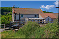
Photos of BS20 8NS


Area Information
Living in BS20 8NS, a small residential cluster in North Somerset, offers a blend of coastal charm and suburban convenience. With a population of 1,790 and a density of 1,010 people per square kilometre, the area feels compact yet well-served by nearby amenities. Nestled near the Bristol Channel, Portishead—a town historically rooted as a fishing port—offers a mix of Victorian-era architecture, a marina repurposed from 19th-century docks, and modern housing developments. The community is predominantly middle-aged, with a median age of 47, and 87% of residents owning their homes. Daily life here balances proximity to Bristol’s urban energy with the tranquillity of a coastal town. Residents can walk to shops, enjoy ferry access to nearby piers, and benefit from rail links to Avonmouth and Nailsea. The area’s compact size means most essentials are within practical reach, though its small footprint means buyers should consider nearby zones for broader options.
- Area Type
- Postcode
- Area Size
- Not available
- Population
- 1790
- Population Density
- 1010 people/km²
The property market in BS20 8NS is characterised by high home ownership (87%) and a predominance of houses. This suggests a market skewed towards owner-occupied properties rather than rentals, with limited availability of flats or apartments. The focus on houses implies a demand for larger homes, likely semi-detached or detached, suited to families or those seeking space. Given the area’s small size, the housing stock is finite, meaning buyers may need to consider nearby postcode areas for more options. The high ownership rate indicates a stable market with low turnover, potentially offering long-term value. However, the compact nature of the area means competition for properties could be fierce, particularly for homes near amenities like the Portishead Marina or schools.
House Prices in BS20 8NS
No properties found in this postcode.
Energy Efficiency in BS20 8NS
Residents of BS20 8NS enjoy a lifestyle shaped by coastal access, retail convenience, and historical charm. Within practical reach are five retail outlets, including Co-op Portishead and Aldi Portishead, offering everyday shopping needs. Ferries to Portishead Pier and Clevedon Pier provide leisure opportunities and links to nearby towns. Rail stations like Portway Park & Ride and Avonmouth Station ensure easy travel to Bristol and beyond. The area’s character is defined by its coastal heritage, with landmarks like the Portishead Marina and St. Peter’s Church. Parks such as Lake Grounds, opened in 1910, offer recreational space. The mix of retail, transport, and historic sites creates a balanced lifestyle, blending urban accessibility with the tranquillity of a seaside community.
Amenities
Schools
The nearest schools to BS20 8NS include Gordano School, which operates as both a primary school and an academy with an Ofsted rating of “good.” This dual role provides a range of educational stages for families, from early years to secondary education. The “good” rating indicates a school that meets standards in teaching quality and student outcomes, though it is not the highest possible. The presence of a single named school suggests a reliance on local institutions, with no mention of other nearby schools in the data. For families, this means a clear, albeit limited, choice of educational providers. The academy status may offer additional resources or specialisms, but parents should verify specific curricula or facilities directly with the school.
| Rank | School | Type | Entry gender | Ages |
|---|
Explore more schools in this area
Go to Schools tabDemographics
BS20 8NS has a median age of 47, with the majority of residents aged between 30 and 64. This suggests a mature, stable community with a strong presence of families and long-term homeowners. Home ownership is exceptionally high at 87%, indicating a lack of rental properties and a focus on private residences. The area is primarily composed of houses, reflecting a preference for larger, detached or semi-detached properties over flats. The predominant ethnic group is White, though specific data on other demographics is not provided. With a population density of 1,010 people per square kilometre, the area is neither overcrowded nor sparse, offering a balanced living environment. The age profile and ownership rates suggest a community prioritising security and permanence, with limited turnover in housing.
Household Size
Accommodation Type
Tenure
Ethnic Group
Religion
Household Composition
Age
Household Deprivation
NS-SEC
Explore more demographic insights in this area
Go to Demographics tabPlanning
Planning Constraints
- Flood RiskPremium
- Ramsar Wetland SitesPremium
- Area of Outstanding Natural BeautyPremium
- Protected Nature ReservePremium
- Protected WoodlandPremium