Area Overview for BS20 8DU
Photos of BS20 8DU
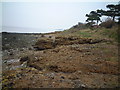
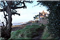

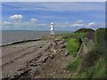

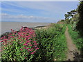
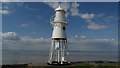
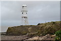
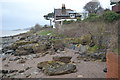
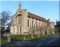
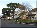
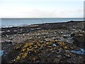
59 photos from this area
Area Information
Key information about the BS20 8DU including its size, population, and administrative classification.
- Area Type
- Postcode
- Area Size
- 2.7 hectares
- Population
- 1363
- Population Density
- 1786 people/km²
House Prices in BS20 8DU
20
Properties
£504,261
Average Sold Price
£95,000
Lowest Price
£1,165,000
Highest Price
Showing 20 properties
| Address | Type | Beds | Baths | Last Sale Price | Last Sale Date | |
|---|---|---|---|---|---|---|
| 123 Nore Road, Portishead, BS20 8DU | Detached | 4 | 2 | £515,000 | Oct 2025 | |
| 111 Nore Road, Portishead, BS20 8DU | Detached | 3 | 2 | £743,000 | Mar 2025 | |
| 82 Nore Road, Portishead, BS20 8DU | Retail | 4 | 1 | £625,000 | Nov 2022 | |
| 127 Nore Road, Portishead, BS20 8DU | house | - | - | £570,000 | Sep 2021 | |
| 121 Nore Road, Portishead, BS20 8DU | Detached | 4 | 2 | £650,000 | Nov 2019 | |
| The Watch House, 70A Nore Road, Portishead, BS20 8DU | Detached | 7 | 6 | £1,165,000 | May 2019 | |
| 109 Nore Road, Portishead, BS20 8DU | Detached | - | - | £359,656 | Jan 2005 | |
| 129 Nore Road, Portishead, BS20 8DU | house | 4 | 3 | £179,950 | May 2000 | |
| 115 Nore Road, Portishead, BS20 8DU | house | - | - | £140,000 | Nov 1996 | |
| 117 Nore Road, Portishead, BS20 8DU | house | - | - | £95,000 | Nov 1996 |
Page 1 of 2
Energy Efficiency in BS20 8DU
Amenities
Schools
| Rank | School | Type | Entry gender | Ages |
|---|
Explore more schools in this area
Go to Schools tabDemographics
Household Size
Two person
most common
Accommodation Type
Houses
most common
Tenure
87
majority
Ethnic Group
White
most common
Religion
N/A
most common
Household Composition
N/A
most common
Age
47
median
Adults (30-64 years)
most common
Household Deprivation
N/A
with no deprivation
NS-SEC
52
in Lower managerial occupations
Explore more demographic insights in this area
Go to Demographics tabPlanning
Planning Constraints
- Flood RiskPremium
- Ramsar Wetland SitesPremium
- Area of Outstanding Natural BeautyPremium
- Protected Nature ReservePremium
- Protected WoodlandPremium