Area Overview for BS20 7TZ
Photos of BS20 7TZ
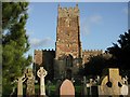
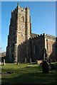
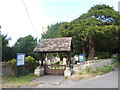
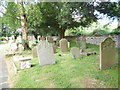
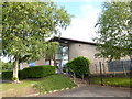
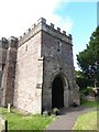
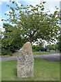
100 photos from this area
Area Information
Key information about the BS20 7TZ including its size, population, and administrative classification.
- Area Type
- Postcode
- Area Size
- 2.1 hectares
- Population
- 1818
- Population Density
- 178 people/km²
House Prices in BS20 7TZ
21
Properties
£170,950
Average Sold Price
£70,000
Lowest Price
£345,000
Highest Price
Showing 21 properties
| Address | Type | Beds | Baths | Last Sale Price | Last Sale Date | |
|---|---|---|---|---|---|---|
| 13 Brittan Place, Portbury, BS20 7TZ | Semi-detached | 3 | 2 | £326,000 | Mar 2023 | |
| 6 Brittan Place, Portbury, BS20 7TZ | Retail | 2 | 1 | £200,000 | Nov 2022 | |
| 12 Brittan Place, Portbury, BS20 7TZ | house | - | - | £345,000 | Jun 2022 | |
| 17 Brittan Place, Portbury, BS20 7TZ | Semi-detached | 3 | - | £231,500 | Aug 2018 | |
| 15 Brittan Place, Portbury, BS20 7TZ | Semi-detached | 3 | 1 | £140,000 | Jun 2009 | |
| 3 Brittan Place, Portbury, BS20 7TZ | Terraced | - | - | £107,000 | Apr 2007 | |
| 9 Brittan Place, Portbury, BS20 7TZ | Detached | 3 | 1 | £70,000 | Jan 2004 | |
| 8 Brittan Place, Portbury, BS20 7TZ | house | - | - | £115,000 | Nov 2003 | |
| 5 Brittan Place, Portbury, BS20 7TZ | Maisonette | 2 | 1 | £99,000 | Apr 2003 | |
| 19 Brittan Place, Portbury, BS20 7TZ | Semi-detached | - | - | £76,000 | Jan 2001 |
Page 1 of 3
Energy Efficiency in BS20 7TZ
Amenities
Schools
| Rank | School | Type | Entry gender | Ages |
|---|
Explore more schools in this area
Go to Schools tabDemographics
Household Size
Family (3-5 people)
most common
Accommodation Type
Houses
most common
Tenure
84
majority
Ethnic Group
White
most common
Religion
N/A
most common
Household Composition
N/A
most common
Age
47
median
Adults (30-64 years)
most common
Household Deprivation
N/A
with no deprivation
NS-SEC
49
in Lower managerial occupations
Explore more demographic insights in this area
Go to Demographics tabPlanning
Planning Constraints
- Flood RiskPremium
- Ramsar Wetland SitesPremium
- Area of Outstanding Natural BeautyPremium
- Protected Nature ReservePremium
- Protected WoodlandPremium