Area Overview for BS20 7TF
Photos of BS20 7TF
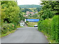
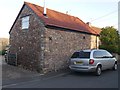

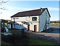
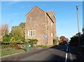
63 photos from this area
Area Information
Key information about the BS20 7TF including its size, population, and administrative classification.
- Area Type
- Postcode
- Area Size
- 18.1 hectares
- Population
- 1818
- Population Density
- 178 people/km²
House Prices in BS20 7TF
11
Properties
£355,833
Average Sold Price
£175,000
Lowest Price
£647,500
Highest Price
Showing 11 properties
| Address | Type | Beds | Baths | Last Sale Price | Last Sale Date | |
|---|---|---|---|---|---|---|
| Holford House, Sheepway, Portbury, BS20 7TF | house | 4 | - | £647,500 | Oct 2007 | |
| The New House, Sheepway, Portbury, BS20 7TF | house | - | - | £245,000 | Mar 2005 | |
| Holford Lodge, Sheepway, Portbury, BS20 7TF | house | - | - | £175,000 | Aug 2001 | |
| Priory Croft, Sheepway, Portbury, BS20 7TF | Retail | - | - | - | - | |
| S J M Photographic, Unit 5, Elm Tree Farm, Sheepway, Portbury, BS20 7TF | Office | - | - | - | - | |
| Holford Cottage, Sheepway, Portbury, BS20 7TF | Semi-detached | - | - | - | - | |
| Astron Fire And Security Ltd, Unit 1 Atcost Barn, Elm Tree Farm, Sheepway, Portbury, BS20 7TF | Office | - | - | - | - | |
| Humberstones Ltd, Low Barn Middle, Elm Tree Farm, Sheepway, Portbury, BS20 7TF | Office | - | - | - | - | |
| Caple Banks Ltd, Caple Banks, Elm Tree Farm, Sheepway, Portbury, BS20 7TF | Office | - | - | - | - | |
| Bristol Menopause & Wellwoman Clinic, Low Barn, Sheepway, Portbury, BS20 7TF | office_workshop | - | - | - | - |
Page 1 of 2
Energy Efficiency in BS20 7TF
Amenities
Schools
| Rank | School | Type | Entry gender | Ages |
|---|
Explore more schools in this area
Go to Schools tabDemographics
Household Size
Family (3-5 people)
most common
Accommodation Type
Houses
most common
Tenure
84
majority
Ethnic Group
White
most common
Religion
N/A
most common
Household Composition
N/A
most common
Age
47
median
Adults (30-64 years)
most common
Household Deprivation
N/A
with no deprivation
NS-SEC
49
in Lower managerial occupations
Explore more demographic insights in this area
Go to Demographics tabPlanning
Planning Constraints
- Flood RiskPremium
- Ramsar Wetland SitesPremium
- Area of Outstanding Natural BeautyPremium
- Protected Nature ReservePremium
- Protected WoodlandPremium