Area Overview for BS20 6JP
Photos of BS20 6JP
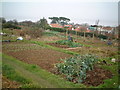
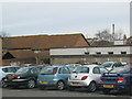
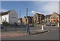
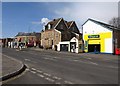
100 photos from this area
Area Information
Key information about the BS20 6JP including its size, population, and administrative classification.
- Area Type
- Postcode
- Area Size
- 6922 m²
- Population
- 1477
- Population Density
- 4409 people/km²
House Prices in BS20 6JP
18
Properties
£244,577
Average Sold Price
£76,000
Lowest Price
£410,000
Highest Price
Showing 18 properties
| Address | Type | Beds | Baths | Last Sale Price | Last Sale Date | |
|---|---|---|---|---|---|---|
| 65 Avon Way, Portishead, BS20 6JP | Semi-detached | 3 | 1 | £330,000 | May 2024 | |
| 53 Avon Way, Portishead, BS20 6JP | Semi-detached | 3 | 1 | £380,000 | Feb 2023 | |
| 51 Avon Way, Portishead, BS20 6JP | Semi-detached | 3 | 1 | £410,000 | Oct 2022 | |
| 57 Avon Way, Portishead, BS20 6JP | Semi-detached | 3 | 1 | £300,000 | Apr 2022 | |
| 45 Avon Way, Portishead, BS20 6JP | house | 3 | - | £262,500 | May 2021 | |
| 47 Avon Way, Portishead, BS20 6JP | Semi-detached | 3 | 2 | £315,000 | Sep 2018 | |
| 59 Avon Way, Portishead, BS20 6JP | Semi-detached | 3 | 1 | £279,000 | Jan 2018 | |
| 49 Avon Way, Portishead, BS20 6JP | Semi-detached | 3 | 2 | £283,000 | Dec 2017 | |
| 55 Avon Way, Portishead, BS20 6JP | Semi-detached | 3 | - | £200,000 | Feb 2015 | |
| 75A Avon Way, Portishead, BS20 6JP | Flat | - | - | £90,000 | Nov 2012 |
Page 1 of 2
Energy Efficiency in BS20 6JP
Amenities
Schools
| Rank | School | Type | Entry gender | Ages |
|---|
Explore more schools in this area
Go to Schools tabDemographics
Household Size
Family (3-5 people)
most common
Accommodation Type
Houses
most common
Tenure
65
majority
Ethnic Group
White
most common
Religion
N/A
most common
Household Composition
N/A
most common
Age
47
median
Adults (30-64 years)
most common
Household Deprivation
N/A
with no deprivation
NS-SEC
36
in Lower managerial occupations
Explore more demographic insights in this area
Go to Demographics tabPlanning
Planning Constraints
- Flood RiskPremium
- Ramsar Wetland SitesPremium
- Area of Outstanding Natural BeautyPremium
- Protected Nature ReservePremium
- Protected WoodlandPremium