Area Overview for BS20 6BW
Photos of BS20 6BW
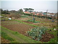
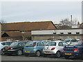
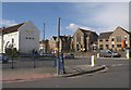
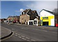
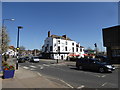
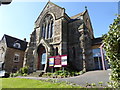
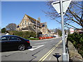
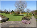
100 photos from this area
Area Information
Key information about the BS20 6BW including its size, population, and administrative classification.
- Area Type
- Postcode
- Area Size
- 7106 m²
- Population
- 1310
- Population Density
- 3204 people/km²
House Prices in BS20 6BW
26
Properties
£242,992
Average Sold Price
£112,950
Lowest Price
£489,950
Highest Price
Showing 26 properties
| Address | Type | Beds | Baths | Last Sale Price | Last Sale Date | |
|---|---|---|---|---|---|---|
| 36 Slade Road, Portishead, BS20 6BW | Terraced | 4 | 2 | £489,950 | Apr 2025 | |
| 56 Slade Road, Portishead, BS20 6BW | Terraced | 2 | 1 | £330,000 | Dec 2024 | |
| 58 Slade Road, Portishead, BS20 6BW | house | - | - | £315,000 | Feb 2022 | |
| 13 Slade Road, Portishead, BS20 6BW | Semi-detached | 3 | 2 | £357,000 | Jul 2019 | |
| 62 Slade Road, Portishead, BS20 6BW | house | 3 | 1 | £280,000 | Jan 2019 | |
| 15 Slade Road, Portishead, BS20 6BW | Semi-detached | 3 | 1 | £325,000 | Jun 2018 | |
| 32 Slade Road, Portishead, BS20 6BW | Terraced | - | - | £350,000 | Dec 2017 | |
| 21 Slade Road, Portishead, BS20 6BW | house | 3 | - | £318,000 | Jan 2016 | |
| 52 Slade Road, Portishead, BS20 6BW | Terraced | 2 | - | £236,000 | Jun 2015 | |
| 54 Slade Road, Portishead, BS20 6BW | Terraced | 3 | - | £240,000 | Sep 2014 |
Page 1 of 3
Energy Efficiency in BS20 6BW
Amenities
Schools
| Rank | School | Type | Entry gender | Ages |
|---|
Explore more schools in this area
Go to Schools tabDemographics
Household Size
One person
most common
Accommodation Type
Houses
most common
Tenure
75
majority
Ethnic Group
White
most common
Religion
N/A
most common
Household Composition
N/A
most common
Age
47
median
Adults (30-64 years)
most common
Household Deprivation
N/A
with no deprivation
NS-SEC
42
in Lower managerial occupations
Explore more demographic insights in this area
Go to Demographics tabPlanning
Planning Constraints
- Flood RiskPremium
- Ramsar Wetland SitesPremium
- Area of Outstanding Natural BeautyPremium
- Protected Nature ReservePremium
- Protected WoodlandPremium