Area Overview for BS20 0EH
Photos of BS20 0EH
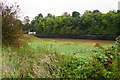
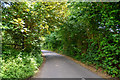
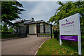
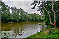
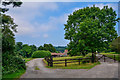
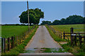
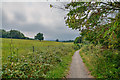
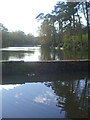
55 photos from this area
Area Information
Key information about the BS20 0EH including its size, population, and administrative classification.
- Area Type
- Postcode
- Area Size
- 4.2 hectares
- Population
- 1907
- Population Density
- 1440 people/km²
House Prices in BS20 0EH
42
Properties
£345,265
Average Sold Price
£149,950
Lowest Price
£760,000
Highest Price
Showing 42 properties
| Address | Type | Beds | Baths | Last Sale Price | Last Sale Date | |
|---|---|---|---|---|---|---|
| 9 Fitzharding Road, Pill, BS20 0EH | Detached | 3 | 2 | £535,000 | Mar 2025 | |
| 18 Fitzharding Road, Pill, BS20 0EH | Detached | 4 | 2 | £605,000 | Jan 2025 | |
| 17 Fitzharding Road, Pill, BS20 0EH | Detached | 4 | 2 | £675,000 | Nov 2024 | |
| 5 Fitzharding Road, Pill, BS20 0EH | Detached | 3 | 3 | £531,000 | Dec 2022 | |
| 45 Fitzharding Road, Pill, BS20 0EH | Detached | 4 | 2 | £615,000 | Jul 2022 | |
| 12 Fitzharding Road, Pill, BS20 0EH | Detached | 3 | 2 | £434,000 | Nov 2021 | |
| 40 Fitzharding Road, Pill, BS20 0EH | house | - | - | £760,000 | Mar 2021 | |
| 6 Fitzharding Road, Pill, BS20 0EH | Detached | 4 | 2 | £455,000 | Aug 2018 | |
| 7 Fitzharding Road, Pill, BS20 0EH | Detached | 4 | 3 | £390,000 | Jun 2016 | |
| 28 Fitzharding Road, Pill, BS20 0EH | Detached | 4 | 2 | £384,000 | Apr 2014 |
Page 1 of 5
Energy Efficiency in BS20 0EH
Amenities
Schools
| Rank | School | Type | Entry gender | Ages |
|---|
Explore more schools in this area
Go to Schools tabDemographics
Household Size
Two person
most common
Accommodation Type
Houses
most common
Tenure
77
majority
Ethnic Group
White
most common
Religion
N/A
most common
Household Composition
N/A
most common
Age
47
median
Adults (30-64 years)
most common
Household Deprivation
N/A
with no deprivation
NS-SEC
41
in Lower managerial occupations
Explore more demographic insights in this area
Go to Demographics tabPlanning
Planning Constraints
- Flood RiskPremium
- Ramsar Wetland SitesPremium
- Area of Outstanding Natural BeautyPremium
- Protected Nature ReservePremium
- Protected WoodlandPremium