Area Overview for BS2 9XA
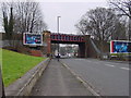
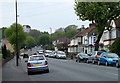
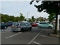
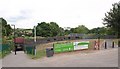
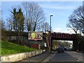
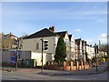
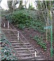
Photos of BS2 9XA

Area Information
BS2 9XA is a small residential postcode in northern Bristol, part of the Lockleaze Ward. With a population of 2200, it is a compact area defined by post-war housing developments built in the 1940s and 1950s. The neighbourhood features pre-cast concrete homes originally owned by Bristol Corporation, set against the backdrop of Purdown hill and nearby green spaces. Its proximity to the city centre—just 3 miles away—offers a balance of suburban tranquillity and urban access. The area is linked to historical landmarks, including the ruins of Purdown Percy, a WWII anti-aircraft site, and St James’ Church, which inspired the musical *Jesus Christ Superstar*. Lockleaze is also a government ‘Frontrunner’ pilot area, focusing on community-led planning for housing, employment, and environmental action. While it retains a council estate character, recent efforts by the Lockleaze Neighbourhood Trust highlight initiatives in climate action, youth provision, and local amenities. The area’s charm lies in its mix of practical living and historical context, though challenges like road safety and childcare shortages persist.
- Area Type
- Postcode
- Area Size
- Not available
- Population
- 2200
- Population Density
- 2856 people/km²
The property market in BS2 9XA is characterised by a high rate of home ownership (73%) and a predominance of houses as the primary accommodation type. This suggests a largely owner-occupied area with a focus on family homes, typical of post-war housing developments. The housing stock consists of pre-cast concrete structures built by Bristol Corporation, many dating from the 1930s and 1950s. While these homes may offer affordability, their age and design could present maintenance challenges. The area’s small size and limited new developments mean the housing market is likely tight, with limited scope for new builds. For buyers, this implies competition for existing properties and potential long-term value retention, though proximity to the city centre may offset any drawbacks. The market’s stability is reinforced by the community’s established character, though buyers should consider the need for modernisation in older properties.
House Prices in BS2 9XA
No properties found in this postcode.
Energy Efficiency in BS2 9XA
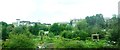
Living in BS2 9XA offers access to a range of amenities within practical reach. Retail options include M&S Bristol, Tesco Bristol E, and Spar Mina, providing everyday shopping needs. The area’s proximity to rail, ferry, and metro services enhances mobility, with Ashley Down, Stapleton Road, and Montpelier stations offering links to the city. For leisure, the nearby Purdown hill and Stoke Park offer green spaces for walking, cycling, or outdoor activities. The Vench playground and new developments on South Purdown provide recreational facilities for families. Cultural landmarks like St James’ and St Mary’s Churches add to the area’s character. While dining options are not explicitly listed, the presence of retail and transport hubs suggests a mix of local eateries and cafes. The combination of practical amenities and green spaces supports a balanced lifestyle, though the area’s suburban nature means some services may require travel to larger centres.
Amenities
Schools
The nearest school to BS2 9XA is Glenfrome Primary School, which has an Ofsted rating of ‘good’. This school serves the local community, providing primary education for children in the area. The presence of a single primary school suggests that families may need to travel to secondary education, though nearby areas may offer additional options. The school’s ‘good’ rating indicates a satisfactory standard of teaching and facilities, which is important for parents prioritising quality education. However, the absence of secondary schools within the immediate vicinity means families may need to consider commuting or enrolling children in nearby districts. The school’s role is central to the area’s social fabric, supporting the needs of the predominantly adult population with children in primary education.
| Rank | School | Type | Entry gender | Ages |
|---|
Explore more schools in this area
Go to Schools tabDemographics
The population of BS2 9XA has a median age of 47, with the majority of residents aged 30–64. This suggests a community of established adults, likely with families or long-term ties to the area. Home ownership is high at 73%, indicating a stable resident base with long-term investment in property. The primary accommodation type is houses, reflecting a suburban layout typical of post-war housing estates. The predominant ethnic group is White, though specific diversity statistics are not provided. The age profile and ownership figures suggest a mature, settled population, which may influence local services and amenities. However, the area’s deprivation levels are not explicitly stated, though community initiatives like the Lockleaze Neighbourhood Trust indicate efforts to address local needs. The demographic makeup aligns with a working-age population, potentially impacting demand for schools, healthcare, and employment opportunities.
Household Size
Accommodation Type
Tenure
Ethnic Group
Religion
Household Composition
Age
Household Deprivation
NS-SEC
Explore more demographic insights in this area
Go to Demographics tabPlanning
Planning Constraints
- Flood RiskPremium
- Ramsar Wetland SitesPremium
- Area of Outstanding Natural BeautyPremium
- Protected Nature ReservePremium
- Protected WoodlandPremium