Area Overview for BS2 8YB
Photos of BS2 8YB
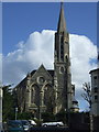
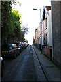
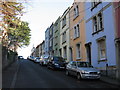
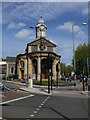
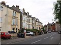
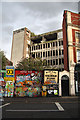
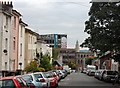
100 photos from this area
Area Information
Key information about the BS2 8YB including its size, population, and administrative classification.
- Area Type
- Postcode
- Area Size
- 8805 m²
- Population
- 1571
- Population Density
- 16976 people/km²
House Prices in BS2 8YB
24
Properties
£218,800
Average Sold Price
£142,000
Lowest Price
£296,000
Highest Price
Showing 24 properties
| Address | Type | Beds | Baths | Last Sale Price | Last Sale Date | |
|---|---|---|---|---|---|---|
| 113 Grosvenor Road, St Pauls, Bristol, BS2 8YB | house | 2 | 1 | £296,000 | Aug 2023 | |
| 103 Grosvenor Road, St Pauls, Bristol, BS2 8YB | Terraced | 2 | 1 | £295,000 | Apr 2021 | |
| 109 Grosvenor Road, St Pauls, Bristol, BS2 8YB | house | - | - | £211,000 | Aug 2017 | |
| 87 Grosvenor Road, St Pauls, Bristol, BS2 8YB | house | - | - | £150,000 | Aug 2014 | |
| 93 Grosvenor Road, St Pauls, Bristol, BS2 8YB | Terraced | 2 | - | £142,000 | Jun 2013 | |
| 81 Grosvenor Road, St Pauls, Bristol, BS2 8YB | Terraced | 2 | - | - | - | |
| 97 Grosvenor Road, St Pauls, Bristol, BS2 8YB | Terraced | - | - | - | - | |
| 101 Grosvenor Road, St Pauls, Bristol, BS2 8YB | house | - | - | - | - | |
| 89 Grosvenor Road, St Pauls, Bristol, BS2 8YB | Terraced | - | - | - | - | |
| 107 Grosvenor Road, St Pauls, Bristol, BS2 8YB | house | - | - | - | - |
Page 1 of 3
Energy Efficiency in BS2 8YB
Amenities
Schools
| Rank | School | Type | Entry gender | Ages |
|---|
Explore more schools in this area
Go to Schools tabDemographics
Household Size
One person
most common
Accommodation Type
Flats
most common
Tenure
18
majority
Ethnic Group
black_total
most common
Religion
N/A
most common
Household Composition
N/A
most common
Age
22
median
Adults (30-64 years)
most common
Household Deprivation
N/A
with no deprivation
NS-SEC
21
in Lower managerial occupations
Explore more demographic insights in this area
Go to Demographics tabPlanning
Planning Constraints
- Flood RiskPremium
- Ramsar Wetland SitesPremium
- Area of Outstanding Natural BeautyPremium
- Protected Nature ReservePremium
- Protected WoodlandPremium