Area Overview for BS2 8UQ
Photos of BS2 8UQ
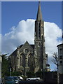
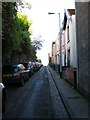
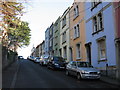
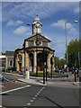
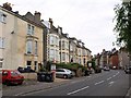
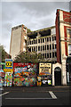
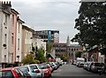
100 photos from this area
Area Information
Key information about the BS2 8UQ including its size, population, and administrative classification.
- Area Type
- Postcode
- Area Size
- 2796 m²
- Population
- 1189
- Population Density
- 17934 people/km²
House Prices in BS2 8UQ
44
Properties
£209,778
Average Sold Price
£60,000
Lowest Price
£900,000
Highest Price
Showing 44 properties
| Address | Type | Beds | Baths | Last Sale Price | Last Sale Date | |
|---|---|---|---|---|---|---|
| Ground And First Floor Maisonette, 87 City Road, St Pauls, Bristol, BS2 8UQ | Unknown | - | - | £315,000 | May 2024 | |
| 87 City Road, St Pauls, Bristol, BS2 8UQ | Terraced | 10 | 2 | £900,000 | Jun 2021 | |
| 75B City Road, St Pauls, Bristol, BS2 8UQ | Flat | 3 | 1 | £195,000 | Feb 2019 | |
| 99D City Road, St Pauls, Bristol, BS2 8UQ | Flat | - | - | £100,000 | Jun 2014 | |
| 99B City Road, St Pauls, Bristol, BS2 8UQ | Flat | - | - | £60,000 | May 2011 | |
| 99A City Road, St Pauls, Bristol, BS2 8UQ | Terraced | - | - | £60,000 | May 2011 | |
| 99C City Road, St Pauls, Bristol, BS2 8UQ | Flat | 1 | 2 | £60,000 | May 2011 | |
| 97C City Road, St Pauls, Bristol, BS2 8UQ | Maisonette | - | - | £135,000 | Nov 2007 | |
| 97B City Road, St Pauls, Bristol, BS2 8UQ | Flat | - | - | £63,000 | Nov 2003 | |
| 85A City Road, St Pauls, Bristol, BS2 8UQ | Flat | 2 | 1 | - | - |
Page 1 of 5
Energy Efficiency in BS2 8UQ
Amenities
Schools
| Rank | School | Type | Entry gender | Ages |
|---|
Explore more schools in this area
Go to Schools tabDemographics
Household Size
One person
most common
Accommodation Type
Flats
most common
Tenure
22
majority
Ethnic Group
White
most common
Religion
N/A
most common
Household Composition
N/A
most common
Age
47
median
Adults (30-64 years)
most common
Household Deprivation
N/A
with no deprivation
NS-SEC
35
in Lower managerial occupations
Explore more demographic insights in this area
Go to Demographics tabPlanning
Planning Constraints
- Flood RiskPremium
- Ramsar Wetland SitesPremium
- Area of Outstanding Natural BeautyPremium
- Protected Nature ReservePremium
- Protected WoodlandPremium