Area Overview for BS2 8SS
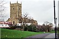
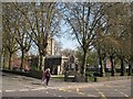
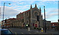
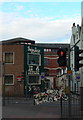
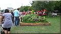
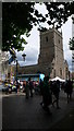
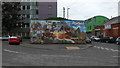
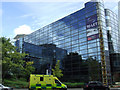
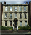
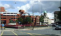
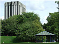
Photos of BS2 8SS

Area Information
BS2 8SS is a compact residential postcode in Bristol, England, nestled northeast of the city centre. With a population of 2,212, it forms part of the Ashley ward, a historically diverse urban area known for its mix of Victorian suburbs, industrial heritage, and recent gentrification. Neighbourhoods like St Paul’s and Montpelier, once associated with deprivation, now attract young professionals and creatives drawn to its alternative culture and transport links. The area is bordered by the M32 motorway, offering easy access to nearby towns, while its proximity to railway stations and ferry landings ensures connectivity. Daily life here is shaped by a young, transient population, with a focus on community and accessibility. The presence of independent schools and retail hubs like Sainsburys and Tesco adds to its appeal, though the area’s character is defined by its evolving social fabric and historical layers, from 18th-century pottery factories to Napoleonic-era street names.
- Area Type
- Postcode
- Area Size
- Not available
- Population
- Not available
- Population Density
- Not available
The property market in BS2 8SS is characterised by a low home ownership rate of 26%, indicating that the majority of residents are renters. Flats dominate the housing stock, reflecting the area’s compact nature and urban layout. This suggests a market skewed towards rental properties, with limited opportunities for owner-occupation. The small postcode area and its immediate surroundings likely offer few detached homes or larger properties, making it more suitable for those prioritising proximity to transport and amenities over space. Buyers should consider the area’s limited housing stock and the potential for higher rental demand, which could influence both property values and availability. The presence of young, transient residents further underscores the need for flexible, short-term housing options.
House Prices in BS2 8SS
No properties found in this postcode.
Energy Efficiency in BS2 8SS
Living in BS2 8SS offers access to a range of amenities within walking or short transit distance. Five retail outlets, including Sainsburys and Tesco, provide everyday shopping needs, while ferry landings like Welsh Back Ferry Landing offer scenic travel options. The area’s railway stations, such as Redland and Montpelier, connect to Bristol’s broader transport network, facilitating easy movement. Parks and open spaces, though not explicitly named, are implied by the ward’s history of Victorian suburbs and community initiatives like the Vocalise magazine. The mix of retail, transport, and historical sites creates a convenient, urban lifestyle, blending practicality with the area’s cultural heritage.
Amenities
Schools
Near BS2 8SS are two schools: St Pauls Nursery School & Children’s Centre, a nursery providing early education, and Catch22 Include Bristol, an independent school. The mix of nursery and independent education options suggests a range of choices for families, though the absence of state secondary schools may require commuting. The nursery caters to younger children, while the independent school likely offers specialist or alternative education pathways. For families prioritising state education, nearby areas may need to be explored, as the immediate vicinity lacks comprehensive school coverage. This dynamic reflects the area’s focus on younger demographics and its role as a node within Bristol’s broader educational network.
| Rank | School | Type | Entry gender | Ages |
|---|
Explore more schools in this area
Go to Schools tabDemographics
BS2 8SS has a median age of 22, with the majority of residents aged 15–29. This reflects a young, dynamic population, typical of urban areas with strong student or professional demographics. Home ownership is low at 26%, indicating a rental-dominated market, with flats being the primary accommodation type. The predominant ethnic group is White, though the ward as a whole has 33.5% of residents from Black, Asian, and Minority Ethnic backgrounds, and 23.8% were born outside the UK. This diversity contributes to a cosmopolitan atmosphere, though the area has faced challenges linked to gentrification, including rising rents and displacement of long-term residents. The young age profile suggests a focus on transient living, with limited family households, shaping the local economy and social dynamics.
Household Size
Accommodation Type
Tenure
Ethnic Group
Religion
Household Composition
Age
Household Deprivation
NS-SEC
Explore more demographic insights in this area
Go to Demographics tabPlanning
Planning Constraints
- Flood RiskPremium
- Ramsar Wetland SitesPremium
- Area of Outstanding Natural BeautyPremium
- Protected Nature ReservePremium
- Protected WoodlandPremium