Area Overview for BS2 0UE
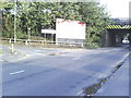
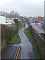
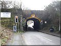
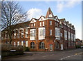
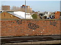
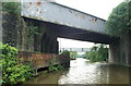
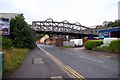
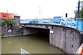
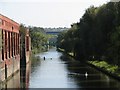
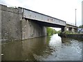
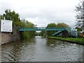
Photos of BS2 0UE

Area Information
BS2 0UE is a small residential postcode cluster in east Bristol, nestled within the Lawrence Hill electoral ward. With a population of 2,510, it is a compact area defined by its proximity to key transport hubs and urban amenities. The postcode straddles districts like Barton Hill, St Philips Marsh, and parts of Easton, offering a blend of historic and modern elements. The area’s name originates from St Lawrence’s Hospital, a medieval leper house founded by King John, though today it is marked by mid-20th-century tower blocks such as Kingsmarsh House and Baynton Houses. Despite its residential density, the area is undergoing revitalisation, with plans to transform the high street near Lawrence Hill Railway Station into a vibrant hub for housing, workspaces, and community facilities. Residents benefit from proximity to the Bristol and Bath Railway Path, major roads like the A420, and nearby retail outlets. With excellent broadband connectivity (99/100) and accessible rail, ferry, and metro services, BS2 0UE is well-positioned for commuters and those seeking urban convenience.
- Area Type
- Postcode
- Area Size
- Not available
- Population
- Not available
- Population Density
- Not available
BS2 0UE’s property market is characterised by a high proportion of rental flats, with only 12% of homes owned by residents. The accommodation type is almost exclusively flats, many of which are mid-20th-century tower blocks such as Kingsmarsh House and Baynton Houses. This suggests a market dominated by private landlords and tenants, with limited opportunities for owner-occupation. The small area’s housing stock is concentrated in these purpose-built flats, which may appeal to renters seeking affordability but present challenges for buyers seeking equity or long-term investment. The proximity to transport hubs like Lawrence Hill and Bristol Temple Meads Railway Stations likely contributes to the area’s rental demand, though the lack of detached housing or newer developments limits options for those prioritising home ownership. Buyers should consider the area’s rental focus and the potential for limited property appreciation in the short term.
House Prices in BS2 0UE
No properties found in this postcode.
Energy Efficiency in BS2 0UE
Daily life in BS2 0UE is shaped by its proximity to retail, transport, and community hubs. The area’s high street near Lawrence Hill Railway Station is undergoing revitalisation, aiming to blend housing, workspaces, and amenities. Nearby, Lidl, Iceland, and M&S offer grocery and retail needs, while the vicinity includes multiple rail, ferry, and metro stations, ensuring easy access to Bristol’s cultural and commercial centres. The Bristol and Bath Railway Path provides a green corridor for walking and cycling, though parks or open spaces are not explicitly listed in the data. The mix of retail outlets, transport options, and planned developments suggests a practical, convenience-driven lifestyle. However, the lack of detailed information on leisure or recreational facilities may leave gaps in understanding the area’s social offerings.
Amenities
Schools
The nearest schools to BS2 0UE include St Philips Marsh Nursery School and Barton Hill Children’s Centre/Cashmore Early Years Centre, a nursery offering early education and childcare. The Meriton Education and Support for Young Parents and Snowdon Village are listed as other educational institutions, though specific curricula or Ofsted ratings are not provided. The presence of a nursery suggests the area caters to young families, but the absence of traditional primary or secondary schools may require residents to travel to nearby districts for comprehensive education. For families relying on local schooling, this could be a limitation, though community centres and outreach programs might supplement educational needs. The mix of early years and specialist provision reflects a focus on vulnerable groups and young parents, rather than a broad range of academic institutions.
| Rank | School | Type | Entry gender | Ages |
|---|
Explore more schools in this area
Go to Schools tabDemographics
The population of BS2 0UE skews toward adults aged 30–64, with a median age of 22, suggesting a mix of younger residents and families. Home ownership is low, with only 12% of households owning their homes, indicating a predominantly rental market. The area’s accommodation is almost entirely flats, reflecting its post-war housing stock. The predominant ethnic group is Black_total, highlighting the area’s cultural diversity. This demographic profile suggests a community shaped by transient living arrangements and a reliance on shared housing. The low home ownership rate may influence local dynamics, with fewer long-term residents and a focus on rental affordability. For families, the presence of nurseries and community centres like St Philips Marsh Nursery School and The Meriton Education offers early years support, though secondary schooling options are limited to non-traditional providers.
Household Size
Accommodation Type
Tenure
Ethnic Group
Religion
Household Composition
Age
Household Deprivation
NS-SEC
Explore more demographic insights in this area
Go to Demographics tabPlanning
Planning Constraints
- Flood RiskPremium
- Ramsar Wetland SitesPremium
- Area of Outstanding Natural BeautyPremium
- Protected Nature ReservePremium
- Protected WoodlandPremium