Area Overview for BS2 0TY
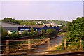
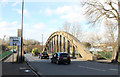
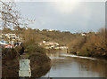
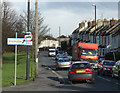
Photos of BS2 0TY
Area Information
BS2 0TY lies within the Lawrence Hill electoral ward in east Bristol, a historically rich area shaped by medieval roots and modern redevelopment. With a population of 2,510, it is a small, tightly knit residential cluster near key districts like Barton Hill, St Philips Marsh, and Temple Meads. The area is defined by its proximity to major roads such as the A420 and A4320, which intersect at the Lawrence Hill roundabout, and the Bristol and Bath Railway Path, offering walking and cycling routes. The ward includes mid-20th-century tower blocks like Kingsmarsh House and Moorfields, alongside revitalisation plans for the high street near the train station, aiming to blend housing, workspaces, and community amenities. Daily life here balances historical architecture with contemporary infrastructure, supported by nearby retail hubs like Broadmead and transport links to Bristol Temple Meads Station. Its strategic location near the city’s core, combined with ongoing urban renewal, makes it a dynamic yet compact neighbourhood for those seeking convenience and connectivity.
- Area Type
- Postcode
- Area Size
- Not available
- Population
- Not available
- Population Density
- Not available
The property market in BS2 0TY is characterised by a low home ownership rate of 12%, suggesting that the area is primarily a rental market rather than one dominated by owner-occupied homes. The accommodation type is predominantly flats, which aligns with the compact nature of the postcode and its proximity to transport networks. This housing stock is likely to appeal to renters seeking affordability and convenience, particularly in a small area with limited land for new developments. The presence of mid-20th-century tower blocks, such as Kingsmarsh House and Moorfields, indicates a mix of older, high-density housing. For buyers, this suggests a challenging market with limited options for purchase, as the area is not geared toward homeownership. Those considering the area should focus on rental opportunities or short-term stays, while developers may find scope for regeneration in the context of the ward’s revitalisation plans.
House Prices in BS2 0TY
No properties found in this postcode.
Energy Efficiency in BS2 0TY
Living in BS2 0TY offers access to a range of amenities within practical reach. Retail options include Lidl St, Iceland Avonmead, and M&S Bristol Avonmead, catering to everyday shopping needs. The area’s transport links, including multiple rail, ferry, and metro services, provide easy access to the city’s core and surrounding regions. The nearby Broadmead shopping area adds to the retail diversity. The Bristol and Bath Railway Path, starting in the ward’s southern part, offers recreational opportunities for walking and cycling. While the data does not specify parks or leisure facilities, the proximity to major roads and transport hubs suggests a lifestyle focused on convenience and connectivity. The proposed revitalisation of the high street may introduce more community spaces and housing, enhancing the area’s appeal for those seeking a blend of urban accessibility and small-town character.
Amenities
Schools
The schools nearest to BS2 0TY include St Philips Marsh Nursery School and Barton Hill Childrens Centre/Cashmore Early Years Centre, a nursery school, and The Meriton Education and Support for Young Parents, which falls under the 'other' category, as does Snowdon Village. This mix of educational institutions suggests a focus on early years care and specialist support for young parents, rather than traditional primary or secondary schools. The absence of mainstream schools in the data implies that families may need to look beyond the immediate area for comprehensive education. The presence of nurseries and support services indicates a community-oriented approach to childcare, potentially serving the needs of working parents in the vicinity. However, the lack of detailed ratings or specific curricular information means that prospective residents should investigate further to assess the quality and suitability of these institutions for their children’s needs.
| Rank | School | Type | Entry gender | Ages |
|---|
Explore more schools in this area
Go to Schools tabDemographics
The population of BS2 0TY skews younger, with a median age of 22, though the most common age range is adults aged 30–64. Home ownership is low at 12%, indicating a rental-dominated market, with flats being the predominant accommodation type. The area’s demographic profile suggests a community centred on working-age adults, possibly including students or professionals in nearby employment hubs. The predominant ethnic group is Black_total, reflecting a diverse population. While deprivation data is not explicitly provided, the low home ownership rate may indicate economic pressures or a transient population. The mix of age groups and housing types suggests a neighbourhood that caters to both long-term residents and those in temporary housing, with limited family-oriented housing stock. This profile shapes a community with a focus on affordability and accessibility over long-term investment in property.
Household Size
Accommodation Type
Tenure
Ethnic Group
Religion
Household Composition
Age
Household Deprivation
NS-SEC
Explore more demographic insights in this area
Go to Demographics tabPlanning
Planning Constraints
- Flood RiskPremium
- Ramsar Wetland SitesPremium
- Area of Outstanding Natural BeautyPremium
- Protected Nature ReservePremium
- Protected WoodlandPremium