Area Overview for BS2 0TP
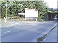
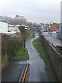
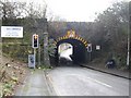
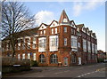
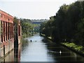
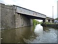
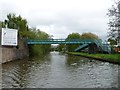
Photos of BS2 0TP

Area Information
Living in BS2 0TP means residing within a compact residential cluster located in the Lawrence Hill electoral ward of Bristol. This specific postcode covers a small population of 2,510 people, concentrating daily life into a defined urban space. You are situated on the boundary of notable neighbourhoods including Barton Hill, St Philips Marsh, and the broader Easton district. The area gained its historical significance from St Lawrence's Hospital, a leper house founded by King John before 1199, though its most visible modern landmarks include mid-1960s tower blocks. You live near the intersection of the A420 and A4320 at the Lawrence Hill roundabout, a key transport hub that slices through the ward. The south end of your community marks the start of the Bristol and Bath Railway Path, offering a dedicated route for walking and cycling. Your immediate surroundings include the start of this iconic trail alongside a high street near the train station that has seen plans for revitalisation. Life here is characterised by dense urban living where your doorstep access connects directly to major road networks and significant transport interchange points.
- Area Type
- Postcode
- Area Size
- Not available
- Population
- Not available
- Population Density
- Not available
Homes in BS2 0TP are characterised by a predominance of flats within a cluster defined by a small residential footprint. With home ownership recorded at merely 12%, the property market here operates primarily as a rental sector rather than an area for first-time buyers seeking homeownership. You are looking at an environment where investment defaults are high and long-term occupancy is less common than transient living arrangements. The dominant accommodation type throughout this specific postcode area is flats, which suits the smaller household sizes typical of the region's median age of 22. This housing stock reflects the historical development of the ward, including the presence of mid-1960s tower blocks such as Kingsmarsh House and Moorfields and Baynton Houses. Potential buyers considering this location should be aware that the market is heavily skewed towards tenants, meaning you will face significant competition and higher demand for rental units. The price points and property values are likely influenced by the strong proximity to Temple Meads and the avgail schools nearby.
House Prices in BS2 0TP
No properties found in this postcode.
Energy Efficiency in BS2 0TP
Daily life in BS2 0TP is supported by a practical network of amenities located within easy reach of your home. For retail needs, you are close to five notable stores including Lidl St, Iceland Avonmead, and M&S Bristol Avonmead SF. These shops cover everyday essentials and classic high street brands. Public engagement and leisure options are enhanced by five nearby ferry terminals such as Temple Bridge Ferry Landing and Temple Meads Station Ferry Landing. Transport links are extensive with five railway stations nearby including Temple Meads Railway Station and Stapleton Road Railway Station. Two metro lines serve the area heading toward Oldland and Bitton, complemented by a single airport option at Bristol Filton Airport. The local high street near the train station is targeted for revitalisation into a vibrant town centre with new housing and workspaces. The Ward also features the start of the Bristol and Bath Railway Path in its southern part for walking and cycling. This combination of retail giants and public transport hubs makes the area convenient for residents without needing to travel far for basic services.
Amenities
Schools
Families living in BS2 0TP have access to a specific selection of early years and support services nearby, though traditional primary and secondary schools are not listed in the immediate vicinity data. The closest educational provision includes St Philips Marsh Nursery School and Barton Hill Childrens Centre, which offers nursery education alongside the Cashmore Early Years Centre. These facilities provide care and early learning for young children in the local cluster. Additional nearby options include The Meriton Education and Support for Young Parents and Snowdon Village, both classified under other educational support types. The presence of these specific institutions indicates a focus on early childhood development and child welfare within the area. There is no data available regarding Ofsted ratings for these specific venues, so any judgement on educational quality must rely on external research. For families requiring primary or secondary education, the immediate postcode offers limited direct school options. Most households in this area likely commute to schools in neighbouring wards such as Bristol or Clifton, given the predominance of flat living and the young age profile of residents.
| Rank | School | Type | Entry gender | Ages |
|---|
Explore more schools in this area
Go to Schools tabDemographics
The community profile for BS2 0TP is defined by a young population with a recorded median age of just 22 years. While the most common age bracket comprises adults between 30 and 64 years, the overall youthful demographic suggests a dynamic environment dominated by students and early career professionals. Rented accommodation is the dominant form of housing, with home ownership standing at only 12% of the total. This low figure indicates that the vast majority of residents in this specific postcode pay to stay rather than own their homes. The predominant ethnic group in the area is Black, reflecting a diverse and multicultural neighbourhood. Most common accommodation types are flats, which aligns with the high concentration of rental properties and the density typical of urban centres like Lawrence Hill. This demographic mix creates a living environment where you will encounter a high turnover of residents and a culturally varied population. The area functions more as a hub for young professionals and students than a traditional family neighbourhood with owner-occupied bungalows.
Household Size
Accommodation Type
Tenure
Ethnic Group
Religion
Household Composition
Age
Household Deprivation
NS-SEC
Explore more demographic insights in this area
Go to Demographics tabPlanning
Planning Constraints
- Flood RiskPremium
- Ramsar Wetland SitesPremium
- Area of Outstanding Natural BeautyPremium
- Protected Nature ReservePremium
- Protected WoodlandPremium