Area Overview for BS2 0TN
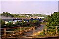
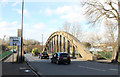
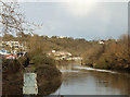
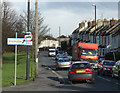
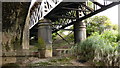
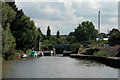
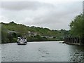
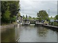
Photos of BS2 0TN
Area Information
Lawrence Hill represents a specific postcode cluster identified as BS2 0TN, situated within the wider electoral ward of Bristol that encompasses districts such as Barton Hill, St Philips Marsh, and Temple Meads. This small residential area forms part of a location historically linked to St Lawrence's Hospital, a medieval leper house founded by King John outside the eastern gates. Today, the postcode serves a population of 2510 people living in a compact environment where major roads like the A420 and A4320 intersect, defining the daily rhythm of local life. Residents often navigate a landscape marked by mid-1960s tower blocks, including Kingsmarsh House and Moorfields, which sit alongside high streets undergoing modernisation plans. Living in this area means being close to the start of the Bristol and Bath Railway Path in the southern part of the ward. The geography is defined by its integration with larger transport hubs and commercial zones, placing residents near the Broadmead shopping area and various railway stations. For those considering moving here, the postcode offers a sense of being central to the city's activity while maintaining a distinct residential identity. The area is characterised by its proximity to key infrastructure rather than expansive green spaces or isolated rural settings.
- Area Type
- Postcode
- Area Size
- Not available
- Population
- Not available
- Population Density
- Not available
The property market in BS2 0TN is characterised by a heavy skew towards rental living. With home ownership standing at just 12%, the area functions largely as a letting market rather than a zone for established owner-occupiers. This low rate of ownership indicates that most of the 2510 residents live in rented accommodation, aligning with the description that the predominant accommodation type in this postcode is flats. Buyers looking for freehold homes in this specific cluster should expect limited availability, as the housing stock is designed for smaller, self-contained living units typical of urban regeneration areas. The prevalence of flats suggests the market caters to individuals or small households rather than large families requiring substantial space. This dynamic creates a community where tenants may move in and out more frequently, reflecting the median age of 22 years old found in the demographic data. The local housing landscape includes high-rise structures such as Kingsmarsh House and Moorfields, which historically shaped the skyline of Lawrence Hill. For prospective buyers, understanding that this is a predominantly rental zone is crucial, as it may affect the stability of long-term neighbourly ties and the overall character of the streets.
House Prices in BS2 0TN
No properties found in this postcode.
Energy Efficiency in BS2 0TN
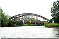
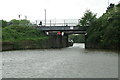
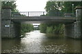
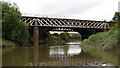
Daily life in BS2 0TN is defined by strong access to retail and transport amenities, all located within practical reach of residents. Locals have five retail choices nearby, including Lidl on the street, Iceland stores on Avonmead, and Marks & Spencer at Bristol Avonmead St. These supermarkets and shops ensure that weekly shopping is convenient without long travel times. Transport infrastructure serves as a central feature of local lifestyle, with five ferry points nearby, including Netham Lock Ferry Terminal and Temple Meads Station Ferry Landing. These terminals provide alternative travel methods across the river. Rail connectivity is equally extensive, with access to Lawrence Hill Railway Station, Bristol Temple Meads Railway Station, and Stapleton Road Railway Station. Two metro lines serve the wider area, stopping at Bitton and Oldland, while Bristol Filton Airport sits within reach for occasional travel needs. The high street near the train station is being revitalised with new housing, workspaces, and community amenities, changing the character of the streets. The area's location near the start of the Bristol and Bath Railway Path adds a recreational dimension, allowing residents to walk or cycle along a dedicated route for leisure or exercise. This blend of urban retail, major transport hubs, and green paths creates a fast-paced but accessible environment for those living in this specific postcode cluster.
Amenities
Schools
Families considering homes in BS2 0TN will find several educational institutions nearby that support early childhood development and special needs care. The closest facility for young children is St Philips Marsh Nursery School and Barton Hill Childrens Centre, which operates as a comprehensive nursery and early years centre. This school is part of the Cashmore Early Years Centre group, offering integrated support for very young learners within the postcode vicinity. Beyond standard primary education, the area provides access to alternative support services. The Meriton Education and Support for Young Parents is located near the area, offering specialised educational guidance for parents who are young. Additionally, Snowdon Village serves as another nearby institution, though its specific curriculum is not detailed in the available records. The mix of these facilities suggests the local authority prioritises early years interventions and support services over a broad range of standard primary or secondary schools within immediate walking distance. Parents relying solely on local primary education may need to look further afield, as the immediate school census data highlights nurseries and other support organisations rather than traditional age-group schools.
| Rank | School | Type | Entry gender | Ages |
|---|
Explore more schools in this area
Go to Schools tabDemographics
The community within BS2 0TN reflects a predominantly young population, with a recorded median age of 22 years old. The majority of residents fall into the adult age bracket spanning from 30 to 64 years, suggesting a mix of students, young professionals, and established workers sharing the local streets. Home ownership stands at a low level of 12%, indicating that the vast majority of the 2510 residents live in rented accommodation. Accommodation types are defined primarily by flats, which aligns with the area's density and historical development patterns. Diversity is a significant feature of the local demographic profile. The predominant ethnic group in the area is specified as black_total, meaning residents from this background make up the largest single demographic segment compared to other groups. This diversity contributes to the cultural fabric of the neighbourhood, shaping interactions within local community centres and residential blocks. The combination of a young median age and high rental occupancy suggests an area popular with those seeking flexible living arrangements rather than long-term property investment. Data shows that adult households dominate the landscape, likely driven by the presence of flats and the area's integration with wider city employment zones.
Household Size
Accommodation Type
Tenure
Ethnic Group
Religion
Household Composition
Age
Household Deprivation
NS-SEC
Explore more demographic insights in this area
Go to Demographics tabPlanning
Planning Constraints
- Flood RiskPremium
- Ramsar Wetland SitesPremium
- Area of Outstanding Natural BeautyPremium
- Protected Nature ReservePremium
- Protected WoodlandPremium