Area Overview for BS2 0TB
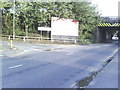
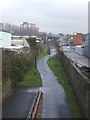
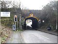
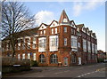
Photos of BS2 0TB

Area Information
BS2 0TB lies in the heart of east Bristol, a historically rich area shaped by medieval foundations and modern urban planning. The postcode covers a small residential cluster within the Lawrence Hill electoral ward, encompassing districts like Barton Hill, St Philips Marsh, and parts of Easton. With a population of 2510, this area is compact but connected to broader Bristol networks. Its proximity to the Broadmead shopping area and key transport hubs, such as Bristol Temple Meads station, makes it a convenient base for commuters and families. The area’s name traces back to St Lawrence’s Hospital, a medieval leper house founded by King John, now replaced by mid-20th-century tower blocks like Kingsmarsh House. Despite its history, the ward is evolving, with revitalisation plans targeting its high street for new housing, workspaces, and community amenities. Daily life here balances urban convenience with pockets of heritage, offering a blend of retail, transport, and recreational opportunities within walking distance.
- Area Type
- Postcode
- Area Size
- Not available
- Population
- Not available
- Population Density
- Not available
The property market in BS2 0TB is dominated by rental demand, with only 12% of homes owner-occupied. This reflects a housing stock largely composed of flats, many of which are part of mid-20th-century tower blocks like Kingsmarsh House and Moorfields. The small area’s limited size means competition for available properties is high, particularly for flats in well-connected locations near transport hubs. For buyers, this suggests a challenging market with few owner-occupied options. The focus on rental properties may indicate that the area is more suited to those seeking short-term or flexible housing rather than long-term investment. Prospective buyers should consider the flat-dominated landscape and the area’s proximity to amenities like the Bristol and Bath Railway Path, which could enhance property value for those prioritising convenience over traditional home ownership.
House Prices in BS2 0TB
No properties found in this postcode.
Energy Efficiency in BS2 0TB
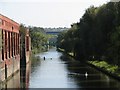
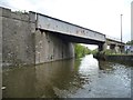
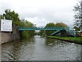
Daily life in BS2 0TB is shaped by its proximity to retail, transport, and leisure amenities. The high street near Bristol Temple Meads station features stores like Lidl St, Iceland Avonmead, and M&S Bristol Avonmead, offering convenience for shopping. Ferries at Netham Lock and Temple Bridge provide water-based transport links, while rail stations connect residents to broader networks. The area’s transport infrastructure includes the Bristol and Bath Railway Path, ideal for walking or cycling. Nearby, the Broadmead shopping area and access to Bristol Filton Airport add to the region’s appeal. The mix of retail, transport, and recreational options ensures a dynamic lifestyle, though the limited local amenities may require residents to travel for more specialised services. This balance of convenience and connectivity defines the area’s character.
Amenities
Schools
The schools near BS2 0TB include St Philips Marsh Nursery School and Barton Hill Childrens Centre/Cashmore Early Years Centre, which provides early education and childcare services. The Meriton Education and Support for Young Parents offers specialised support for families with young children, while Snowdon Village is listed as an other type of educational institution, though its specific focus is unclear. The mix of nursery care and targeted support services suggests a focus on early years education and family needs. However, the absence of primary or secondary schools in the area may require families to travel to nearby wards for comprehensive schooling. This highlights a potential gap in the local educational infrastructure, though the existing institutions cater to specific needs such as childcare and parental support.
| Rank | School | Type | Entry gender | Ages |
|---|
Explore more schools in this area
Go to Schools tabDemographics
The population of BS2 0TB skews young, with a median age of 22, though the most common age range is adults aged 30-64. This suggests a mix of older residents and younger professionals or students. Home ownership is exceptionally low at 12%, indicating that the majority of residents are renters. The accommodation type is predominantly flats, reflecting a housing stock shaped by post-war development. The predominant ethnic group is Black_total, highlighting the area’s cultural diversity. While specific deprivation data is absent, the low home ownership rate and flat-dominated landscape may reflect economic pressures or a transient population. The community’s character is defined by its demographic composition, with a focus on rental affordability and shared living spaces. This profile may appeal to those seeking cost-effective housing but may also signal limited long-term investment potential.
Household Size
Accommodation Type
Tenure
Ethnic Group
Religion
Household Composition
Age
Household Deprivation
NS-SEC
Explore more demographic insights in this area
Go to Demographics tabPlanning
Planning Constraints
- Flood RiskPremium
- Ramsar Wetland SitesPremium
- Area of Outstanding Natural BeautyPremium
- Protected Nature ReservePremium
- Protected WoodlandPremium