Area Overview for BS2 0RY
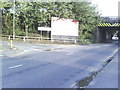
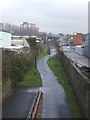
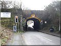
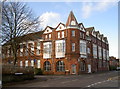
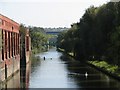
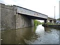
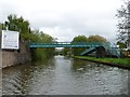
Photos of BS2 0RY

Area Information
Living in BS2 0RY places you in a small, residential postcode cluster within the Lawrence Hill ward of Bristol. With a population of 1,744, this area is compact yet connected to the broader city’s infrastructure. The ward spans parts of Barton Hill, St Philips Marsh, and Redcliffe, with historical roots tracing back to St Lawrence’s Hospital, founded in the late 12th century. Daily life here is shaped by proximity to transport hubs, including Bristol Temple Meads Railway Station and multiple ferry landings, which link residents to the city’s commercial and cultural centres. The area’s revitalisation plans, such as the proposed redevelopment of the high street near the train station, suggest a focus on blending housing, workspaces, and community amenities. While the median age is 22, the most common age group is adults aged 30–64, indicating a mix of younger professionals and established families. This makes BS2 0RY a dynamic but tightly knit community, where the character of 1960s tower blocks contrasts with ongoing urban renewal efforts.
- Area Type
- Postcode
- Area Size
- Not available
- Population
- Not available
- Population Density
- Not available
The property market in BS2 0RY is characterised by a low home ownership rate of 29%, pointing to a rental-focused environment rather than a buyers’ market. The predominant accommodation type is flats, many of which are part of 1960s developments such as Moorfields and Baynton Houses. This suggests a housing stock that is largely purpose-built and suited to smaller households or individuals. For buyers, the small area and its immediate surroundings offer limited options, with most properties being flats rather than detached homes. The low home ownership rate may indicate challenges in securing long-term investment, though the proximity to transport links and ongoing regeneration projects could enhance future value. Prospective buyers should consider the area’s density and the potential for rental returns, given the current market dynamics.
House Prices in BS2 0RY
No properties found in this postcode.
Energy Efficiency in BS2 0RY
Residents of BS2 0RY have access to a range of amenities within practical reach. Retail options include M&S Bristol Temple, Sainsburys Bristol, and Tesco Bristol, providing everyday shopping needs. The area’s proximity to the train station and the proposed revitalisation of the high street suggest potential for dining and leisure activities. Ferry landings and rail stations offer easy access to the city’s broader network, while the nearby Bristol and Bath Railway Path allows for walking and cycling. The presence of multiple transport hubs and retail outlets contributes to a convenient lifestyle, though the area’s focus on flats and rental properties may limit opportunities for larger family homes. The mix of historical and modern infrastructure reflects a balance between tradition and contemporary living.
Amenities
Schools
The nearest school to BS2 0RY is Hannah More Primary School, a primary institution with a good Ofsted rating. This school serves the local community, providing education for younger children in the area. While no secondary schools are listed, the presence of a primary school with a positive rating is a key consideration for families with young children. The absence of secondary schools nearby may require families to travel to adjacent wards or rely on nearby secondary institutions in broader Bristol. The single school listed suggests a focus on primary education within the area, which could be advantageous for families prioritising early education but may necessitate planning for secondary schooling.
| Rank | School | Type | Entry gender | Ages |
|---|
Explore more schools in this area
Go to Schools tabDemographics
BS2 0RY’s population skews young, with a median age of 22, though the most common age range is 30–64, suggesting a balance between younger residents and those in their prime working years. Home ownership here is relatively low at 29%, indicating a rental-dominated market. The predominant accommodation type is flats, reflecting the area’s density and the presence of mid-20th-century tower blocks like Kingsmarsh House. The White ethnic group constitutes the majority, though specific diversity statistics are not provided. This demographic profile implies a community of renters, possibly including students or young professionals, living in purpose-built housing. The lower home ownership rate may impact long-term stability, but the presence of established adults in the 30–64 range suggests a mix of transient and settled populations.
Household Size
Accommodation Type
Tenure
Ethnic Group
Religion
Household Composition
Age
Household Deprivation
NS-SEC
Explore more demographic insights in this area
Go to Demographics tabPlanning
Planning Constraints
- Flood RiskPremium
- Ramsar Wetland SitesPremium
- Area of Outstanding Natural BeautyPremium
- Protected Nature ReservePremium
- Protected WoodlandPremium