Area Overview for BS2 0PU
Photos of BS2 0PU


Area Information
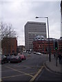
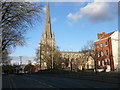
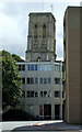
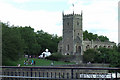
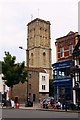
BS2 0PU is a small residential postcode area in England, part of a compact cluster of homes in Bristol. With a population of 2012, it reflects a tight-knit community shaped by its historical roots. The area lies within the Lawrence Hill electoral ward, which includes districts like Barton Hill, St Philips Marsh, and parts of Easton. Originally named St Lawrence Hill after a medieval leper hospital founded by King John, the area has evolved into a mix of mid-20th-century tower blocks and modern housing. Daily life here is influenced by its proximity to major transport routes, including the A420 and A4320, and its access to the Bristol and Bath Railway Path. Residents benefit from nearby amenities such as retail hubs, rail stations, and ferry services. The area’s character is defined by its blend of urban infrastructure and historical landmarks, making it a practical choice for those seeking connectivity without sacrificing a sense of local identity.
- Area Type
- Postcode
- Area Size
- Not available
- Population
- Not available
- Population Density
- Not available
The property market in BS2 0PU is characterised by a high proportion of rental properties, with only 22% of homes owned by residents. Flats dominate the housing stock, a reflection of the area’s compact layout and historical development as a residential cluster. This suggests a market more aligned with rental demand than owner-occupation, likely catering to students, young professionals, and those requiring short-term housing. The prevalence of flats may also indicate limited scope for major property renovations or extensions, which could be a consideration for buyers seeking long-term investment. Given the area’s small size, the immediate surroundings offer similar housing dynamics, reinforcing the need for prospective buyers to assess whether rental affordability or potential for property value growth aligns with their goals.
House Prices in BS2 0PU
No properties found in this postcode.
Energy Efficiency in BS2 0PU
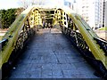
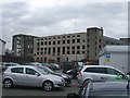
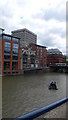
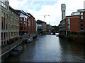
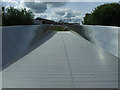
Daily life in BS2 0PU is supported by a range of nearby amenities, including major retailers like Sainsburys, M&S, and Tesco, which cater to everyday shopping needs. The area’s transport links also grant access to ferry services such as Temple Bridge Ferry Landing and rail stations like Bristol Temple Meads, enhancing mobility for residents. The presence of the Bristol and Bath Railway Path adds recreational value, encouraging walking and cycling. While the data does not specify parks or leisure facilities, the proximity to the Broadmead shopping area and mid-1960s tower blocks like Kingsmarsh House suggests a mix of urban living and historical architecture. These amenities collectively offer convenience for residents, though the lack of detailed information on green spaces or cultural venues may require further local investigation.
Amenities
Schools
The nearest school to BS2 0PU is Andalusia Academy Bristol, an independent institution. While no Ofsted rating is provided, the presence of an independent school suggests access to alternative educational options, which may appeal to families prioritising specific curricula or smaller class sizes. However, the data does not include state school options or their performance metrics, so families seeking a broader range of educational choices may need to look further afield. The mix of school types in the area is limited, with only one named institution listed, meaning prospective residents should investigate additional educational resources beyond the immediate vicinity.
| Rank | School | Type | Entry gender | Ages |
|---|
Explore more schools in this area
Go to Schools tabDemographics
The population of BS2 0PU is predominantly young adults, with a median age of 22 and the most common age range being 15–29 years. This suggests a community focused on early career development and student life. Home ownership is relatively low, at 22%, indicating that a significant portion of the population resides in rental properties. The primary accommodation type is flats, reflecting a trend towards high-density living in this small area. The predominant ethnic group is White, with no specific data provided on other demographics. The low home ownership rate and youthful demographic may contribute to a transient community, though the area’s proximity to educational institutions and transport links suggests it is well-suited for students and young professionals.
Household Size
Accommodation Type
Tenure
Ethnic Group
Religion
Household Composition
Age
Household Deprivation
NS-SEC
Explore more demographic insights in this area
Go to Demographics tabPlanning
Planning Constraints
- Flood RiskPremium
- Ramsar Wetland SitesPremium
- Area of Outstanding Natural BeautyPremium
- Protected Nature ReservePremium
- Protected WoodlandPremium