Area Overview for BS2 0PN
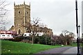
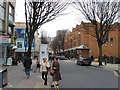
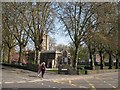
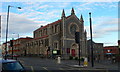
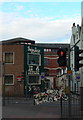
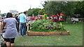
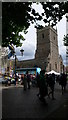
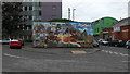
Photos of BS2 0PN
Area Information
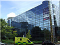
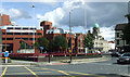
Living in BS2 0PN means residing in one of the most densely packed residential clusters in England. This specific postcode covers just 3015 square metres, yet it supports a population of 1744 people. The area represents an intensely urban environment where space at a micro-level is extremely limited. The location falls within the historic Lawrence Hill ward in Bristol, an area that stretches from the mid-20th-century tower blocks near the train station down toward the Broadmead shopping district. Residents here are surrounded by major roads, including the A420 and A4320, which intersect at the formidable Lawrence Hill roundabout. The proximity to the city centre is a defining feature, placing you steps away from the historic St Philip's Marsh and the vibrant commercial heart of Bristol. Daily life revolves around this compact footprint, offering instant access to the regions most significant transport and retail hubs. You are effectively living on the edge of the city's busier precincts, benefiting from immediate connectivity while navigating the high footfall associated with such a concentrated population. This is an area defined by its density and its strategic position within the broader west of England region.
- Area Type
- Postcode
- Area Size
- 3015 m²
- Population
- Not available
- Population Density
- Not available
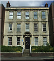
The property market in BS2 0PN is overwhelmingly defined by rental living rather than owner-occupation. Data shows that only 29% of residents own their homes, meaning over two-thirds of the population rents from landlords or housing associations. This statistic points to a density of accommodation built with shared ownership or letting schemes in mind. Flats constitute the primary accommodation type, which reduces the availability of traditional detached or semi-detached houses for purchase. For buyers seeking to live in this area, the immediate postcode might offer limited options for outright purchase. The surrounding Lawrence Hill ward contains notable mid-1960s towers, such as the 13-storey Kingsmarsh House and the Baynton and Moorfields Houses, which historically cemented the area's character as a flat-heavy zone. While specific sale prices for this exact postcode are not provided, the structural composition suggests that entering the market here requires patience. You are likely to compete heavily for the few privately owned units that may surface among the predominantly tenanted stock. The presence of major transport hubs also suggests potential rental pressure, influencing the values of any available properties within this narrow geographical spread.
House Prices in BS2 0PN
Showing 70 properties
Energy Efficiency in BS2 0PN
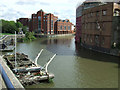
Residents of BS2 0PN enjoy immediate access to a comprehensive range of amenities within practical walking distance. The local retail landscape includes branches of Sainsburys Bristol and M&S Bristol Temple, providing essential shopping options close to your home. Public transport infrastructure is dense, with five railway stations and five ferry landings in immediate proximity. This includes the historic St Philip's Bridge, which connects the city centre to the east side, and Temple Meads Station Ferry Landing. The presence of five rail stations ensures that getting to work or leisure destinations is a matter of minutes rather than hours. You are also close to the start of the Bristol and Bath Railway Path, a significant feature for walkers and cyclists running through the southern part of the ward. This pedestrian and cycle path connects the area to the wider BATH region, offering a recreational outlet away from the urban bustle. The convenience of having world-class shopping on the doorstep combined with viable active travel routes makes daily life in this postcode efficient and connected.
Amenities
Schools
Families considering schools near BS2 0PN have a clear, high-quality option immediately accessible. Hannah More Primary School serves as the key local institution for early education in this vicinity. This school holds a 'good' Ofsted rating, indicating that it meets high standards for educational provision and care. As a primary school, it caters specifically to children of school age, which aligns with the area's mix of young families and young adults. There are no secondary schools listed within the immediate data for this specific cluster, meaning that older children would likely need to travel to other wards in the south west of Bristol for their secondary education. The presence of a well-rated primary school is a significant advantage for those living in flats within BS2 0PN who wish to keep their youngest children close to home. The mix of school types suggests a community where elementary education is localised, while higher education requires bus or train transport. This educational landscape is practical for early schooling but requires planning for teenagers.
| Rank | School | Type | Entry gender | Ages |
|---|
Explore more schools in this area
Go to Schools tabDemographics
The community profile of BS2 0PN reflects a neighbourhood dominated by younger residents and young families. The median age for those living here is just 22 years, which signifies a very youthful demographic compared to the national average. Although the most common age group among adults falls between 30 and 64 years, the overall population skew remains heavily weighted toward those in their twenties and thirties. Accommodation data confirms that flats are the predominant form of housing in this cluster. This housing typology naturally favours individuals who prefer low-maintenance living or those transitioning into independent living. Property ownership stands at a relatively low 29%, indicating that the majority of residents are likely renting their homes. The ethnic makeup is primarily White, though the area's high density and student-like age profile often suggest a diverse mix of workers and students passing through. With such a low ownership rate and a median age of 22, the social fabric is likely characterised by a transient yet tight-knit community of professionals and young families sharing flats in the heart of a major city ward.
Household Size
Accommodation Type
Tenure
Ethnic Group
Religion
Household Composition
Age
Household Deprivation
NS-SEC
Explore more demographic insights in this area
Go to Demographics tabPlanning
Planning Constraints
- Flood RiskPremium
- Ramsar Wetland SitesPremium
- Area of Outstanding Natural BeautyPremium
- Protected Nature ReservePremium
- Protected WoodlandPremium