Area Overview for BS2 0PG
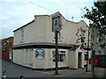
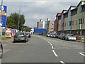
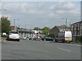
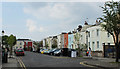
Photos of BS2 0PG
Area Information
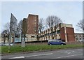
BS2 0PG lies in the heart of Lawrence Hill, a historically rich area of Bristol that blends medieval heritage with modern urban living. This small postcode cluster, home to 1,744 residents, sits within an electoral ward encompassing districts like Barton Hill, St Philips Marsh, and Temple Meads. The area’s character is shaped by its proximity to the Broadmead shopping district, the A420 and A4320 roads, and the start of the Bristol and Bath Railway Path. Daily life here is defined by its transport links, with Lawrence Hill Railway Station, Bristol Temple Meads, and nearby ferry services offering easy access to the city and beyond. The area’s revitalisation plans for its high street promise a mix of housing, workspaces, and community amenities. While the median age is 22, the majority of residents are adults aged 30–64, suggesting a dynamic mix of younger professionals and families. The presence of mid-1960s tower blocks and a focus on flats reflects a housing stock tailored to urban living, though the 29% home ownership rate indicates a largely rental-based community.
- Area Type
- Postcode
- Area Size
- Not available
- Population
- Not available
- Population Density
- Not available
The property market in BS2 0PG is characterised by a low home ownership rate of 29%, with flats making up the majority of accommodation. This suggests a rental-dominated market, likely influenced by the area’s history of high-density housing, including mid-1960s tower blocks like Kingsmarsh House and Moorfields. The small postcode cluster means housing options are limited, and buyers may find owner-occupied properties scarce. Flats in this area are typically part of larger developments, offering convenience but potentially less privacy than detached homes. For investors, the rental market may be stable, but the lack of data on property prices or demand trends means potential buyers should scrutinise local listings closely. The proximity to transport hubs like Lawrence Hill and Temple Meads Railway Stations adds to the area’s appeal for commuters, though the focus on flats may not suit those seeking larger family homes.
House Prices in BS2 0PG
No properties found in this postcode.
Energy Efficiency in BS2 0PG
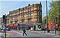
Living in BS2 0PG offers access to a range of amenities within practical reach. Retail options include Sainsburys Bristol, M&S Bristol Temple, and Lidl, providing everyday shopping needs. The nearby Broadmead shopping area adds to the retail diversity. For transport, residents can use ferry services at St Philip’s Bridge and Temple Meads Station, as well as rail links at Lawrence Hill and Stapleton Road stations. The area’s proximity to Bristol Filton Airport and the A420/A4320 roads enhances connectivity. The planned revitalisation of the high street near the train station hints at future improvements in dining and leisure options. While the data does not specify parks or recreational spaces, the presence of the Bristol and Bath Railway Path suggests opportunities for outdoor activity. The mix of retail, transport, and planned developments creates a convenient, though compact, lifestyle for residents.
Amenities
Schools
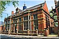
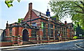
The nearest school to BS2 0PG is Hannah More Primary School, a primary institution with a ‘good’ Ofsted rating. This school serves the local community, offering education for younger children in the area. The absence of secondary schools in the immediate vicinity means families may need to consider nearby districts for secondary education, though the data does not specify alternatives. The presence of a primary school with a positive rating is a key draw for families prioritising local schooling. However, the lack of data on school catchment areas or pupil numbers means the full extent of the school’s capacity and impact on the community remains unclear. For those seeking a school within walking distance, Hannah More Primary provides a reliable option, though broader educational planning may require looking beyond BS2 0PG.
| Rank | School | Type | Entry gender | Ages |
|---|
Explore more schools in this area
Go to Schools tabDemographics
The population of BS2 0PG has a median age of 22, but the most common age group is adults aged 30–64, suggesting a balance between younger residents and those in their prime working years. Only 29% of homes are owner-occupied, with flats being the predominant accommodation type. This points to a community where renting is the norm, possibly driven by the area’s history of high-rise housing, such as the 13-storey Kingsmarsh House. The predominant ethnic group is White, though no specific data on diversity beyond this is provided. The low home ownership rate may indicate a transient population or a focus on rental investment. For families, the presence of Hannah More Primary School, rated ‘good’ by Ofsted, offers a local education option. However, the absence of detailed data on deprivation or income levels means the quality of life implications of the 29% ownership rate remain unquantified.
Household Size
Accommodation Type
Tenure
Ethnic Group
Religion
Household Composition
Age
Household Deprivation
NS-SEC
Explore more demographic insights in this area
Go to Demographics tabPlanning
Planning Constraints
- Flood RiskPremium
- Ramsar Wetland SitesPremium
- Area of Outstanding Natural BeautyPremium
- Protected Nature ReservePremium
- Protected WoodlandPremium