Area Overview for BS2 0HD
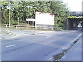
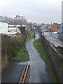
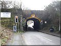
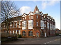
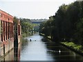
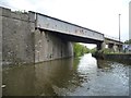
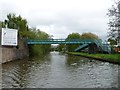
Photos of BS2 0HD

Area Information
BS2 0HD is a small, tightly knit residential postcode in east Bristol, encompassing parts of Lawrence Hill, Barton Hill, and St Philips Marsh. With a population of 1,744, it is a compact area defined by its proximity to key landmarks such as Broadmead, the Broadmead shopping area, and the start of the Bristol and Bath Railway Path. The district’s history dates back to the medieval era, with its name originating from St Lawrence’s Hospital, a leper house founded in the late 12th century. Today, the area is characterised by a mix of mid-20th-century tower blocks like Kingsmarsh House and more recent developments. Its location near major roads like the A420 and A4320, along with access to Bristol Temple Meads Railway Station, makes it a convenient base for commuters. The area is undergoing revitalisation, with plans to transform parts of the high street into a vibrant hub for housing, workspaces, and community amenities. For buyers, BS2 0HD offers a blend of historical charm and modern practicality, though its small size means the housing stock is limited and often rental-focused.
- Area Type
- Postcode
- Area Size
- Not available
- Population
- Not available
- Population Density
- Not available
The property market in BS2 0HD is heavily rental-focused, with only 29% of homes owned by residents. This suggests a high proportion of leasehold properties, many of which are flats. The area’s housing stock is dominated by mid-20th-century tower blocks such as Kingsmarsh House, Moorfields, and Baynton Houses, built in the 1960s. These structures, while functional, may not appeal to buyers seeking larger or more traditional homes. The small size of the postcode means the available properties are limited, and competition for owner-occupied homes is likely fierce. For buyers, this area is not ideal for those prioritising property ownership, as the market is skewed toward renters. However, the planned revitalisation of the high street could introduce new housing options in the future, though current buyers should expect a focus on flats and limited availability.
House Prices in BS2 0HD
No properties found in this postcode.
Energy Efficiency in BS2 0HD
Living in BS2 0HD offers access to a range of amenities within practical reach. The high street near Bristol Temple Meads is a focal point, with nearby shops like Sainsburys, M&S, and Lidl providing daily essentials. The area’s proximity to Broadmead shopping area adds to its convenience. For leisure, the Bristol and Bath Railway Path offers walking and cycling opportunities, while nearby parks and green spaces are not explicitly named in the data. The presence of multiple rail, ferry, and metro stations ensures easy access to Bristol’s cultural and commercial hubs. However, the area’s small size means amenities are concentrated, and residents may need to travel further for specialist services. The planned revitalisation of the high street could enhance local facilities, but current buyers should consider the existing infrastructure as modest yet functional.
Amenities
Schools
The nearest school to BS2 0HD is Hannah More Primary School, which serves the local community with a good Ofsted rating. As a primary school, it caters to children aged 4–11, making it a key consideration for families with young children. The absence of secondary schools in the immediate vicinity means students may need to travel to nearby areas for secondary education, such as those in Broadmead or Easton. The good rating at Hannah More suggests a reliable standard of teaching, but parents should investigate further to confirm the availability of secondary school places and transport links. For families prioritising a strong primary education within walking distance, this school is a positive feature, though the broader educational landscape requires additional research.
| Rank | School | Type | Entry gender | Ages |
|---|
Explore more schools in this area
Go to Schools tabDemographics
The population of BS2 0HD has a median age of 22, but the most common age range is adults aged 30–64, suggesting a mix of younger residents and families. Home ownership here is relatively low at 29%, indicating that the majority of households are likely renters. The accommodation type is predominantly flats, reflecting the area’s post-war housing stock and its role as a rental market. The predominant ethnic group is White, though no specific data on diversity or deprivation levels is provided. The low home ownership rate may impact community stability, while the presence of flats suggests a focus on affordability over spacious living. The age profile hints at a dynamic population, possibly including students or young professionals, but the lack of data on household composition or income levels means the full picture of quality of life remains partial.
Household Size
Accommodation Type
Tenure
Ethnic Group
Religion
Household Composition
Age
Household Deprivation
NS-SEC
Explore more demographic insights in this area
Go to Demographics tabPlanning
Planning Constraints
- Flood RiskPremium
- Ramsar Wetland SitesPremium
- Area of Outstanding Natural BeautyPremium
- Protected Nature ReservePremium
- Protected WoodlandPremium