Area Overview for BS2 0GW
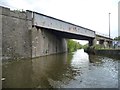
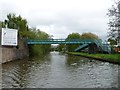
Photos of BS2 0GW


Area Information
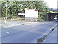
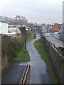
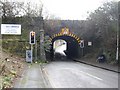
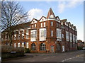
BS2 0GW is a small residential postcode cluster in east Bristol, encompassing parts of Barton Hill, St Philips Marsh, and Temple Meads. With a population of 2,510, it is a compact area defined by its proximity to key transport hubs and historical landmarks. The ward’s origins trace back to St Lawrence’s Hospital, a medieval leper house founded in the late 12th century, though the area today is shaped by modern infrastructure. Residents live in a mix of 1960s tower blocks and newer developments, with the high street near Bristol Temple Meads Railway Station undergoing revitalisation. The area’s character is defined by its connectivity: major roads like the A420 and A4320 intersect here, and the Bristol and Bath Railway Path begins nearby. While the population is relatively young, with a median age of 22, the most common age range is 30–64, suggesting a blend of younger professionals and established families. Daily life revolves around nearby amenities, from retail outlets to ferry terminals, and the area’s proximity to the Broadmead shopping district adds convenience. However, the high crime risk reported in assessments necessitates caution, balancing the area’s accessibility with practical considerations for safety.
- Area Type
- Postcode
- Area Size
- Not available
- Population
- Not available
- Population Density
- Not available
The property market in BS2 0GW is characterised by a 12% home ownership rate, with flats making up the majority of accommodation. This indicates a rental market, where few properties are owner-occupied. The area’s housing stock is dominated by post-war tower blocks, such as the 13-storey Kingsmarsh House and 11- and 13-storey Moorfields and Baynton Houses, which are typical of mid-20th-century urban development. These properties are likely to be in high demand for their proximity to transport links, including Bristol Temple Meads Railway Station and nearby metro stops. However, the low home ownership rate suggests limited availability for buyers seeking owner-occupied homes, with most properties rented out to tenants. For those considering purchase, the market may be competitive, with few opportunities for investment in private residences. The focus on flats also means that buyers should prioritise rental yield potential over long-term equity growth. The area’s compact size and limited housing stock mean that proximity to amenities and transport is a key selling point.
House Prices in BS2 0GW
No properties found in this postcode.
Energy Efficiency in BS2 0GW
Living in BS2 0GW offers access to a range of amenities within walking or short transit distance. Retail options include Lidl St, M&S Bristol Avonmead SF, and Iceland Avonmead, providing everyday shopping needs. The area’s proximity to the Broadmead shopping district adds further convenience. For transport, residents can use nearby ferry terminals, rail stations, and metro stops, with Bristol Filton Airport just one stop away. The high street near Bristol Temple Meads Railway Station is undergoing redevelopment, promising future improvements in local commerce and community spaces. While the area lacks extensive parks or green spaces, the Bristol and Bath Railway Path offers recreational opportunities for walking and cycling. The mix of retail, transport, and planned revitalisation suggests a practical, commuter-focused lifestyle. However, the absence of detailed data on leisure facilities means residents may need to look further afield for cultural or recreational activities.
Amenities
Schools
The schools nearest to BS2 0GW include St Philips Marsh Nursery School and Barton Hill Childrens Centre/Cashmore Early Years Centre, which provides nursery education. The Meriton Education and Support for Young Parents and Snowdon Village are listed as other educational institutions, though their specific roles are not detailed. The presence of a nursery school suggests some childcare provision for younger families, but the lack of primary or secondary schools in the immediate vicinity may require residents to travel to nearby areas. The mix of nursery and unspecified educational facilities indicates a focus on early years care rather than comprehensive schooling. Families with older children may need to rely on nearby schools in adjacent wards, such as those in the Broadmead area. The absence of detailed Ofsted ratings or school performance data means that prospective residents should investigate further to assess educational quality.
| Rank | School | Type | Entry gender | Ages |
|---|
Explore more schools in this area
Go to Schools tabDemographics
BS2 0GW has a median age of 22, but the most common age range among residents is 30–64 years, indicating a mix of younger and middle-aged populations. Home ownership is exceptionally low at 12%, with flats being the predominant accommodation type. This suggests a rental-dominated market, likely attracting tenants rather than long-term homeowners. The area’s predominant ethnic group is Black, reflecting a diverse community. The low home ownership rate may impact long-term investment value, while the age distribution hints at a workforce-focused demographic. The presence of families is implied by nearby schools, though the data does not specify childcare provision. The area’s demographic profile is shaped by its historical role as a transit hub, with residents possibly drawn by proximity to transport links rather than residential stability. The combination of flat living and rental prevalence may appeal to those seeking affordability over property equity, but it also limits opportunities for owner-occupation.
Household Size
Accommodation Type
Tenure
Ethnic Group
Religion
Household Composition
Age
Household Deprivation
NS-SEC
Explore more demographic insights in this area
Go to Demographics tabPlanning
Planning Constraints
- Flood RiskPremium
- Ramsar Wetland SitesPremium
- Area of Outstanding Natural BeautyPremium
- Protected Nature ReservePremium
- Protected WoodlandPremium