Area Overview for BS2 0DJ
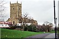
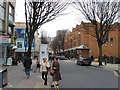
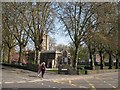
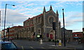
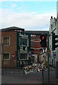
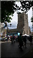
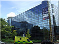
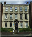
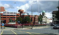
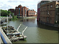
Photos of BS2 0DJ


Area Information
BS2 0DJ is a small residential cluster in England, part of a broader area with a population of 2012. Situated in east Bristol, it lies near the historic Lawrence Hill ward, which includes districts like Barton Hill, St Philips Marsh, and parts of Easton. The area is defined by its proximity to major roads such as the A420 and A4320, and it sits near the start of the Bristol and Bath Railway Path. Daily life here is shaped by its compact size and integration with nearby urban hubs. The area’s history dates back to the 12th century, when St Lawrence’s Hospital, a medieval leper house, was founded. Today, it blends historical context with modern infrastructure, including retail outlets, transport links, and planned revitalisation projects. While the population is small, the area is connected to broader Bristol networks, offering access to shopping, transport, and community amenities within a short distance. Living here means navigating a mix of residential and commercial spaces, with a focus on connectivity to the city’s core.
- Area Type
- Postcode
- Area Size
- Not available
- Population
- Not available
- Population Density
- Not available
The property market in BS2 0DJ is characterised by a low home ownership rate of 22%, indicating that most residents rent rather than own their homes. The accommodation type is almost entirely flats, reflecting a high-density housing stock typical of urban or semi-urban areas. This suggests that the area is not a traditional owner-occupied neighbourhood but one where rental demand is more prominent. For buyers, this means limited availability of owner-occupied properties, with flats forming the bulk of the housing stock. The small population and compact size of the area may limit property diversity, but proximity to transport hubs like Bristol Temple Meads Railway Station and retail centres could enhance appeal. Investors or buyers seeking long-term residency may find the market challenging, with fewer opportunities for purchase compared to areas with higher home ownership rates.
House Prices in BS2 0DJ
No properties found in this postcode.
Energy Efficiency in BS2 0DJ
Residents of BS2 0DJ have access to a range of amenities within practical reach. Retail options include Sainsburys and Tesco in Bristol, providing everyday shopping convenience. The area is near multiple railway stations, including Bristol Temple Meads, which connects to broader transport networks. Ferry services like St Philip’s Bridge and Castle Park Ferry Landing add to the local connectivity. The nearby Bristol and Bath Railway Path offers recreational opportunities for walking and cycling. While the data does not list specific parks or leisure venues, the proximity to Broadmead shopping area and planned revitalisation projects suggest potential for future development. The mix of retail, transport, and green spaces contributes to a functional lifestyle, though the area’s small size may limit the diversity of amenities compared to larger urban centres.
Amenities
Schools
The nearest school to BS2 0DJ is Andalusia Academy Bristol, an independent school. No other schools are listed in the data, so families relying on state education may need to look further afield. The presence of an independent school suggests that the area attracts households prioritising private education, though it does not provide a comprehensive range of school types. For families seeking state-funded options, the lack of nearby schools could be a limitation, requiring careful consideration of commuting distances. The single school listed does not indicate Ofsted ratings, but its independent status may imply higher fees and selective admissions. This mix of school types may cater to specific educational preferences but may not fully meet the needs of all residents.
| Rank | School | Type | Entry gender | Ages |
|---|
Explore more schools in this area
Go to Schools tabDemographics
The median age in BS2 0DJ is 22, with the majority of residents aged 15–29. This reflects a young adult demographic, likely drawn to the area’s proximity to transport and employment opportunities. Home ownership rates are low, at 22%, suggesting that a significant portion of the population rents. The accommodation type is predominantly flats, indicating a higher density of housing. The predominant ethnic group is White, though specific diversity statistics are not provided. The age profile and housing stock suggest a transient or student population, with limited long-term residency. The low home ownership rate may impact community stability, and the flat-dominated landscape could influence property values and investment potential. For buyers, this demographic profile means a market skewed toward rental properties and a community with a youthful, possibly evolving character.
Household Size
Accommodation Type
Tenure
Ethnic Group
Religion
Household Composition
Age
Household Deprivation
NS-SEC
Explore more demographic insights in this area
Go to Demographics tabPlanning
Planning Constraints
- Flood RiskPremium
- Ramsar Wetland SitesPremium
- Area of Outstanding Natural BeautyPremium
- Protected Nature ReservePremium
- Protected WoodlandPremium