Area Overview for BS2 0BS
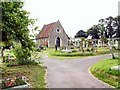
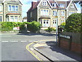
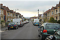
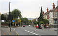
Photos of BS2 0BS
Area Information
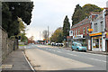
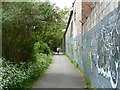
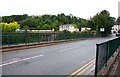
BS2 0BS is a compact postcode area in east Bristol, encompassing parts of Lawrence Hill, a historically significant district with roots tracing back to the 12th century. The area covers 9,714 square metres and is densely populated, with 2,012 residents packed into just 207,125 people per square kilometre. This density reflects its role as a residential hub near key transport arteries like the A420 and A4320. Daily life here is shaped by proximity to Bristol Temple Meads Railway Station and the nearby Broadmead shopping area, offering easy access to retail, dining, and transport. The area’s character is defined by its mix of mid-20th-century tower blocks, such as Kingsmarsh House, and ongoing redevelopment plans for the high street near the train station. With a young population skewing heavily toward adults aged 15–29, the area feels dynamic but compact, catering to commuters and students. Its location near the Bristol and Bath Railway Path also provides recreational opportunities, though the high population density means space is limited. For buyers, this postcode represents a small, tightly knit community with a strong transport network but limited green space.
- Area Type
- Postcode
- Area Size
- 9714 m²
- Population
- Not available
- Population Density
- Not available
The property market in BS2 0BS is dominated by rental flats, with only 22% of homes owned by residents. This low home ownership rate points to a market where private landlords and student housing providers hold significant influence. The area’s compact size and high population density mean property options are limited, with most homes being mid- to high-rise flats built in the 1960s, such as the 13-storey Kingsmarsh House. These properties are likely to be in demand among students and young professionals seeking affordable, centrally located housing. However, the lack of owner-occupied homes suggests limited long-term investment opportunities for buyers seeking property for personal use. The small area size also means competition for available properties is fierce, particularly near transport hubs like Bristol Temple Meads Station. For buyers, this postcode may appeal to those prioritising convenience over space, but the rental-heavy market may limit appreciation potential.
House Prices in BS2 0BS
Showing 1 properties
| Address | Type | Beds | Baths | Last Sale Price | Last Sale Date | |
|---|---|---|---|---|---|---|
| B S S Group Plc, Albert Road, St Philips, Bristol, BS2 0BS | general_industrial | - | - | - | - |
Energy Efficiency in BS2 0BS
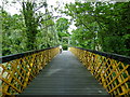
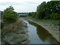
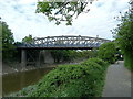
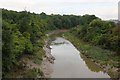
Residents of BS2 0BS have access to a range of retail and transport amenities within walking distance. The area includes five notable retail outlets, such as M&S Bristol Avonmead and Sainsburys Castle, providing everyday shopping options. Ferry terminals like Netham Lock and Temple Bridge Ferry Landing offer water-based transport links, while rail stations such as Bristol Temple Meads and Bedminster Railway Station connect to major routes. The nearby Bristol Filton Airport adds to the area’s transport diversity, though it is not a primary hub. For leisure, the Bristol and Bath Railway Path begins in the southern part of the ward, offering walking and cycling opportunities. However, the high population density means limited open space, and the focus on retail and transport over parks or recreational areas suggests a lifestyle centred on convenience rather than leisure. The presence of Lidl and other stores indicates a practical, service-oriented environment tailored to commuters and students.
Amenities
Schools
The only school explicitly listed near BS2 0BS is Andalusia Academy Bristol, an independent institution. No state schools or Ofsted ratings are provided in the data, so families seeking state education would need to look beyond the immediate area. The presence of a single independent school suggests that families prioritising private education may find this postcode advantageous, while others may need to consider nearby wards for state school options. The lack of detailed school data means the full range of educational choices available to residents remains unclear, but the existing school caters to a specific demographic. For those relying on state education, the absence of nearby schools could be a drawback, requiring careful research into commuting distances and availability.
| Rank | School | Type | Entry gender | Ages |
|---|
Explore more schools in this area
Go to Schools tabDemographics
The population of BS2 0BS is overwhelmingly young, with a median age of 22 and 73% of residents falling within the 15–29 age range. This demographic profile suggests a community dominated by students, graduates, and young professionals, likely drawn by proximity to Bristol’s universities and transport links. Home ownership is exceptionally low at 22%, indicating that most residents are renters, possibly students or temporary workers. The area’s accommodation is almost entirely flats, reflecting its high-density layout. The predominant ethnic group is White, with no specific data provided on other groups. The low home ownership rate and young population suggest a transient community, where housing is often short-term or rented through private landlords. This dynamic may affect local services and amenities, which must cater to a mobile population with shifting needs. The absence of detailed diversity data means the full extent of the community’s composition remains unclear, but the figures highlight a youthful, rental-focused environment.
Household Size
Accommodation Type
Tenure
Ethnic Group
Religion
Household Composition
Age
Household Deprivation
NS-SEC
Explore more demographic insights in this area
Go to Demographics tabPlanning
Planning Constraints
- Flood RiskPremium
- Ramsar Wetland SitesPremium
- Area of Outstanding Natural BeautyPremium
- Protected Nature ReservePremium
- Protected WoodlandPremium