Area Overview for BS2 0AY
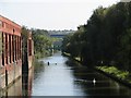
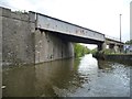
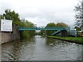
Photos of BS2 0AY

Area Information
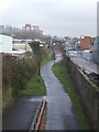
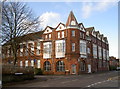
BS2 0AY is a compact residential postcode in east Bristol, nestled within the Lawrence Hill ward. This area spans 4,414 square metres and is home to 1,744 people, making it one of the most densely populated zones in the city. Its proximity to Broadmead, Temple Meads, and parts of Easton places it at the heart of a historically rich district. Originally named St Lawrence Hill after a medieval leper hospital founded by King John, the area has evolved into a hub of mid-20th-century tower blocks like Kingsmarsh House and Moorfields, alongside revitalisation efforts targeting its high street. Daily life here is shaped by its proximity to transport networks, including the A420 and A4320 roads, and the Bristol and Bath Railway Path. Residents benefit from nearby retail, rail, and ferry services, though the area’s small size means every amenity is within walking distance. With a median age of 22 and a majority of residents aged 30–64, this postcode reflects a mix of young professionals and established families navigating the challenges of urban living.
- Area Type
- Postcode
- Area Size
- 4414 m²
- Population
- Not available
- Population Density
- Not available
BS2 0AY’s property market is characterised by a 29% home ownership rate, meaning the majority of residents rent their homes. The accommodation type is predominantly flats, a common feature in high-density urban areas. This reflects the area’s history of mid-20th-century housing developments, such as the 13-storey Kingsmarsh House and the 11- and 13-storey Moorfields and Baynton Houses. The small size of the postcode and its immediate surroundings means housing stock is limited, with little scope for new developments. For buyers, this presents a challenge: the market is likely competitive, with limited options for owner-occupied properties. However, the area’s proximity to transport links and amenities like the Broadmead shopping district may make it appealing for investors seeking rental income. Prospective buyers should consider the high population density and the potential for future redevelopment plans, such as the proposed revitalisation of the high street near the train station.
House Prices in BS2 0AY
No properties found in this postcode.
Energy Efficiency in BS2 0AY
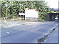
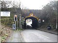
Living in BS2 0AY offers access to a range of amenities within practical reach. Retail options include Sainsburys Bristol, M&S Bristol Temple, and Lidl Easton, providing everyday shopping needs. The area’s proximity to the Broadmead shopping district and the revitalisation plans for the high street near the train station suggest opportunities for leisure and dining. Transport links are robust, with multiple rail stations, ferry landings, and the nearby Bristol Filton Airport. The A420 and A4320 roads provide road connectivity, while the Bristol and Bath Railway Path offers a scenic route for walking and cycling. The character of the area is shaped by its mix of historic and modern elements, from mid-20th-century tower blocks to ongoing redevelopment projects. These amenities and transport options create a convenient, though compact, lifestyle for residents.
Amenities
Schools
The nearest school to BS2 0AY is Hannah More Primary School, which serves the area with a primary education offering. The school holds a ‘good’ Ofsted rating, indicating it meets national standards in teaching and student outcomes. While no secondary schools are listed in the data, the presence of a primary school suggests the area is suitable for families with young children, though parents may need to look further afield for secondary education. The single school type available means families should assess whether the school’s curriculum and facilities align with their needs. The absence of additional schools in the data implies limited options for parents seeking a range of educational institutions, though the area’s proximity to transport links could ease access to schools beyond the immediate postcode.
| Rank | School | Type | Entry gender | Ages |
|---|
Explore more schools in this area
Go to Schools tabDemographics
The population of BS2 0AY is 1,744 people, with a median age of 22, though the most common age range is 30–64 years. This suggests a community skewed toward working-age adults, possibly including students and professionals. Home ownership is low at 29%, indicating that most residents rent their accommodation. The predominant housing type is flats, reflecting the area’s high population density of 395,068 people per square kilometre. The majority of residents identify as White, with no specific data on other ethnic groups provided. The high density and rental market suggest a transient population, though the presence of mid-1960s tower blocks and ongoing revitalisation projects implies a mix of long-term residents and new arrivals. The lack of deprivation data means it is unclear how this affects access to services, but the area’s proximity to amenities like schools and transport hubs suggests a functional, though compact, quality of life.
Household Size
Accommodation Type
Tenure
Ethnic Group
Religion
Household Composition
Age
Household Deprivation
NS-SEC
Explore more demographic insights in this area
Go to Demographics tabPlanning
Planning Constraints
- Flood RiskPremium
- Ramsar Wetland SitesPremium
- Area of Outstanding Natural BeautyPremium
- Protected Nature ReservePremium
- Protected WoodlandPremium