Area Overview for BS19 5DS
Photos of BS19 5DS


Area Information
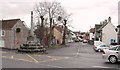
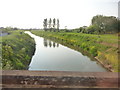
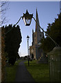
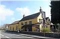
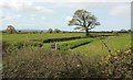
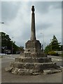
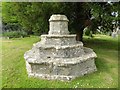
Living in BS19 5DS offers a distinct experience within the rural landscape of North Somerset. Thispostcode covers a specific residential cluster in Congresbury, a village defined by its historic conservation area. The area sits south of the River Yeo, centred on the historic core including St Andrew's Church and Broad Street. A population of 1,889 resides within this compact space, creating a tightly knit community rather than a sprawling suburb. The village retains the character of traditional two-storey stone cottages and Georgian classical structures, yet it remains accessible via the A370 main road. You will find your daily surroundings surrounded by countryside in the Mendip Hills Area of Outstanding Natural Beauty, though the village itself does not lie within the protected AONB boundary. The area maintains a density of 175 people per square kilometre, ensuring that while you enjoy a quiet, country-side setting, amenities remain within practical reach. For those prioritising history and seclusion, this location provides a rare blend of deep heritage, with sites dating back to Roman and Saxon times, and modern convenience. The conservation area, adopted in 1990, strictly preserves the architectural integrity of High Street, Station Road, Paul's Causeway, and Mill Lane, ensuring the visual character remains unchanged for future residents. The community in BS19 5DS reflects a settled, older demographic profile. The median age for residents is 47 years, indicating that the most common age group consists of adults between 30 and 64 years of age. This age distribution suggests a neighbourhood favoured by those further along in their careers or seeking stability. Home ownership stands at an impressive 81 percent, meaning that the vast majority of households reside in properties they own outright or have a long-term mortgage. This high rate of ownership points to a stability in the local housing market that rental investors typically avoid or complement with owner-occupied properties. Accommodation types are predominantly houses, which aligns with the preference for detached or semi-detached living common in such villages. The predominant ethnic group is White, reflecting the traditional composition of much of rural North Somerset. With a safety score of 83 out of 100, the area demonstrates below-average crime rates, contributing to a secure environment for families and individuals. The combination of high home ownership and a mature adult population creates a quiet, reliable atmosphere where residents have established roots. This demographic makeup makes it an attractive option for downsizers or families seeking a permanent, low-churn residential environment. The property market in BS19 5DS is characterised by a predominately owner-occupied stock, with 81 percent of homes held by their residents. This statistic reveals that the area operates more as a settled residential market rather than a high-turnover rental hub. Accommodation types are almost exclusively houses, fitting the vernacular of Congresbury's historic conservation area which includes Georgean classical structures and traditional stone cottages. Prospective buyers looking at this postcode will find that most transactions involve existing homeowners moving to similar properties or upgrading within the village limits. The high level of home ownership implies strong community attachment and a stable tenure structure that can be appealing for those seeking long-term security. When considering homes in BS19 5DS, you should expect a focus on detached or semi-detached properties that align with the village's two-storey cottage-style architecture. The small population size of 1,889 means that available stock is limited, and many properties have remained in the same family lineages over decades, as evidenced by the history of land sales occurring selectively in the 1920s and 1970s. This market dynamic supports a retiree demographic and families prioritising established neighbourhoods over new-build developments. The conservation status of the area, covering 12.5 hectares, ensures that any new construction or renovation must adhere to strict planning guidelines, preserving the village's historic streetscape. Families considering living in BS19 5DS will find several primary education options within the immediate locality. You can access The Glebe Infant School, which serves the younger children in the parish. Nearby options include St Andrew's Primary School and St Andrew's CofE Primary School, both of which cater to the educational needs of the community. These institutions reflect the village deep history, as the local primary school often serves a generationally loyal community where children attend the same school multiple generations later. The presence of these three schools indicates a focus on local provision rather than relying heavily on out-of-area secondary specialised institutions. For residents prioritising education within the neighbourhood, the choice of a Church of England primary school alongside a standard infant school offers different curriculum emphases while maintaining local accessibility. The proximity of these schools to the village core on Broad Street and High Street means that young families benefit from short travel times to education. Digital connectivity for residents of BS19 5DS supports remote working and modern internet usage needs effectively. The area achieves a broadband quality score of 78 out of 100, indicating a fixed broadband connection that meets most home office requirements. Mobile network coverage scores even higher at 83 out of 100, ensuring reliable voice and data signals throughout the village and surrounding countryside. While the village was originally served by a railway station from 1869 on the Strawberry Line, the track is now closed, so current transport relies heavily on road networks and digital links. You will find that the A370 main road provides the primary arterial route for travel to nearby towns and Bristol Airport. The robust mobile score suggests you can stream, video conference, or manage smart home technology without significant interruption. For those working digitally, the combination of strong mobile signals and excellent fixed-line broadband removes the traditional rural downfalls of poor internet access, making BS19 5DS a viable location for remote professionals. Your daily life in BS19 5DS is supported by a practical range of amenities within easy reach. For retail needs, you have access to five major shopping locations, including The Southern Co-operative Co, Tesco Congresbury, and Co-op Yatton. These supermarkets provide comprehensive weekly shopping without the need to travel far. Transport links are significant for leisure and commuting, with four nearby railway stations including Yatton Railway Station, Nailsea and Backwell Railway Station, and Worle Railway Station. For those interested in coastal leisure, Clevedon Pier offers a ferry connection to the sea within a short drive. Bristol Airport is also nearby, facilitating easy travel for domestic and international journeys. The village character is centred on Broad Street, a small shopping thoroughfare featuring the Grade I listed St Andrew's Church and a 15th-century market cross. This layout provides a rural lifestyle with urban convenience, allowing you to enjoy countryside walks in the Mendip Hills while accessing fresh produce and goods locally. Safety and environmental considerations for BS19 5DS show predominantly reassuring findings across key risk categories. The flood risk assessment presents a pass with a score of 0, indicating low flood risk coverage and minimal threat from waterlogging. Ramsar wetland sites, Areas of Outstanding Natural Beauty, protected nature reserves, and protected woodland all show passes with scores of 0, meaning the specific residential postcode does not face planning constraints or legal restrictions associated with these designations. The crime risk score is 83 out of 100, categorised as a pass with low crime risk. This figure indicates that the area has below-average crime rates compared to the national standard, suggesting a safer neighbourhood for residents. You can expect a peaceful environment where the primary concerns revolve around standard rural living issues rather than significant safety threats. The low scores across planning constraints allow for standard development patterns without the complications often found in protected landscapes, though the conservation area status does impose controls on property modifications to maintain the historic character of High Street and Mill Lane. Who typically lives in BS19 5DS?The median age of residents is 47 years, with the majority falling into the 30-64 age bracket. Home ownership is high at 81 percent, and the community is predominantly White. The area attracts those seeking stability in a rural setting with a mature population. What schools are available for children in the area?Families have access to The Glebe Infant School and both St Andrew's Primary School and St Andrew's CofE Primary School. These local institutions serve the village core, providing primary education for children living in the BS19 5DS postcode. How good is the internet connection for working from home?Digital infrastructure is robust with a broadband score of 78 and a mobile coverage score of 83 out of 100. These high ratings indicate reliable high-speed internet and strong mobile signals, making it suitable for remote work and streaming. Is the area considered safe regarding crime and environmental risks?The area scores 83 out of 100 for low crime risk, with flood risk, wetland, and woodland constraints all showing zero risk scores. This profile indicates a safe, secure environment with minimal environmental planning constraints affecting daily life.
- Area Type
- Postcode
- Area Size
- Not available
- Population
- 1889
- Population Density
- 175 people/km²
The property market in BS19 5DS is characterised by a predominately owner-occupied stock, with 81 percent of homes held by their residents. This statistic reveals that the area operates more as a settled residential market rather than a high-turnover rental hub. Accommodation types are almost exclusively houses, fitting the vernacular of Congresbury's historic conservation area which includes Georgean classical structures and traditional stone cottages. Prospective buyers looking at this postcode will find that most transactions involve existing homeowners moving to similar properties or upgrading within the village limits. The high level of home ownership implies strong community attachment and a stable tenure structure that can be appealing for those seeking long-term security. When considering homes in BS19 5DS, you should expect a focus on detached or semi-detached properties that align with the village's two-storey cottage-style architecture. The small population size of 1,889 means that available stock is limited, and many properties have remained in the same family lineages over decades, as evidenced by the history of land sales occurring selectively in the 1920s and 1970s. This market dynamic supports a retiree demographic and families prioritising established neighbourhoods over new-build developments. The conservation status of the area, covering 12.5 hectares, ensures that any new construction or renovation must adhere to strict planning guidelines, preserving the village's historic streetscape. Families considering living in BS19 5DS will find several primary education options within the immediate locality. You can access The Glebe Infant School, which serves the younger children in the parish. Nearby options include St Andrew's Primary School and St Andrew's CofE Primary School, both of which cater to the educational needs of the community. These institutions reflect the village deep history, as the local primary school often serves a generationally loyal community where children attend the same school multiple generations later. The presence of these three schools indicates a focus on local provision rather than relying heavily on out-of-area secondary specialised institutions. For residents prioritising education within the neighbourhood, the choice of a Church of England primary school alongside a standard infant school offers different curriculum emphases while maintaining local accessibility. The proximity of these schools to the village core on Broad Street and High Street means that young families benefit from short travel times to education. Digital connectivity for residents of BS19 5DS supports remote working and modern internet usage needs effectively. The area achieves a broadband quality score of 78 out of 100, indicating a fixed broadband connection that meets most home office requirements. Mobile network coverage scores even higher at 83 out of 100, ensuring reliable voice and data signals throughout the village and surrounding countryside. While the village was originally served by a railway station from 1869 on the Strawberry Line, the track is now closed, so current transport relies heavily on road networks and digital links. You will find that the A370 main road provides the primary arterial route for travel to nearby towns and Bristol Airport. The robust mobile score suggests you can stream, video conference, or manage smart home technology without significant interruption. For those working digitally, the combination of strong mobile signals and excellent fixed-line broadband removes the traditional rural downfalls of poor internet access, making BS19 5DS a viable location for remote professionals. Your daily life in BS19 5DS is supported by a practical range of amenities within easy reach. For retail needs, you have access to five major shopping locations, including The Southern Co-operative Co, Tesco Congresbury, and Co-op Yatton. These supermarkets provide comprehensive weekly shopping without the need to travel far. Transport links are significant for leisure and commuting, with four nearby railway stations including Yatton Railway Station, Nailsea and Backwell Railway Station, and Worle Railway Station. For those interested in coastal leisure, Clevedon Pier offers a ferry connection to the sea within a short drive. Bristol Airport is also nearby, facilitating easy travel for domestic and international journeys. The village character is centred on Broad Street, a small shopping thoroughfare featuring the Grade I listed St Andrew's Church and a 15th-century market cross. This layout provides a rural lifestyle with urban convenience, allowing you to enjoy countryside walks in the Mendip Hills while accessing fresh produce and goods locally. Safety and environmental considerations for BS19 5DS show predominantly reassuring findings across key risk categories. The flood risk assessment presents a pass with a score of 0, indicating low flood risk coverage and minimal threat from waterlogging. Ramsar wetland sites, Areas of Outstanding Natural Beauty, protected nature reserves, and protected woodland all show passes with scores of 0, meaning the specific residential postcode does not face planning constraints or legal restrictions associated with these designations. The crime risk score is 83 out of 100, categorised as a pass with low crime risk. This figure indicates that the area has below-average crime rates compared to the national standard, suggesting a safer neighbourhood for residents. You can expect a peaceful environment where the primary concerns revolve around standard rural living issues rather than significant safety threats. The low scores across planning constraints allow for standard development patterns without the complications often found in protected landscapes, though the conservation area status does impose controls on property modifications to maintain the historic character of High Street and Mill Lane. Who typically lives in BS19 5DS?The median age of residents is 47 years, with the majority falling into the 30-64 age bracket. Home ownership is high at 81 percent, and the community is predominantly White. The area attracts those seeking stability in a rural setting with a mature population. What schools are available for children in the area?Families have access to The Glebe Infant School and both St Andrew's Primary School and St Andrew's CofE Primary School. These local institutions serve the village core, providing primary education for children living in the BS19 5DS postcode. How good is the internet connection for working from home?Digital infrastructure is robust with a broadband score of 78 and a mobile coverage score of 83 out of 100. These high ratings indicate reliable high-speed internet and strong mobile signals, making it suitable for remote work and streaming. Is the area considered safe regarding crime and environmental risks?The area scores 83 out of 100 for low crime risk, with flood risk, wetland, and woodland constraints all showing zero risk scores. This profile indicates a safe, secure environment with minimal environmental planning constraints affecting daily life.
House Prices in BS19 5DS
No properties found in this postcode.
Energy Efficiency in BS19 5DS
Your daily life in BS19 5DS is supported by a practical range of amenities within easy reach. For retail needs, you have access to five major shopping locations, including The Southern Co-operative Co, Tesco Congresbury, and Co-op Yatton. These supermarkets provide comprehensive weekly shopping without the need to travel far. Transport links are significant for leisure and commuting, with four nearby railway stations including Yatton Railway Station, Nailsea and Backwell Railway Station, and Worle Railway Station. For those interested in coastal leisure, Clevedon Pier offers a ferry connection to the sea within a short drive. Bristol Airport is also nearby, facilitating easy travel for domestic and international journeys. The village character is centred on Broad Street, a small shopping thoroughfare featuring the Grade I listed St Andrew's Church and a 15th-century market cross. This layout provides a rural lifestyle with urban convenience, allowing you to enjoy countryside walks in the Mendip Hills while accessing fresh produce and goods locally. Safety and environmental considerations for BS19 5DS show predominantly reassuring findings across key risk categories. The flood risk assessment presents a pass with a score of 0, indicating low flood risk coverage and minimal threat from waterlogging. Ramsar wetland sites, Areas of Outstanding Natural Beauty, protected nature reserves, and protected woodland all show passes with scores of 0, meaning the specific residential postcode does not face planning constraints or legal restrictions associated with these designations. The crime risk score is 83 out of 100, categorised as a pass with low crime risk. This figure indicates that the area has below-average crime rates compared to the national standard, suggesting a safer neighbourhood for residents. You can expect a peaceful environment where the primary concerns revolve around standard rural living issues rather than significant safety threats. The low scores across planning constraints allow for standard development patterns without the complications often found in protected landscapes, though the conservation area status does impose controls on property modifications to maintain the historic character of High Street and Mill Lane. Who typically lives in BS19 5DS?The median age of residents is 47 years, with the majority falling into the 30-64 age bracket. Home ownership is high at 81 percent, and the community is predominantly White. The area attracts those seeking stability in a rural setting with a mature population. What schools are available for children in the area?Families have access to The Glebe Infant School and both St Andrew's Primary School and St Andrew's CofE Primary School. These local institutions serve the village core, providing primary education for children living in the BS19 5DS postcode. How good is the internet connection for working from home?Digital infrastructure is robust with a broadband score of 78 and a mobile coverage score of 83 out of 100. These high ratings indicate reliable high-speed internet and strong mobile signals, making it suitable for remote work and streaming. Is the area considered safe regarding crime and environmental risks?The area scores 83 out of 100 for low crime risk, with flood risk, wetland, and woodland constraints all showing zero risk scores. This profile indicates a safe, secure environment with minimal environmental planning constraints affecting daily life.
Amenities
Schools
Families considering living in BS19 5DS will find several primary education options within the immediate locality. You can access The Glebe Infant School, which serves the younger children in the parish. Nearby options include St Andrew's Primary School and St Andrew's CofE Primary School, both of which cater to the educational needs of the community. These institutions reflect the village deep history, as the local primary school often serves a generationally loyal community where children attend the same school multiple generations later. The presence of these three schools indicates a focus on local provision rather than relying heavily on out-of-area secondary specialised institutions. For residents prioritising education within the neighbourhood, the choice of a Church of England primary school alongside a standard infant school offers different curriculum emphases while maintaining local accessibility. The proximity of these schools to the village core on Broad Street and High Street means that young families benefit from short travel times to education. Digital connectivity for residents of BS19 5DS supports remote working and modern internet usage needs effectively. The area achieves a broadband quality score of 78 out of 100, indicating a fixed broadband connection that meets most home office requirements. Mobile network coverage scores even higher at 83 out of 100, ensuring reliable voice and data signals throughout the village and surrounding countryside. While the village was originally served by a railway station from 1869 on the Strawberry Line, the track is now closed, so current transport relies heavily on road networks and digital links. You will find that the A370 main road provides the primary arterial route for travel to nearby towns and Bristol Airport. The robust mobile score suggests you can stream, video conference, or manage smart home technology without significant interruption. For those working digitally, the combination of strong mobile signals and excellent fixed-line broadband removes the traditional rural downfalls of poor internet access, making BS19 5DS a viable location for remote professionals. Your daily life in BS19 5DS is supported by a practical range of amenities within easy reach. For retail needs, you have access to five major shopping locations, including The Southern Co-operative Co, Tesco Congresbury, and Co-op Yatton. These supermarkets provide comprehensive weekly shopping without the need to travel far. Transport links are significant for leisure and commuting, with four nearby railway stations including Yatton Railway Station, Nailsea and Backwell Railway Station, and Worle Railway Station. For those interested in coastal leisure, Clevedon Pier offers a ferry connection to the sea within a short drive. Bristol Airport is also nearby, facilitating easy travel for domestic and international journeys. The village character is centred on Broad Street, a small shopping thoroughfare featuring the Grade I listed St Andrew's Church and a 15th-century market cross. This layout provides a rural lifestyle with urban convenience, allowing you to enjoy countryside walks in the Mendip Hills while accessing fresh produce and goods locally. Safety and environmental considerations for BS19 5DS show predominantly reassuring findings across key risk categories. The flood risk assessment presents a pass with a score of 0, indicating low flood risk coverage and minimal threat from waterlogging. Ramsar wetland sites, Areas of Outstanding Natural Beauty, protected nature reserves, and protected woodland all show passes with scores of 0, meaning the specific residential postcode does not face planning constraints or legal restrictions associated with these designations. The crime risk score is 83 out of 100, categorised as a pass with low crime risk. This figure indicates that the area has below-average crime rates compared to the national standard, suggesting a safer neighbourhood for residents. You can expect a peaceful environment where the primary concerns revolve around standard rural living issues rather than significant safety threats. The low scores across planning constraints allow for standard development patterns without the complications often found in protected landscapes, though the conservation area status does impose controls on property modifications to maintain the historic character of High Street and Mill Lane. Who typically lives in BS19 5DS?The median age of residents is 47 years, with the majority falling into the 30-64 age bracket. Home ownership is high at 81 percent, and the community is predominantly White. The area attracts those seeking stability in a rural setting with a mature population. What schools are available for children in the area?Families have access to The Glebe Infant School and both St Andrew's Primary School and St Andrew's CofE Primary School. These local institutions serve the village core, providing primary education for children living in the BS19 5DS postcode. How good is the internet connection for working from home?Digital infrastructure is robust with a broadband score of 78 and a mobile coverage score of 83 out of 100. These high ratings indicate reliable high-speed internet and strong mobile signals, making it suitable for remote work and streaming. Is the area considered safe regarding crime and environmental risks?The area scores 83 out of 100 for low crime risk, with flood risk, wetland, and woodland constraints all showing zero risk scores. This profile indicates a safe, secure environment with minimal environmental planning constraints affecting daily life.
| Rank | School | Type | Entry gender | Ages |
|---|
Explore more schools in this area
Go to Schools tabDemographics
The community in BS19 5DS reflects a settled, older demographic profile. The median age for residents is 47 years, indicating that the most common age group consists of adults between 30 and 64 years of age. This age distribution suggests a neighbourhood favoured by those further along in their careers or seeking stability. Home ownership stands at an impressive 81 percent, meaning that the vast majority of households reside in properties they own outright or have a long-term mortgage. This high rate of ownership points to a stability in the local housing market that rental investors typically avoid or complement with owner-occupied properties. Accommodation types are predominantly houses, which aligns with the preference for detached or semi-detached living common in such villages. The predominant ethnic group is White, reflecting the traditional composition of much of rural North Somerset. With a safety score of 83 out of 100, the area demonstrates below-average crime rates, contributing to a secure environment for families and individuals. The combination of high home ownership and a mature adult population creates a quiet, reliable atmosphere where residents have established roots. This demographic makeup makes it an attractive option for downsizers or families seeking a permanent, low-churn residential environment. The property market in BS19 5DS is characterised by a predominately owner-occupied stock, with 81 percent of homes held by their residents. This statistic reveals that the area operates more as a settled residential market rather than a high-turnover rental hub. Accommodation types are almost exclusively houses, fitting the vernacular of Congresbury's historic conservation area which includes Georgean classical structures and traditional stone cottages. Prospective buyers looking at this postcode will find that most transactions involve existing homeowners moving to similar properties or upgrading within the village limits. The high level of home ownership implies strong community attachment and a stable tenure structure that can be appealing for those seeking long-term security. When considering homes in BS19 5DS, you should expect a focus on detached or semi-detached properties that align with the village's two-storey cottage-style architecture. The small population size of 1,889 means that available stock is limited, and many properties have remained in the same family lineages over decades, as evidenced by the history of land sales occurring selectively in the 1920s and 1970s. This market dynamic supports a retiree demographic and families prioritising established neighbourhoods over new-build developments. The conservation status of the area, covering 12.5 hectares, ensures that any new construction or renovation must adhere to strict planning guidelines, preserving the village's historic streetscape. Families considering living in BS19 5DS will find several primary education options within the immediate locality. You can access The Glebe Infant School, which serves the younger children in the parish. Nearby options include St Andrew's Primary School and St Andrew's CofE Primary School, both of which cater to the educational needs of the community. These institutions reflect the village deep history, as the local primary school often serves a generationally loyal community where children attend the same school multiple generations later. The presence of these three schools indicates a focus on local provision rather than relying heavily on out-of-area secondary specialised institutions. For residents prioritising education within the neighbourhood, the choice of a Church of England primary school alongside a standard infant school offers different curriculum emphases while maintaining local accessibility. The proximity of these schools to the village core on Broad Street and High Street means that young families benefit from short travel times to education. Digital connectivity for residents of BS19 5DS supports remote working and modern internet usage needs effectively. The area achieves a broadband quality score of 78 out of 100, indicating a fixed broadband connection that meets most home office requirements. Mobile network coverage scores even higher at 83 out of 100, ensuring reliable voice and data signals throughout the village and surrounding countryside. While the village was originally served by a railway station from 1869 on the Strawberry Line, the track is now closed, so current transport relies heavily on road networks and digital links. You will find that the A370 main road provides the primary arterial route for travel to nearby towns and Bristol Airport. The robust mobile score suggests you can stream, video conference, or manage smart home technology without significant interruption. For those working digitally, the combination of strong mobile signals and excellent fixed-line broadband removes the traditional rural downfalls of poor internet access, making BS19 5DS a viable location for remote professionals. Your daily life in BS19 5DS is supported by a practical range of amenities within easy reach. For retail needs, you have access to five major shopping locations, including The Southern Co-operative Co, Tesco Congresbury, and Co-op Yatton. These supermarkets provide comprehensive weekly shopping without the need to travel far. Transport links are significant for leisure and commuting, with four nearby railway stations including Yatton Railway Station, Nailsea and Backwell Railway Station, and Worle Railway Station. For those interested in coastal leisure, Clevedon Pier offers a ferry connection to the sea within a short drive. Bristol Airport is also nearby, facilitating easy travel for domestic and international journeys. The village character is centred on Broad Street, a small shopping thoroughfare featuring the Grade I listed St Andrew's Church and a 15th-century market cross. This layout provides a rural lifestyle with urban convenience, allowing you to enjoy countryside walks in the Mendip Hills while accessing fresh produce and goods locally. Safety and environmental considerations for BS19 5DS show predominantly reassuring findings across key risk categories. The flood risk assessment presents a pass with a score of 0, indicating low flood risk coverage and minimal threat from waterlogging. Ramsar wetland sites, Areas of Outstanding Natural Beauty, protected nature reserves, and protected woodland all show passes with scores of 0, meaning the specific residential postcode does not face planning constraints or legal restrictions associated with these designations. The crime risk score is 83 out of 100, categorised as a pass with low crime risk. This figure indicates that the area has below-average crime rates compared to the national standard, suggesting a safer neighbourhood for residents. You can expect a peaceful environment where the primary concerns revolve around standard rural living issues rather than significant safety threats. The low scores across planning constraints allow for standard development patterns without the complications often found in protected landscapes, though the conservation area status does impose controls on property modifications to maintain the historic character of High Street and Mill Lane. Who typically lives in BS19 5DS?The median age of residents is 47 years, with the majority falling into the 30-64 age bracket. Home ownership is high at 81 percent, and the community is predominantly White. The area attracts those seeking stability in a rural setting with a mature population. What schools are available for children in the area?Families have access to The Glebe Infant School and both St Andrew's Primary School and St Andrew's CofE Primary School. These local institutions serve the village core, providing primary education for children living in the BS19 5DS postcode. How good is the internet connection for working from home?Digital infrastructure is robust with a broadband score of 78 and a mobile coverage score of 83 out of 100. These high ratings indicate reliable high-speed internet and strong mobile signals, making it suitable for remote work and streaming. Is the area considered safe regarding crime and environmental risks?The area scores 83 out of 100 for low crime risk, with flood risk, wetland, and woodland constraints all showing zero risk scores. This profile indicates a safe, secure environment with minimal environmental planning constraints affecting daily life.
Household Size
Accommodation Type
Tenure
Ethnic Group
Religion
Household Composition
Age
Household Deprivation
NS-SEC
Explore more demographic insights in this area
Go to Demographics tabPlanning
Planning Constraints
- Flood RiskPremium
- Ramsar Wetland SitesPremium
- Area of Outstanding Natural BeautyPremium
- Protected Nature ReservePremium
- Protected WoodlandPremium