Area Overview for BS19 4AP
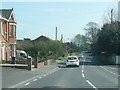
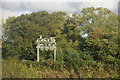
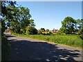
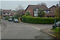
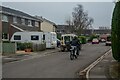
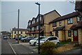
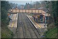
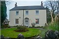
Photos of BS19 4AP
Area Information
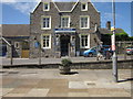
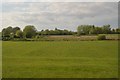
BS19 4AP is a small, tightly knit residential postcode area in North Somerset, just 11 miles south-west of Bristol. With a population of 2,167 and a density of 229 people per square kilometre, it reflects a compact, community-focused settlement. The area’s character is shaped by its historical roots, including Iron Age hill forts and Roman-era settlements, yet it remains a modern commuter hub thanks to its railway connections. Daily life here balances rural tranquillity with proximity to urban amenities. Residents benefit from easy access to Bristol’s economic and cultural offerings, while the surrounding North Somerset Levels provide a landscape of low-lying moorland and drained ground known as ‘batches’. The area’s appeal lies in its blend of historical significance, practical connectivity, and a demographic skewed towards middle-aged homeowners. For those seeking a quiet yet accessible location, BS19 4AP offers a unique mix of heritage and contemporary living.
- Area Type
- Postcode
- Area Size
- Not available
- Population
- 2167
- Population Density
- 229 people/km²
The property market in BS19 4AP is largely owner-occupied, with 78% of homes owned by their residents. The predominant accommodation type is houses, which is typical for a small, rural postcode area. This suggests a market characterised by family homes and long-term residency rather than a rental-focused environment. Given the area’s limited size, the housing stock is unlikely to be extensive, meaning buyers may need to consider nearby settlements for more options. The high proportion of owner-occupied properties also implies a stable market with less turnover, which could be advantageous for those seeking a secure investment. However, the small scale of the area means competition for properties may be keen, particularly for homes with specific features or proximity to amenities.
House Prices in BS19 4AP
No properties found in this postcode.
Energy Efficiency in BS19 4AP
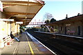
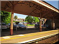
Living in BS19 4AP offers access to a range of amenities within practical reach. Retail options include Co-op Yatton, Tesco Congresbury, and Budgens Cleeve, providing everyday shopping convenience. The area’s historical significance is reflected in nearby sites like Cadbury Hill, which features Iron Age and Roman remains, offering opportunities for cultural and historical exploration. The presence of Clevedon Pier and proximity to Bristol Airport add to the lifestyle’s variety, while the railway stations facilitate easy travel. The mix of modern retail, historical landmarks, and transport links creates a balanced lifestyle, blending rural charm with urban accessibility.
Amenities
Schools
The nearest school to BS19 4AP is Chestnut Park Primary, a primary school with an outstanding Ofsted rating. This indicates a high standard of education for younger children, which is a key consideration for families. The absence of secondary schools in the immediate vicinity means students may need to travel to nearby towns for higher education, but the outstanding rating at Chestnut Park Primary suggests a strong foundation for early learning. The school’s presence adds to the area’s appeal for families, though the lack of comprehensive data on other educational institutions limits a full picture of the local school ecosystem.
| Rank | School | Type | Entry gender | Ages |
|---|
Explore more schools in this area
Go to Schools tabDemographics
The population of BS19 4AP has a median age of 47, with the majority of residents aged between 30 and 64 years. This suggests a community of established professionals and families, rather than a transient or youthful demographic. Home ownership is high at 78%, indicating a stable, long-term resident base. The accommodation type is predominantly houses, which aligns with the area’s character as a low-density, residential cluster. The predominant ethnic group is White, reflecting the broader demographic patterns of North Somerset. While specific data on deprivation is not provided, the high home ownership rate and age profile imply a relatively secure economic environment. However, the absence of detailed diversity statistics means the full scope of the community’s social fabric remains partially unexplored.
Household Size
Accommodation Type
Tenure
Ethnic Group
Religion
Household Composition
Age
Household Deprivation
NS-SEC
Explore more demographic insights in this area
Go to Demographics tabPlanning
Planning Constraints
- Flood RiskPremium
- Ramsar Wetland SitesPremium
- Area of Outstanding Natural BeautyPremium
- Protected Nature ReservePremium
- Protected WoodlandPremium