Area Overview for BS19 3TB
Photos of BS19 3TB
Area Information
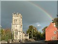
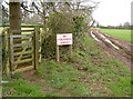
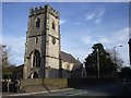
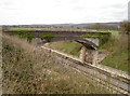
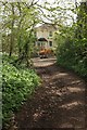
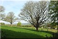
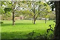
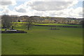
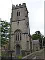
BS19 3TB, a small postcode area in Somerset near Bristol, is a quiet residential cluster with a population of 1,484 spread over 116 people per square kilometre. Nestled in the North West of Bristol, the area is part of Flax Bourton civil parish, a village with historical roots in flax processing and a landscape defined by the limestone gorge of Bourton Combe. Its proximity to the Bristol to Exeter railway line and Backwell makes it a convenient base for commuters, while the village’s compact size fosters a close-knit community. The area’s charm lies in its blend of rural tranquillity and practical connectivity, with frequent bus services linking it to Bristol and nearby towns. The parish’s history includes a 19th-century mill on the Land Yeo river, now reduced to a single-storey structure, and a 20th-century Esso facility. For those seeking a peaceful yet accessible location, BS19 3TB offers a snapshot of South West England’s heritage, with easy access to natural and cultural amenities.
- Area Type
- Postcode
- Area Size
- Not available
- Population
- 1484
- Population Density
- 116 people/km²
BS19 3TB is predominantly an owner-occupied area, with 85% of properties owned by residents rather than rented. The housing stock consists mainly of houses, reflecting a traditional, low-density settlement. This contrasts with urban areas where flats or apartments dominate, and suggests a focus on family homes with garden space. The small size of the postcode area means the housing market is limited, with few new developments. Buyers should consider nearby towns for broader options, though the existing stock offers a stable, established market. The high home ownership rate indicates strong community ties, with properties likely retaining value due to their rarity in the region. For those seeking a home, the area’s compact nature means proximity to amenities and transport links is a key selling point.
House Prices in BS19 3TB
No properties found in this postcode.
Energy Efficiency in BS19 3TB
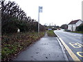
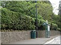
Daily life in BS19 3TB is shaped by its small-scale amenities and natural surroundings. Retail options include Spar, The Southern Co-operative Co, and Tesco Bristol, providing essentials within walking distance. The village’s proximity to the Stour river and Bourton Combe offers recreational opportunities, with the limestone gorge accessible via local bus routes. Transport links to Bristol and nearby towns mean residents can enjoy city amenities while retaining a rural feel. Ferries like the Cottage Ferry Landing add to the area’s connectivity. The presence of multiple railway stations and airports ensures easy travel, while the low population density fosters a relaxed pace of life. For those valuing convenience and scenery, the balance of local shops, transport, and natural beauty makes BS19 3TB appealing.
Amenities
Schools
The nearest schools to BS19 3TB are both Flax Bourton Church of England Primary School, a primary school serving the local community. While no secondary schools are listed, the presence of two primary schools suggests a focus on early education. The duplication of the same school name may indicate a single institution with multiple entries in the data. For families with young children, this provides a convenient option, though older students may need to travel to nearby towns for secondary education. The lack of diversity in school types means parents should investigate further for secondary options. The schools’ religious affiliation may appeal to families seeking faith-based education, but the absence of performance ratings or Ofsted data leaves room for further research into quality.
| Rank | School | Type | Entry gender | Ages |
|---|
Explore more schools in this area
Go to Schools tabDemographics
The population of BS19 3TB skews towards adults aged 30–64, with a median age of 47, reflecting a mature, settled community. Home ownership is high at 85%, with the majority of properties being houses rather than flats, indicating a preference for traditional, family-friendly housing. The predominant ethnic group is White, aligning with broader regional demographics. This age profile suggests a stable population with established careers and families, contributing to a low-deprivation environment. The absence of significant youth or elderly populations means community needs are largely centred on middle-aged residents. The high home ownership rate implies a long-term commitment to the area, with limited rental activity. This demographic structure supports a quiet, low-traffic lifestyle, though it may limit opportunities for younger or older residents seeking specific services.
Household Size
Accommodation Type
Tenure
Ethnic Group
Religion
Household Composition
Age
Household Deprivation
NS-SEC
Explore more demographic insights in this area
Go to Demographics tabPlanning
Planning Constraints
- Flood RiskPremium
- Ramsar Wetland SitesPremium
- Area of Outstanding Natural BeautyPremium
- Protected Nature ReservePremium
- Protected WoodlandPremium