Area Overview for BS19 3SG
Photos of BS19 3SG


Area Information
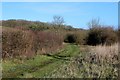
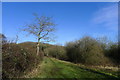
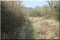
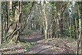
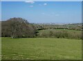
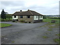
Living in BS19 3SG means being part of a small, semi-rural village nestled in North Somerset, just 5 miles from Bristol city centre. The postcode area covers a compact residential cluster with a population of 1,484, spread across 116 people per square kilometre. This is Barrow Gurney, a village with a picturesque feel, featuring a village green, meandering stream, and remnants of historical mills. Its location on the B3130, midway between the A38 and A370, makes it a strategic spot near the Long Ashton bypass and Bristol Airport. Daily life here blends rural tranquillity with practical access to urban amenities. The narrow roads, while traffic-calmed, serve as a local shortcut to the airport, reflecting the area’s integration with regional transport networks. With a median age of 47 and a community dominated by adults aged 30–64, BS19 3SG is a stable, family-oriented area. Its semi-rural character, combined with proximity to Bristol, offers a balance of countryside charm and connectivity.
- Area Type
- Postcode
- Area Size
- Not available
- Population
- 1484
- Population Density
- 116 people/km²
BS19 3SG is a small, owner-occupied area where 85% of homes are owned by residents rather than rented. The accommodation type is predominantly houses, which is typical of semi-rural villages with limited high-density development. This suggests a low-rise, suburban housing stock that prioritises private living space over shared or multi-unit dwellings. For buyers, this means a market focused on individual properties rather than flats or apartments. The area’s compact size and proximity to Bristol may make it appealing to those seeking a quieter alternative to city living, though the limited number of homes could restrict availability. The high home ownership rate also indicates a stable market, with fewer turnover pressures. However, buyers should consider the area’s small footprint and the need for proximity to larger urban centres for more extensive amenities.
House Prices in BS19 3SG
No properties found in this postcode.
Energy Efficiency in BS19 3SG
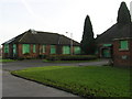
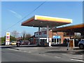
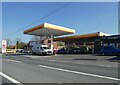
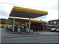
Living in BS19 3SG offers access to a mix of retail, transport, and leisure amenities within practical reach. The area has five retail outlets, including Co-op Long and Morrisons Daily, providing essential shopping options. For transport, residents can use rail services at Parson Street and Bedminster stations, as well as ferry landings like Nova Scotia and Pumphouse. The proximity to Bristol Airport adds convenience for frequent travelers. The village itself retains a semi-rural character, with a village green, stream, and historical sites such as the 12th-century Church of St Mary and St Edward. Pubs and the remnants of old mills contribute to a sense of local heritage. While the area’s small size means amenities are limited, its blend of countryside and connectivity supports a lifestyle that balances tranquillity with accessibility.
Amenities
Schools
The nearest school to BS19 3SG is Flax Bourton Church of England Primary School, which serves the area’s primary education needs. The school’s name and type are listed twice in the data, but no Ofsted rating or performance metrics are provided. As a primary school, it caters to younger children, though families requiring secondary education may need to look further afield. The lack of secondary schools in the immediate vicinity means parents should assess the catchment areas of nearby schools or consider commuting to larger towns like Bristol. The presence of a single primary school suggests a modest educational infrastructure, which may be sufficient for young families but could pose challenges for those needing more comprehensive schooling options.
| Rank | School | Type | Entry gender | Ages |
|---|
Explore more schools in this area
Go to Schools tabDemographics
The community in BS19 3SG is predominantly composed of adults aged 30–64, with a median age of 47. Home ownership is high at 85%, indicating a settled population with long-term ties to the area. The accommodation type is primarily houses, reflecting a low-density, suburban layout. The predominant ethnic group is White, though specific data on diversity or deprivation is not provided. This age profile suggests a mix of middle-aged professionals, retirees, and families, all contributing to a stable local economy. The high home ownership rate implies lower rental demand, which may influence property values and community cohesion. With no data on deprivation levels, it is reasonable to infer that the area’s safety and amenities support a moderate quality of life. The absence of significant demographic diversity, however, means the social fabric is largely homogenous.
Household Size
Accommodation Type
Tenure
Ethnic Group
Religion
Household Composition
Age
Household Deprivation
NS-SEC
Explore more demographic insights in this area
Go to Demographics tabPlanning
Planning Constraints
- Flood RiskPremium
- Ramsar Wetland SitesPremium
- Area of Outstanding Natural BeautyPremium
- Protected Nature ReservePremium
- Protected WoodlandPremium