Area Overview for BS19 3RP
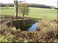
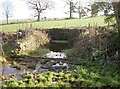
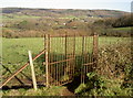
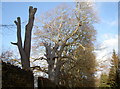
Photos of BS19 3RP
Area Information
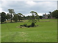
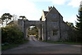
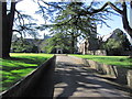
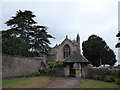
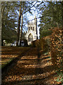
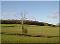
BS19 3RP is a small, semi-rural postcode area in North Somerset, England, nestled in wooded countryside near Bristol. With a population of 1,484 and a density of 116 people per square kilometre, it reflects a close-knit community. The area is part of Barrow Gurney, a village with a picturesque feel, featuring a village green, meandering stream, and historic sites like the 12th-century Church of St Mary and St Edward. Its location on the B3130 road, midway between the A38 and A370, offers convenient access to Bristol Airport and the Long Ashton bypass. Despite its rural charm, the area is practical for commuters, with narrow roads often used as a shortcut to the airport. Daily life here blends quiet countryside living with proximity to urban amenities, making it appealing for those seeking a balance between seclusion and connectivity.
- Area Type
- Postcode
- Area Size
- Not available
- Population
- 1484
- Population Density
- 116 people/km²
BS19 3RP is primarily an owner-occupied area, with 85% of homes owned by residents rather than rented. The accommodation type is predominantly houses, which is typical of semi-rural settings where larger properties are more common. This suggests a housing stock that prioritises family homes and private living spaces over flats or apartments. Given the area’s small size and low population density, the property market is likely limited in scale, with limited scope for new developments. For buyers, this means a focus on existing homes with character, possibly benefiting from the area’s proximity to natural landscapes and historical sites. However, the small size of the postcode may mean that nearby areas, such as Barrow Gurney or Long Ashton, offer more options for property seekers.
House Prices in BS19 3RP
No properties found in this postcode.
Energy Efficiency in BS19 3RP
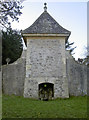
Living in BS19 3RP offers a mix of rural tranquillity and accessible amenities. Nearby shops include Spar, Co-op Long, and The Southern Co-operative, providing essentials within reach. The village itself features a village green, two pubs, and historic sites like the ruins of pre-Domesday mills, offering both leisure and cultural value. Transport links to rail, ferry, and airport services enhance convenience, while the semi-rural setting allows for walks in wooded countryside. The presence of a primary school and proximity to Bristol’s urban centres make it a practical choice for families seeking a balance between nature and connectivity. Local character, including references in music and historical ties to the Domesday Book, adds depth to daily life.
Amenities
Schools
The nearest school to BS19 3RP is Flax Bourton Church of England Primary School, a primary school serving the local community. While the data lists this school twice, it appears to be the only educational institution explicitly mentioned. The presence of a primary school indicates that the area is suitable for families with young children, though secondary education options would require travel to nearby towns. The single primary school may suggest limited local school capacity, meaning residents might need to consider commuting for higher education. For families prioritising proximity to schools, this could be a factor in deciding whether BS19 3RP meets their needs.
| Rank | School | Type | Entry gender | Ages |
|---|
Explore more schools in this area
Go to Schools tabDemographics
The population of BS19 3RP has a median age of 47, with the majority of residents aged 30–64. This suggests a community skewed toward middle-aged adults, likely including professionals and families. Home ownership is high at 85%, indicating a stable, long-term resident base. The predominant accommodation type is houses, reflecting a residential cluster rather than high-density housing. The predominant ethnic group is White, though specific data on diversity is not provided. With 85% of homes owned rather than rented, the area is less reliant on rental markets, which may influence local property values and community cohesion. The age profile suggests a mature population, potentially with established careers and family ties to the area.
Household Size
Accommodation Type
Tenure
Ethnic Group
Religion
Household Composition
Age
Household Deprivation
NS-SEC
Explore more demographic insights in this area
Go to Demographics tabPlanning
Planning Constraints
- Flood RiskPremium
- Ramsar Wetland SitesPremium
- Area of Outstanding Natural BeautyPremium
- Protected Nature ReservePremium
- Protected WoodlandPremium