Area Overview for BS19 3QD
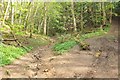
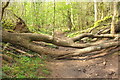
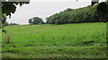
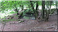
Photos of BS19 3QD

Area Information
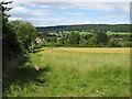
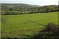
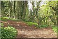
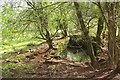
Living in BS19 3QD, a small residential cluster in North Somerset, offers a quiet, stable lifestyle rooted in historical significance. The area, part of the ancient parish of Backwell, lies approximately 7 miles west-south-west of Bristol, with coordinates around 51.412021, -2.735573. Its population of 1,484, spread over 116 people per square kilometre, reflects a close-knit community. The area’s character is shaped by its medieval heritage, including St. Andrew’s Anglican church, a Grade I listed building, and Backwell House, a historic venue. Daily life here balances rural tranquillity with practical connectivity, with rail links to Nailsea and nearby ferry services. The median age of 47 and high home ownership rate of 85% suggest a community of long-term residents, predominantly adults aged 30–64. This is a place where tradition meets modern convenience, with little change to the village’s character over centuries.
- Area Type
- Postcode
- Area Size
- Not available
- Population
- 1484
- Population Density
- 116 people/km²
BS19 3QD is primarily an owner-occupied area, with 85% of homes owned by residents rather than rented. The accommodation type is predominantly houses, reflecting a traditional, low-density housing stock. This contrasts with areas dominated by flats or high-rise buildings, offering more private, spacious living. The small postcode area’s limited size means the property market is niche, with few new developments. For buyers, this suggests a stable market with established homes, though choices may be restricted. The high ownership rate also implies strong community ties, with fewer transient residents. However, the absence of rental properties may limit options for those seeking short-term stays or investment opportunities.
House Prices in BS19 3QD
No properties found in this postcode.
Energy Efficiency in BS19 3QD
Residents of BS19 3QD have access to a range of amenities within practical reach. Retail options include Spar, The Southern Co-operative Co, and Tesco Bristol, ensuring everyday shopping needs are met. The area’s rail stations link to nearby towns, while ferry services provide water-based travel options. Historical sites like St. Andrew’s Church and Backwell Hillfort add cultural value, though recreational parks are not explicitly mentioned. The presence of multiple airports and ferries suggests a lifestyle that balances local convenience with regional connectivity. While the data does not specify dining venues, the retail and transport infrastructure implies a functional, community-focused lifestyle.
Amenities
Schools
The nearest school to BS19 3QD is Flax Bourton Church of England Primary School, a primary school serving the area. While no Ofsted rating is provided, the presence of a single primary school suggests a focus on early education for local children. The lack of secondary schools or additional educational institutions means families may need to travel to nearby towns for further schooling. This could be a consideration for parents prioritising a full range of educational options. However, the school’s existence indicates some local provision, though its capacity and performance are not detailed in the data.
| Rank | School | Type | Entry gender | Ages |
|---|
Explore more schools in this area
Go to Schools tabDemographics
BS19 3QD’s population is predominantly White, with 85% of residents owning their homes. The median age of 47 indicates a mature demographic, with the most common age range being 30–64 years. This suggests a community of established professionals and families, rather than students or young workers. The high home ownership rate implies stability, with few rental properties. The absence of specific data on deprivation or diversity means the area’s socioeconomic profile is not fully detailed, but the age and ownership statistics point to a settled, middle-aged population. The lack of younger residents may affect local services and school dynamics, though the presence of Flax Bourton Church of England Primary School indicates some provision for children.
Household Size
Accommodation Type
Tenure
Ethnic Group
Religion
Household Composition
Age
Household Deprivation
NS-SEC
Explore more demographic insights in this area
Go to Demographics tabPlanning
Planning Constraints
- Flood RiskPremium
- Ramsar Wetland SitesPremium
- Area of Outstanding Natural BeautyPremium
- Protected Nature ReservePremium
- Protected WoodlandPremium